


<< Other Photo Pages >> Broxmouth Hill Fort - Hillfort in Scotland in East Lothian
Submitted by Andy B on Wednesday, 29 January 2014 Page Views: 10342
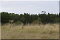
Iron Age and Later PrehistorySite Name: Broxmouth Hill FortCountry: Scotland County: East Lothian Type: Hillfort
Nearest Village: Dunbar
Map Ref: NT7011177388
Latitude: 55.988523N Longitude: 2.480662W
Condition:
| 5 | Perfect |
| 4 | Almost Perfect |
| 3 | Reasonable but with some damage |
| 2 | Ruined but still recognisable as an ancient site |
| 1 | Pretty much destroyed, possibly visible as crop marks |
| 0 | No data. |
| -1 | Completely destroyed |
| 5 | Superb |
| 4 | Good |
| 3 | Ordinary |
| 2 | Not Good |
| 1 | Awful |
| 0 | No data. |
| 5 | Can be driven to, probably with disabled access |
| 4 | Short walk on a footpath |
| 3 | Requiring a bit more of a walk |
| 2 | A long walk |
| 1 | In the middle of nowhere, a nightmare to find |
| 0 | No data. |
| 5 | co-ordinates taken by GPS or official recorded co-ordinates |
| 4 | co-ordinates scaled from a detailed map |
| 3 | co-ordinates scaled from a bad map |
| 2 | co-ordinates of the nearest village |
| 1 | co-ordinates of the nearest town |
| 0 | no data |
Internal Links:
External Links:
")
The near-total excavation of the site marked one of the first major rescue projects in Scotland; it is now entirely gone, and like many projects of its time it remained unpublished until recently.
There is some evidence of human activity dating back to around 3000 BC. The early Iron Age structure was limited to a palisade trench and some fragmentary ditch elements. The major enclosure was built about 500 BC, and rebuilt several times over the next two hundred years. Eventually, the fort had at least four ramparts and ditches and a complex series of entrance gates.
For more information see Canmore ID 58800 which gives details of finds, usage of the site throughout the ages and the three defensive stages: "a palisade enclosing .25ha on the crown of the hill; a univallate defence with a single entrance enclosing .65ha; and a multivallate defence with entrances in the E and SW extending over 2ha."
Note: Excavations of the Broxmouth hillfort destroyed in the 1970s have been published, metal find is earliest use of steel in Britain and Ireland
You may be viewing yesterday's version of this page. To see the most up to date information please register for a free account.
Do not use the above information on other web sites or publications without permission of the contributor.
Nearby Images from Geograph Britain and Ireland:
©2010(licence)
©2021(licence)
©2005(licence)
©2016(licence)
©2019(licence)
The above images may not be of the site on this page, they are loaded from Geograph.
Please Submit an Image of this site or go out and take one for us!
Click here to see more info for this site
Nearby sites
Key: Red: member's photo, Blue: 3rd party photo, Yellow: other image, Green: no photo - please go there and take one, Grey: site destroyed
Download sites to:
KML (Google Earth)
GPX (GPS waypoints)
CSV (Garmin/Navman)
CSV (Excel)
To unlock full downloads you need to sign up as a Contributory Member. Otherwise downloads are limited to 50 sites.
Turn off the page maps and other distractions
Nearby sites listing. In the following links * = Image available
2.2km WSW 249° Easter Broomhouse* Standing Stone (Menhir) (NT6800876615)
2.3km SW 217° Doon Hill Dunbar* Ancient Village or Settlement (NT6868775539)
3.3km WSW 238° St John's Well (Spott)* Holy Well or Sacred Spring (NT67277561)
3.9km SW 235° Witches' Stone (Spott)* Holy Well or Sacred Spring (NT66917520)
8.3km WSW 249° Rood Well* Holy Well or Sacred Spring (NT6237674417)
8.4km W 271° Kirklandhill* Standing Stone (Menhir) (NT61687760)
9.6km SE 130° Cockburnspath Cross* Ancient Cross (NT7743071100)
10.1km W 274° Prestonkirk Cursus Cursus (NT60007809)
10.4km W 273° Prestonkirk Cursus Cursus (NT59657799)
10.8km W 272° St Baldred's Well* Holy Well or Sacred Spring (NT59317780)
10.8km W 273° Prestonkirk Cursus Cursus (NT59257798)
11.1km SSW 205° Yadlee* Stone Circle (NT65406732)
11.1km WNW 292° Our Lady's Well (Whitekirk) Holy Well or Sacred Spring (NT598816)
11.2km W 272° Prestonkirk Cursus Cursus (NT58927790)
11.7km SSW 192° Bothwell Water (Cranshaws) Natural Stone / Erratic / Other Natural Feature (NT67656598)
12.0km W 267° Pencraig Brae* Standing Stone (Menhir) (NT58087681)
12.0km SSW 210° Spartleton Edge Stone Circle (NT640670)
12.1km WSW 257° Maiden Stone (East Lothian)* Standing Stone (Menhir) (NT5830774748)
12.2km ESE 123° St. Helen's on the Lea (Old Cambus)* Sculptured Stone (NT8037870676)
12.3km WSW 257° Traprain Law* Hillfort (NT5805674696)
12.4km SW 224° White Castle Fort* Hillfort (NT61356860)
12.7km WSW 255° Loth Stone* Standing Stone (Menhir) (NT5782374146)
12.9km WSW 253° Standingstone (East Lothian)* Standing Stone (Menhir) (NT57737363)
13.0km WNW 303° St. Baldred's Well (Auldhame)* Holy Well or Sacred Spring (NT59168450)
13.1km SW 218° Ragstone Rig (Cranshaws) Stone Row / Alignment (NT61956705)
View more nearby sites and additional images


 We would like to know more about this location. Please feel free to add a brief description and any relevant information in your own language.
 Wir möchten mehr über diese Stätte erfahren. Bitte zögern Sie nicht, eine kurze Beschreibung und relevante Informationen in Deutsch hinzuzufügen.
 Nous aimerions en savoir encore un peu sur les lieux. S'il vous plaît n'hesitez pas à ajouter une courte description et tous les renseignements pertinents dans votre propre langue.
 Quisieramos informarnos un poco más de las lugares. No dude en añadir una breve descripción y otros datos relevantes en su propio idioma.