

<< Our Photo Pages >> Moortop Barrows - Round Barrow(s) in England in Greater Manchester
Submitted by vicky on Thursday, 25 March 2004 Page Views: 6815
Neolithic and Bronze AgeSite Name: Moortop BarrowsCountry: England County: Greater Manchester Type: Round Barrow(s)
Nearest Town: Bolton Nearest Village: Smithills Dean
Map Ref: SD682134 Landranger Map Number: 109
Latitude: 53.616173N Longitude: 2.482179W
Condition:
| 5 | Perfect |
| 4 | Almost Perfect |
| 3 | Reasonable but with some damage |
| 2 | Ruined but still recognisable as an ancient site |
| 1 | Pretty much destroyed, possibly visible as crop marks |
| 0 | No data. |
| -1 | Completely destroyed |
| 5 | Superb |
| 4 | Good |
| 3 | Ordinary |
| 2 | Not Good |
| 1 | Awful |
| 0 | No data. |
| 5 | Can be driven to, probably with disabled access |
| 4 | Short walk on a footpath |
| 3 | Requiring a bit more of a walk |
| 2 | A long walk |
| 1 | In the middle of nowhere, a nightmare to find |
| 0 | No data. |
| 5 | co-ordinates taken by GPS or official recorded co-ordinates |
| 4 | co-ordinates scaled from a detailed map |
| 3 | co-ordinates scaled from a bad map |
| 2 | co-ordinates of the nearest village |
| 1 | co-ordinates of the nearest town |
| 0 | no data |
Internal Links:
External Links:
")
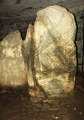
Coal tip slag heaps that have been mistaken for round barrows
You may be viewing yesterday's version of this page. To see the most up to date information please register for a free account.
")
")
")
Do not use the above information on other web sites or publications without permission of the contributor.
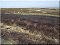
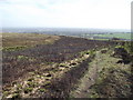
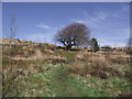
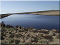
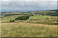
Nearby Images from Geograph Britain and Ireland:
©2011(licence)
©2011(licence)
©2011(licence)
©2011(licence)
©2022(licence)
The above images may not be of the site on this page, they are loaded from Geograph.
Please Submit an Image of this site or go out and take one for us!
Click here to see more info for this site
Nearby sites
Key: Red: member's photo, Blue: 3rd party photo, Yellow: other image, Green: no photo - please go there and take one, Grey: site destroyed
Download sites to:
KML (Google Earth)
GPX (GPS waypoints)
CSV (Garmin/Navman)
CSV (Excel)
To unlock full downloads you need to sign up as a Contributory Member. Otherwise downloads are limited to 50 sites.
Turn off the page maps and other distractions
Nearby sites listing. In the following links * = Image available
499m SW 216° Brown Stones* Stone Row / Alignment (SD679130)
533m SE 128° Priests Crown* Long Barrow (SD68621307)
537m ENE 68° Horrocks Moor Barrow* Artificial Mound (SD687136)
1.2km NW 305° Counting Hill Row* Stone Row / Alignment (SD672141)
1.3km WSW 253° Sugarloaf Standing Stone* Standing Stone (Menhir) (SD66981304)
1.3km WNW 296° Counting Hill Ringcairn Ring Cairn (SD670140)
1.3km WSW 252° Sugarloaf Hill Barrow* Round Barrow(s) (SD66911300)
1.6km SSW 194° The Thurstones Rock Art (SD678118)
1.7km W 263° Holden's Farm Ring Cairn (SD665132)
1.7km WSW 246° Burnt Edge* Stone Row / Alignment (SD666127)
1.8km S 183° Thurstones Row Stone Row / Alignment (SD681116)
2.1km WSW 242° Adam Hill* Cairn (SD663124)
2.2km WSW 239° Montcliffe Cairn (SD663123)
2.4km S 173° The Doffcocker Cross Ancient Cross (SD6846411027)
2.7km W 267° Two Lads (Rivington)* Cairn (SD65541330)
3.0km SE 133° Toothill Long Barrow* Long Barrow (SD704113)
3.1km WNW 301° Winter Hill Cairn* Cairn (SD65581499)
3.8km WNW 294° Noon Hill Slack* Cairn (SD64691499)
3.9km W 276° Rivington Pike* Cairn (SD64311382)
4.2km NE 54° Cheetham Close* Stone Circle (SD71631586)
5.5km SE 143° Bolton Museum* Museum (SD715090)
5.6km SE 136° St Peter's Church (Bolton)* Ancient Cross (SD721093)
6.0km W 273° Rivington Stone* Rock Art (SD62181378)
6.1km SE 136° Haulgh (Bolton) Cairn (SD72420899)
6.3km W 266° Grimeford Headless Cross* Ancient Cross (SD6190113018)
View more nearby sites and additional images


 We would like to know more about this location. Please feel free to add a brief description and any relevant information in your own language.
 Wir möchten mehr über diese Stätte erfahren. Bitte zögern Sie nicht, eine kurze Beschreibung und relevante Informationen in Deutsch hinzuzufügen.
 Nous aimerions en savoir encore un peu sur les lieux. S'il vous plaît n'hesitez pas à ajouter une courte description et tous les renseignements pertinents dans votre propre langue.
 Quisieramos informarnos un poco más de las lugares. No dude en añadir una breve descripción y otros datos relevantes en su propio idioma.