 with our Megalithic Portal iPhone app")

<< Our Photo Pages >> Castle Rock (Auchmithie) - Promontory Fort / Cliff Castle in Scotland in Angus
Submitted by hamilton on Tuesday, 07 July 2015 Page Views: 3259
Iron Age and Later PrehistorySite Name: Castle Rock (Auchmithie)Country: Scotland County: Angus Type: Promontory Fort / Cliff Castle
Nearest Town: Arbroath Nearest Village: Auchmithie
Map Ref: NO68074416
Latitude: 56.588263N Longitude: 2.521482W
Condition:
| 5 | Perfect |
| 4 | Almost Perfect |
| 3 | Reasonable but with some damage |
| 2 | Ruined but still recognisable as an ancient site |
| 1 | Pretty much destroyed, possibly visible as crop marks |
| 0 | No data. |
| -1 | Completely destroyed |
| 5 | Superb |
| 4 | Good |
| 3 | Ordinary |
| 2 | Not Good |
| 1 | Awful |
| 0 | No data. |
| 5 | Can be driven to, probably with disabled access |
| 4 | Short walk on a footpath |
| 3 | Requiring a bit more of a walk |
| 2 | A long walk |
| 1 | In the middle of nowhere, a nightmare to find |
| 0 | No data. |
| 5 | co-ordinates taken by GPS or official recorded co-ordinates |
| 4 | co-ordinates scaled from a detailed map |
| 3 | co-ordinates scaled from a bad map |
| 2 | co-ordinates of the nearest village |
| 1 | co-ordinates of the nearest town |
| 0 | no data |
Internal Links:
External Links:
 (PID:134236)")
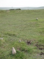
This fastness was formed by isolating the promontory by means of a triple curved rampart with medial ditches, broken by a central entrance causeway 2 metres wide. Alas, the location is currently inaccessible, as the promontory is embedded in thick, impenetrable gorse, and visiting it is impossible.
The site was cleared during the 1960s, when Arbroath Antiquary Club carried out extensive excavations, a detailed description being available at the Archaeology Data Service (ADS). (PDF file)
The fort itself was quite small, approximately 30 metres square, but now considerably eroded on the north and to a lesser extent on the east. Features included various postholes and hearths, associated with a floor, possibly a single circular structure with a porch or a series of windbreaks, or lean-to shelters.
An aerial photograph can be viewed on the RCAHMS website.
You may be viewing yesterday's version of this page. To see the most up to date information please register for a free account.
 (PID:134237)")
 (PID:134241)")
 (PID:134240)")
 (PID:134239)")
 (PID:134242)")
Do not use the above information on other web sites or publications without permission of the contributor.
Click here to see more info for this site
Nearby sites
Key: Red: member's photo, Blue: 3rd party photo, Yellow: other image, Green: no photo - please go there and take one, Grey: site destroyed
Download sites to:
KML (Google Earth)
GPX (GPS waypoints)
CSV (Garmin/Navman)
CSV (Excel)
To unlock full downloads you need to sign up as a Contributory Member. Otherwise downloads are limited to 50 sites.
Turn off the page maps and other distractions
Nearby sites listing. In the following links * = Image available
740m S 181° Lud Castle* Promontory Fort / Cliff Castle (NO68054342)
2.2km NNE 33° West Mains of Ethie* Promontory Fort / Cliff Castle (NO69284600)
2.4km SSW 208° Maiden Castle Promontory Fort* Promontory Fort / Cliff Castle (NO66894202)
2.7km WSW 256° Dickmount Law* Cairn (NO65474355)
2.7km NE 34° Prail Castle* Promontory Fort / Cliff Castle (NO69624643)
3.7km SW 216° St Ninian's Well (Arbroath)* Holy Well or Sacred Spring (NO65894116)
3.8km NNE 32° Red Head* Promontory Fort / Cliff Castle (NO70134740)
4.1km WSW 242° Arbroath Eastern Cemetery souterrain* Souterrain (Fogou, Earth House) (NO64394227)
4.4km WSW 253° St. Vigeans Museum* Museum (NO63834294)
5.0km NW 307° Kinblethmont* Class I Pictish Symbol Stone (NO641472)
6.4km NW 306° Westfield 1 Timber Circle (NO629479)
6.4km NW 306° Westfield 2 Timber Circle (NO629479)
7.6km WNW 301° Inverkeilor Cursus Cursus (NO61534812)
9.2km NW 304° Kinnell Cursus Cursus (NO605494)
9.2km NW 307° Kinnell Cursus Cursus (NO607497)
9.4km NW 310° Kinnell Pictish Cross Slab Class III Pictish Cross Slab (NO60885028)
10.5km WNW 303° Guthrie Cursus Cursus (NO592499)
11.0km WNW 302° Guthrie Cursus Cursus (NO587500)
11.9km N 11° Inchbrayock 3* Class III Pictish Cross Slab (NO704558)
12.9km N 354° Maryton Cursus Cursus (NO66715699)
13.1km N 351° Maryton Cursus Cursus (NO66105713)
13.4km WNW 286° Dumbarrow Hill Stone Fort or Dun (NO55154791)
13.5km W 266° Carmyllie Hill (Greystone) Cairn (NO545434)
14.0km NNE 14° Inchbrayock 1* Class II Pictish Symbol Stone (NO71625771)
14.0km NNE 14° Montrose Museum* Museum (NO7163457711)
View more nearby sites and additional images


 We would like to know more about this location. Please feel free to add a brief description and any relevant information in your own language.
 Wir möchten mehr über diese Stätte erfahren. Bitte zögern Sie nicht, eine kurze Beschreibung und relevante Informationen in Deutsch hinzuzufügen.
 Nous aimerions en savoir encore un peu sur les lieux. S'il vous plaît n'hesitez pas à ajouter une courte description et tous les renseignements pertinents dans votre propre langue.
 Quisieramos informarnos un poco más de las lugares. No dude en añadir una breve descripción y otros datos relevantes en su propio idioma.