 with our Megalithic Portal iPhone app")


<< Text Pages >> Bothwell Water (Cranshaws) - Natural Stone / Erratic / Other Natural Feature in Scotland in Scottish Borders
Submitted by Anne T on Tuesday, 23 October 2018 Page Views: 1140
Natural PlacesSite Name: Bothwell Water (Cranshaws)Country: Scotland County: Scottish Borders Type: Natural Stone / Erratic / Other Natural Feature
Nearest Town: Duns Nearest Village: Longformacus
Map Ref: NT67656598
Latitude: 55.885869N Longitude: 2.518735W
Condition:
| 5 | Perfect |
| 4 | Almost Perfect |
| 3 | Reasonable but with some damage |
| 2 | Ruined but still recognisable as an ancient site |
| 1 | Pretty much destroyed, possibly visible as crop marks |
| 0 | No data. |
| -1 | Completely destroyed |
| 5 | Superb |
| 4 | Good |
| 3 | Ordinary |
| 2 | Not Good |
| 1 | Awful |
| 0 | No data. |
| 5 | Can be driven to, probably with disabled access |
| 4 | Short walk on a footpath |
| 3 | Requiring a bit more of a walk |
| 2 | A long walk |
| 1 | In the middle of nowhere, a nightmare to find |
| 0 | No data. |
| 5 | co-ordinates taken by GPS or official recorded co-ordinates |
| 4 | co-ordinates scaled from a detailed map |
| 3 | co-ordinates scaled from a bad map |
| 2 | co-ordinates of the nearest village |
| 1 | co-ordinates of the nearest town |
| 0 | no data |
Be the first person to rate this site - see the 'Contribute!' box in the right hand menu.
Internal Links:
External Links:
Natural Stone / Erratic / Other Natural Feature in Scottish Borders
These stones are featured on The Ancient Stones: A Guide to Standing Stones and Stone Circles in the South of Scotland - see their entry for Stones, Bothwell Water, Cranshaws. Ancient Stones tells us: "This large group of stones sits between Bothwell Water and a farm track leading to Caldercleuch and comprises some sizeable stones, the largest around 1.00m high. Some of the stones seem to be set on edge and there are numerous smaller stones in and around the setting. One of the larger slabs has a number of 'cup marks' although these are likely to be of natural origin. The largest of the stones also has cup-marks but these are much more advanced and have actually formed pockets in the stone."
The Ancient Stones entry includes directions for finding this site together with nearby parking and fieldnotes. It also includes a second entry, with the same grid reference for a 'wee pebble' of 0.80m height and 4m girth - see their entry for Stone, Bothwell Water, Cranshaws, which can be found by the side of the track running north alongside Bothwell Water. They add it compares with the Holyrood Park Stone which is believed to be of volcanic origin.
Note: Have you visited this site? Do you have any photographs, information or comments to add?
You may be viewing yesterday's version of this page. To see the most up to date information please register for a free account.
Do not use the above information on other web sites or publications without permission of the contributor.
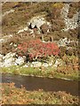
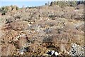
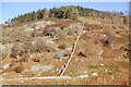
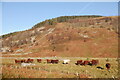
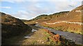
Nearby Images from Geograph Britain and Ireland:
©2009(licence)
©2020(licence)
©2020(licence)
©2020(licence)
©2009(licence)
The above images may not be of the site on this page, they are loaded from Geograph.
Please Submit an Image of this site or go out and take one for us!
Click here to see more info for this site
Nearby sites
Key: Red: member's photo, Blue: 3rd party photo, Yellow: other image, Green: no photo - please go there and take one, Grey: site destroyed
Download sites to:
KML (Google Earth)
GPX (GPS waypoints)
CSV (Garmin/Navman)
CSV (Excel)
To unlock full downloads you need to sign up as a Contributory Member. Otherwise downloads are limited to 50 sites.
Turn off the page maps and other distractions
Nearby sites listing. In the following links * = Image available
2.6km WNW 300° Yadlee* Stone Circle (NT65406732)
3.1km SSW 203° Kilmade Hillfort* Hillfort (NT66456315)
3.7km WSW 239° Kell Burn Stone Circle (NT645641)
3.8km WSW 241° Whiteadder Reservoir* Cairn (NT64336421)
3.8km WNW 285° Spartleton Edge Stone Circle (NT640670)
3.8km WSW 245° Packman's Grave (Whiteadder Reservoir) Stone Row / Alignment (NT64176439)
4.6km SW 232° Penshiel Grange Stone Circle* Stone Circle (NT64016317)
4.6km SW 232° Chapel Stone (Penshiel Grange)* Stone Circle (NT64016317)
4.8km WSW 248° Penshiel Hill Stone Circle (NT632642)
4.8km WSW 254° Mayshiel Stone Circle* Stone Circle (NT62986465)
5.1km W 259° Kingside Hill Stone Circle (NT62636503)
5.1km W 261° Stone Standing Stone Standing Stone (Menhir) (NT62586518)
5.1km W 264° Nine Stones Rig* Stone Circle (NT62546549)
5.3km W 277° Tavers Cleugh* Cairn (NT62386671)
5.8km W 280° Ragstone Rig (Cranshaws) Stone Row / Alignment (NT61956705)
5.9km W 262° Crow Stones (Cranshaws)* Stone Circle (NT61836519)
6.1km WSW 256° Mayshiel Stone Circle (NT617646)
6.8km WNW 292° White Castle Fort* Hillfort (NT61356860)
8.0km ESE 112° Shannabank Hill Hillfort (NT75096292)
8.8km SW 217° Mutiny Stones* Cairn (NT62255902)
9.2km N 355° Witches' Stone (Spott)* Holy Well or Sacred Spring (NT66917520)
9.6km N 6° Doon Hill Dunbar* Ancient Village or Settlement (NT6868775539)
9.6km N 357° St John's Well (Spott)* Holy Well or Sacred Spring (NT67277561)
9.9km NNW 328° Rood Well* Holy Well or Sacred Spring (NT6237674417)
10.6km N 1° Easter Broomhouse* Standing Stone (Menhir) (NT6800876615)
View more nearby sites and additional images


 We would like to know more about this location. Please feel free to add a brief description and any relevant information in your own language.
 Wir möchten mehr über diese Stätte erfahren. Bitte zögern Sie nicht, eine kurze Beschreibung und relevante Informationen in Deutsch hinzuzufügen.
 Nous aimerions en savoir encore un peu sur les lieux. S'il vous plaît n'hesitez pas à ajouter une courte description et tous les renseignements pertinents dans votre propre langue.
 Quisieramos informarnos un poco más de las lugares. No dude en añadir una breve descripción y otros datos relevantes en su propio idioma.