


<< Our Photo Pages >> Hollin Stump Cairn - Cairn in England in Cumbria
Submitted by vicky on Wednesday, 18 September 2002 Page Views: 6884
Neolithic and Bronze AgeSite Name: Hollin Stump CairnCountry: England County: Cumbria Type: Cairn
Nearest Town: Kirkby Stephen
Map Ref: NY652117 Landranger Map Number: 94
Latitude: 54.499421N Longitude: 2.538846W
Condition:
| 5 | Perfect |
| 4 | Almost Perfect |
| 3 | Reasonable but with some damage |
| 2 | Ruined but still recognisable as an ancient site |
| 1 | Pretty much destroyed, possibly visible as crop marks |
| 0 | No data. |
| -1 | Completely destroyed |
| 5 | Superb |
| 4 | Good |
| 3 | Ordinary |
| 2 | Not Good |
| 1 | Awful |
| 0 | No data. |
| 5 | Can be driven to, probably with disabled access |
| 4 | Short walk on a footpath |
| 3 | Requiring a bit more of a walk |
| 2 | A long walk |
| 1 | In the middle of nowhere, a nightmare to find |
| 0 | No data. |
| 5 | co-ordinates taken by GPS or official recorded co-ordinates |
| 4 | co-ordinates scaled from a detailed map |
| 3 | co-ordinates scaled from a bad map |
| 2 | co-ordinates of the nearest village |
| 1 | co-ordinates of the nearest town |
| 0 | no data |
Internal Links:
External Links:
I have visited· I would like to visit
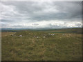
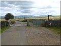
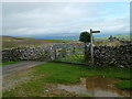
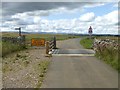
Anne T visited on 11th Sep 2016 - their rating: Cond: 3 Amb: 4 Access: 3 Hollin Stump Cairn, Gaythorp Plain, Cumbria: From St Helen's Well at Great Asby, we headed south south west, following the single track road to ASby Winderwath Common, were the metalled carriageway turned west across Gaythorne Plain. We parked by the cattle grid on opposite Linglow Hill, where a dog walker had taken up much of the dry parking area and was waiting for his 2 lively terriers to wear themselves out tearing across the grass.
We hadn’t spotted a gateway into the field containing Hollin Stump Cairn from the road, so followed the bridlepath south. There was a gate into the field about a quarter mile from the road, but there was a herd of large cows (and a bull) surrounding the cairn, so we only go to view this from a distance.
We carried along the bridlwway to find the Gaythorn Plain Ring Cairn/Stone Row (not sure we found it, need to process the photos). The latter was visit 7/5 (not yet logged).
")
Have you visited this site? Please add a comment below.
You may be viewing yesterday's version of this page. To see the most up to date information please register for a free account.
")
")
Do not use the above information on other web sites or publications without permission of the contributor.
Nearby Images from Geograph Britain and Ireland:
©2017(licence)
©2019(licence)
©2008(licence)
©2009(licence)
©2019(licence)
The above images may not be of the site on this page, they are loaded from Geograph.
Please Submit an Image of this site or go out and take one for us!
Click here to see more info for this site
Nearby sites
Key: Red: member's photo, Blue: 3rd party photo, Yellow: other image, Green: no photo - please go there and take one, Grey: site destroyed
Download sites to:
KML (Google Earth)
GPX (GPS waypoints)
CSV (Garmin/Navman)
CSV (Excel)
To unlock full downloads you need to sign up as a Contributory Member. Otherwise downloads are limited to 50 sites.
Turn off the page maps and other distractions
Nearby sites listing. In the following links * = Image available
452m WNW 300° Gaythorne Plain Round Cairns* Cairn (NY64811193)
706m SW 224° Gaythorn Plain* Ring Cairn (NY647112)
1.2km SE 129° Ling Bank North Settlement/Enclosures* Ancient Village or Settlement (NY6616310906)
1.5km SE 127° Ling Bank South Prehistoric Settlement/Enclosures* Ancient Village or Settlement (NY6639910793)
2.0km NW 311° Raise Howe Cairn* Cairn (NY63711303)
2.2km ESE 110° Asby Common Ancient Village or Settlement (NY673109)
2.3km S 185° Castle Folds* Ancient Village or Settlement (NY64990936)
2.6km WSW 241° Penhurrock* Multiple Stone Rows / Avenue (NY62881043)
2.7km SE 136° Muddygill Plain, Great Asby Scar* Cairn (NY6704309747)
2.7km S 178° Raisbeck Wood* Round Cairn (NY65260896)
2.9km WNW 301° Howarcles Ancient Village or Settlement (NY627132)
2.9km WSW 246° Howe Robin Ancient Village or Settlement (NY625105)
3.0km SSE 153° Little Kinmond Cairn* Cairn (NY66540899)
3.1km W 281° Burwens Ancient Village or Settlement (NY622123)
3.1km ENE 78° Holborn Hill Ancient Village or Settlement (NY682123)
3.4km ENE 62° St Helen's Well (Great Asby)* Holy Well or Sacred Spring (NY6817813278)
3.7km W 274° Cow Green Long Barrow* Long Barrow (NY61541199)
3.7km SSW 198° Gamelands* Stone Circle (NY64010816)
3.8km NW 307° Crosby Ravensworth Stone Row* Multiple Stone Rows / Avenue (NY6212514022)
4.1km WSW 257° Kings Well spring* Holy Well or Sacred Spring (NY612108)
4.2km WSW 258° Hazel Moor Enclosure* Ancient Village or Settlement (NY611109)
4.2km W 268° White Hag Round cairn* Round Cairn (NY61011158)
4.2km WNW 285° Ewe Locks* Ancient Village or Settlement (NY6112512794)
4.4km NW 315° Crosby Ravensworth Cross* Ancient Cross (NY6214314823)
4.4km SE 139° Howes Well ring cairn* Ring Cairn (NY6804908373)
View more nearby sites and additional images


 We would like to know more about this location. Please feel free to add a brief description and any relevant information in your own language.
 Wir möchten mehr über diese Stätte erfahren. Bitte zögern Sie nicht, eine kurze Beschreibung und relevante Informationen in Deutsch hinzuzufügen.
 Nous aimerions en savoir encore un peu sur les lieux. S'il vous plaît n'hesitez pas à ajouter une courte description et tous les renseignements pertinents dans votre propre langue.
 Quisieramos informarnos un poco más de las lugares. No dude en añadir una breve descripción y otros datos relevantes en su propio idioma.