


<< Our Photo Pages >> Four Barrow Hill - Round Barrow(s) in England in Dorset
Submitted by formicaant on Wednesday, 09 January 2008 Page Views: 6177
Neolithic and Bronze AgeSite Name: Four Barrow HillCountry: England County: Dorset Type: Round Barrow(s)
Nearest Village: winterbourne st mart
Map Ref: SY651880
Latitude: 50.690595N Longitude: 2.495438W
Condition:
| 5 | Perfect |
| 4 | Almost Perfect |
| 3 | Reasonable but with some damage |
| 2 | Ruined but still recognisable as an ancient site |
| 1 | Pretty much destroyed, possibly visible as crop marks |
| 0 | No data. |
| -1 | Completely destroyed |
| 5 | Superb |
| 4 | Good |
| 3 | Ordinary |
| 2 | Not Good |
| 1 | Awful |
| 0 | No data. |
| 5 | Can be driven to, probably with disabled access |
| 4 | Short walk on a footpath |
| 3 | Requiring a bit more of a walk |
| 2 | A long walk |
| 1 | In the middle of nowhere, a nightmare to find |
| 0 | No data. |
| 5 | co-ordinates taken by GPS or official recorded co-ordinates |
| 4 | co-ordinates scaled from a detailed map |
| 3 | co-ordinates scaled from a bad map |
| 2 | co-ordinates of the nearest village |
| 1 | co-ordinates of the nearest town |
| 0 | no data |
Internal Links:
External Links:
")
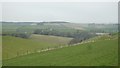
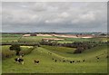
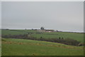
The barrows have a common ditch which was hidden by crops when I was last close to it. It can be walked past on a public footpath but is best seen from the Weymouth road below it. To the east of it is another unique barrow above Upwey on Goulds hill. It is the only extant example of a bell-disc barrow known.
You may be viewing yesterday's version of this page. To see the most up to date information please register for a free account.
Do not use the above information on other web sites or publications without permission of the contributor.
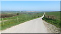
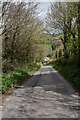
Nearby Images from Geograph Britain and Ireland:
©2023(licence)
©2018(licence)
©2014(licence)
©2018(licence)
©2020(licence)
The above images may not be of the site on this page, they are loaded from Geograph.
Please Submit an Image of this site or go out and take one for us!
Click here to see more info for this site
Nearby sites
Key: Red: member's photo, Blue: 3rd party photo, Yellow: other image, Green: no photo - please go there and take one, Grey: site destroyed
Download sites to:
KML (Google Earth)
GPX (GPS waypoints)
CSV (Garmin/Navman)
CSV (Excel)
To unlock full downloads you need to sign up as a Contributory Member. Otherwise downloads are limited to 50 sites.
Turn off the page maps and other distractions
Nearby sites listing. In the following links * = Image available
500m SW 216° Eweleaze Barn* Barrow Cemetery (SY648876)
1.1km NNE 27° Clandon Barrow* Round Barrow(s) (SY65638900)
1.3km SE 130° Ashton Farm Bowl Barrows Barrow Cemetery (SY66088717)
1.3km SSW 193° Ridge Hill* Barrow Cemetery (SY648867)
1.6km ENE 60° Maiden Castle Long Barrow 1 Long Barrow (SY66518879)
1.8km SW 227° Great Hill (Martinstown)* Barrow Cemetery (SY638868)
1.8km SE 140° Upwey Ridgeway* Barrow Cemetery (SY66298659)
1.9km ENE 75° Maiden Castle (Dorset)* Hillfort (SY66908846)
1.9km ENE 74° Maiden Castle Bank Barrow* Long Barrow (SY66928850)
1.9km ENE 75° Maiden Castle Causewayed Enclosure* Causewayed Enclosure (SY66938848)
1.9km NE 51° Maiden Castle Barrow Cemetery* Barrow Cemetery (SY666892)
2.0km NE 52° Lanceborough Enclosure Misc. Earthwork (SY66658920)
2.0km ENE 58° Maiden Castle Linear Earthwork Misc. Earthwork (SY66798902)
2.0km NE 46° Maiden Castle Long Barrow 2 Long Barrow (SY66578938)
2.3km N 355° Bridport Road Barrow Cemetery Barrow Cemetery (SY649903)
2.7km WSW 245° Bronkham Hill* Barrow Cemetery (SY62678688)
2.7km SSW 201° Friar Waddon Hill Barrow Cemetery (SY641855)
3.0km SSE 160° Upwey Wishing Well* Holy Well or Sacred Spring (SY661852)
3.0km SE 136° Ridgeway Hill* Barrow Cemetery (SY672858)
3.4km E 82° Herringston Bowl Barrow* Round Barrow(s) (SY68478842)
3.4km W 265° Smitten Corner* Barrow Cemetery (SY617877)
3.5km E 82° Herringston Long Barrow* Long Barrow (SY68548844)
3.5km SE 124° Winterborne Came 18b (Bincombe) Cairn (SY680860)
3.6km SE 129° Bincombe Down* Barrow Cemetery (SY679857)
3.7km WSW 249° Portesham Stone 6 Standing Stone (Menhir) (SY616867)
View more nearby sites and additional images


 We would like to know more about this location. Please feel free to add a brief description and any relevant information in your own language.
 Wir möchten mehr über diese Stätte erfahren. Bitte zögern Sie nicht, eine kurze Beschreibung und relevante Informationen in Deutsch hinzuzufügen.
 Nous aimerions en savoir encore un peu sur les lieux. S'il vous plaît n'hesitez pas à ajouter une courte description et tous les renseignements pertinents dans votre propre langue.
 Quisieramos informarnos un poco más de las lugares. No dude en añadir una breve descripción y otros datos relevantes en su propio idioma.