


<< Our Photo Pages >> Abbey Camp - Hillfort in England in Gloucestershire
Submitted by 4clydesdale7 on Sunday, 14 August 2011 Page Views: 6536
Iron Age and Later PrehistorySite Name: Abbey CampCountry: England County: Gloucestershire Type: Hillfort
Nearest Town: Thornbury Nearest Village: Alveston
Map Ref: ST65008870
Latitude: 51.596050N Longitude: 2.506675W
Condition:
| 5 | Perfect |
| 4 | Almost Perfect |
| 3 | Reasonable but with some damage |
| 2 | Ruined but still recognisable as an ancient site |
| 1 | Pretty much destroyed, possibly visible as crop marks |
| 0 | No data. |
| -1 | Completely destroyed |
| 5 | Superb |
| 4 | Good |
| 3 | Ordinary |
| 2 | Not Good |
| 1 | Awful |
| 0 | No data. |
| 5 | Can be driven to, probably with disabled access |
| 4 | Short walk on a footpath |
| 3 | Requiring a bit more of a walk |
| 2 | A long walk |
| 1 | In the middle of nowhere, a nightmare to find |
| 0 | No data. |
| 5 | co-ordinates taken by GPS or official recorded co-ordinates |
| 4 | co-ordinates scaled from a detailed map |
| 3 | co-ordinates scaled from a bad map |
| 2 | co-ordinates of the nearest village |
| 1 | co-ordinates of the nearest town |
| 0 | no data |
Internal Links:
External Links:
I have visited· I would like to visit
4clydesdale7 visited on 13th Aug 2011 - their rating: Cond: 2 Amb: 2 Access: 4 Astride the A38 at Alveston -
")
The oval Hillfort was protected by a single bank which at some points is over 25m wide but most have been severely damaged by the plough. The entrance to the fort can still be seen at the S end of the earthworks. The NW side of the fort enjoys extensive views over the River Severn from Chepstow as far N as the Malvern Hills.
Many other fortified positions on the W edge of the Cotswold scarp can be seen to the NNE, NE and E. The hillfort was later occupied by the Romans. Folklore tells of a bloody massacre having taken place on Abbey Lane, which stills persuades those of fainter heart not to walk the Lane at night.
You may be viewing yesterday's version of this page. To see the most up to date information please register for a free account.
")
Do not use the above information on other web sites or publications without permission of the contributor.
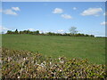
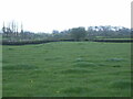
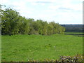
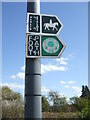
Nearby Images from Geograph Britain and Ireland:
©2021(licence)

©2021(licence)
©2021(licence)
©2021(licence)
©2021(licence)
The above images may not be of the site on this page, they are loaded from Geograph.
Please Submit an Image of this site or go out and take one for us!
Click here to see more info for this site
Nearby sites
Key: Red: member's photo, Blue: 3rd party photo, Yellow: other image, Green: no photo - please go there and take one, Grey: site destroyed
Download sites to:
KML (Google Earth)
GPX (GPS waypoints)
CSV (Garmin/Navman)
CSV (Excel)
To unlock full downloads you need to sign up as a Contributory Member. Otherwise downloads are limited to 50 sites.
Turn off the page maps and other distractions
Nearby sites listing. In the following links * = Image available
1.5km ESE 104° Tytherington Camp* Promontory Fort / Cliff Castle (ST66438834)
2.3km SW 228° Fishmonger's Swallet Cave or Rock Shelter (ST63318720)
2.4km W 260° Alveston Round Barrow* Round Barrow(s) (ST62608831)
3.6km WNW 296° St Arilds Well* Holy Well or Sacred Spring (ST61759030)
4.1km N 10° Camp Hill (Rockhampton)* Hillfort (ST657927)
4.2km W 266° Elberton Camp* Hillfort (ST60808840)
4.8km NE 54° Bloody Acre Camp* Hillfort (ST689915)
4.8km WSW 239° Rams Well* Holy Well or Sacred Spring (ST6085186266)
5.1km WSW 246° Miles Well* Holy Well or Sacred Spring (ST6036486654)
5.1km N 7° Rockhampton Standing Stone* Marker Stone (ST65679378)
5.3km NW 307° St Arilda's, Oldbury-on-Severn* Artificial Mound (ST60839191)
5.3km NW 313° Oldbury Standing Stone* Standing Stone (Menhir) (ST61169234)
5.6km NW 315° The Toots (Oldbury)* Hillfort (ST611927)
6.1km SSE 149° Iron Acton Churchyard Cross* Ancient Cross (ST6807583467)
6.9km ENE 58° Tortworth Stone* Standing Stone (Menhir) (ST7088092360)
7.1km NE 49° Tortworth Cross* Ancient Cross (ST7043393353)
7.6km SW 225° Knole Park Camp* Hillfort (ST59638334)
7.7km NW 318° Oldbury-on-Severn Submerged Forest* Natural Stone / Erratic / Other Natural Feature (ST59849440)
8.1km NE 45° Damery Camp* Hillfort (ST70749440)
8.2km N 3° Blisbury Hill Camp* Hillfort (ST65569692)
9.6km S 178° Bury Hill Camp (Winterbourne)* Hillfort (ST652791)
9.7km SW 216° Highwood Road Modern Menhir* Modern Stone Circle etc (ST5928080878)
9.9km SSE 168° The Beeracres Stone* Modern Stone Circle etc (ST6779)
10.2km W 277° St Tecla's Chapel & Holy Well Holy Well or Sacred Spring (ST5484390020)
10.9km SE 129° Chipping Sodbury Stone Circle* Modern Stone Circle etc (ST73398176)
View more nearby sites and additional images


 We would like to know more about this location. Please feel free to add a brief description and any relevant information in your own language.
 Wir möchten mehr über diese Stätte erfahren. Bitte zögern Sie nicht, eine kurze Beschreibung und relevante Informationen in Deutsch hinzuzufügen.
 Nous aimerions en savoir encore un peu sur les lieux. S'il vous plaît n'hesitez pas à ajouter une courte description et tous les renseignements pertinents dans votre propre langue.
 Quisieramos informarnos un poco más de las lugares. No dude en añadir una breve descripción y otros datos relevantes en su propio idioma.