


<< Text Pages >> Inverkeilor Cursus - Cursus in Scotland in Angus
Submitted by EssexMan on Wednesday, 07 April 2010 Page Views: 3012
Neolithic and Bronze AgeSite Name: Inverkeilor CursusCountry: Scotland
NOTE: This site is 0.2 km away from the location you searched for.
County: Angus Type: Cursus
Nearest Town: Arbroath Nearest Village: Inverkeilor
Map Ref: NO61534812 Landranger Map Number: 54
Latitude: 56.623345N Longitude: 2.628549W
Condition:
| 5 | Perfect |
| 4 | Almost Perfect |
| 3 | Reasonable but with some damage |
| 2 | Ruined but still recognisable as an ancient site |
| 1 | Pretty much destroyed, possibly visible as crop marks |
| 0 | No data. |
| -1 | Completely destroyed |
| 5 | Superb |
| 4 | Good |
| 3 | Ordinary |
| 2 | Not Good |
| 1 | Awful |
| 0 | No data. |
| 5 | Can be driven to, probably with disabled access |
| 4 | Short walk on a footpath |
| 3 | Requiring a bit more of a walk |
| 2 | A long walk |
| 1 | In the middle of nowhere, a nightmare to find |
| 0 | No data. |
| 5 | co-ordinates taken by GPS or official recorded co-ordinates |
| 4 | co-ordinates scaled from a detailed map |
| 3 | co-ordinates scaled from a bad map |
| 2 | co-ordinates of the nearest village |
| 1 | co-ordinates of the nearest town |
| 0 | no data |
Internal Links:
External Links:
Long Enclosure in Angus
Status: Certain
NMR No. NO64NW 99
Extent: 69mx19m
Terminal type: Square
Pit-defined, 3930-3390 cal BC
You may be viewing yesterday's version of this page. To see the most up to date information please register for a free account.
Do not use the above information on other web sites or publications without permission of the contributor.
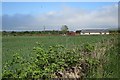
Nearby Images from Geograph Britain and Ireland:
©2015(licence)
©2015(licence)
©2017(licence)
©2015(licence)
©2017(licence)
The above images may not be of the site on this page, they are loaded from Geograph.
Please Submit an Image of this site or go out and take one for us!
Click here to see more info for this site
Nearby sites
Key: Red: member's photo, Blue: 3rd party photo, Yellow: other image, Green: no photo - please go there and take one, Grey: site destroyed
Download sites to:
KML (Google Earth)
GPX (GPS waypoints)
CSV (Garmin/Navman)
CSV (Excel)
To unlock full downloads you need to sign up as a Contributory Member. Otherwise downloads are limited to 50 sites.
Turn off the page maps and other distractions
Nearby sites listing. In the following links * = Image available
1.4km E 99° Westfield 1 Timber Circle (NO629479)
1.4km E 99° Westfield 2 Timber Circle (NO629479)
1.6km NW 321° Kinnell Cursus Cursus (NO605494)
1.8km NNW 332° Kinnell Cursus Cursus (NO607497)
2.3km NNW 343° Kinnell Pictish Cross Slab Class III Pictish Cross Slab (NO60885028)
2.7km ESE 109° Kinblethmont* Class I Pictish Symbol Stone (NO641472)
2.9km NW 307° Guthrie Cursus Cursus (NO592499)
3.4km WNW 303° Guthrie Cursus Cursus (NO587500)
5.7km SSE 156° St. Vigeans Museum* Museum (NO63834294)
6.0km SE 139° Dickmount Law* Cairn (NO65474355)
6.4km W 268° Dumbarrow Hill Stone Fort or Dun (NO55154791)
6.5km SSE 153° Arbroath Eastern Cemetery souterrain* Souterrain (Fogou, Earth House) (NO64394227)
7.6km ESE 121° Castle Rock (Auchmithie)* Promontory Fort / Cliff Castle (NO68074416)
8.0km ESE 105° West Mains of Ethie* Promontory Fort / Cliff Castle (NO69284600)
8.0km SE 125° Lud Castle* Promontory Fort / Cliff Castle (NO68054342)
8.1km SE 138° Maiden Castle Promontory Fort* Promontory Fort / Cliff Castle (NO66894202)
8.2km SSE 147° St Ninian's Well (Arbroath)* Holy Well or Sacred Spring (NO65894116)
8.2km ESE 101° Prail Castle* Promontory Fort / Cliff Castle (NO69624643)
8.4km SW 236° Carmyllie Hill (Greystone) Cairn (NO545434)
8.6km E 94° Red Head* Promontory Fort / Cliff Castle (NO70134740)
8.8km WNW 296° Westerton (Aberlemno)* Stone Circle (NO53645210)
8.8km W 280° Girdle Stane of Dunnichen* Rock Art (NO5280849737)
9.2km NNW 340° St Murdoch's Well (Brechin) Holy Well or Sacred Spring (NO58405682)
10.0km W 278° Dunnichen* Class I Pictish Symbol Stone (NO516496)
10.1km NNE 26° Maryton Cursus Cursus (NO66105713)
View more nearby sites and additional images


 We would like to know more about this location. Please feel free to add a brief description and any relevant information in your own language.
 Wir möchten mehr über diese Stätte erfahren. Bitte zögern Sie nicht, eine kurze Beschreibung und relevante Informationen in Deutsch hinzuzufügen.
 Nous aimerions en savoir encore un peu sur les lieux. S'il vous plaît n'hesitez pas à ajouter une courte description et tous les renseignements pertinents dans votre propre langue.
 Quisieramos informarnos un poco más de las lugares. No dude en añadir una breve descripción y otros datos relevantes en su propio idioma.