 with our Megalithic Portal iPhone app")


<< Our Photo Pages >> Glen Dye Fogou - Souterrain (Fogou, Earth House) in Scotland in Aberdeenshire
Submitted by NikkiJane on Tuesday, 22 June 2021 Page Views: 700
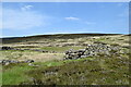
Iron Age and Later PrehistorySite Name: Glen Dye Fogou Alternative Name: Glen Dye Burial MoundCountry: Scotland
NOTE: This site is 3.2 km away from the location you searched for.
County: Aberdeenshire Type: Souterrain (Fogou, Earth House)
Nearest Town: Banchory Nearest Village: Fettercairn
Map Ref: NO629837
Latitude: 56.943071N Longitude: 2.611402W
Condition:
| 5 | Perfect |
| 4 | Almost Perfect |
| 3 | Reasonable but with some damage |
| 2 | Ruined but still recognisable as an ancient site |
| 1 | Pretty much destroyed, possibly visible as crop marks |
| 0 | No data. |
| -1 | Completely destroyed |
| 5 | Superb |
| 4 | Good |
| 3 | Ordinary |
| 2 | Not Good |
| 1 | Awful |
| 0 | No data. |
| 5 | Can be driven to, probably with disabled access |
| 4 | Short walk on a footpath |
| 3 | Requiring a bit more of a walk |
| 2 | A long walk |
| 1 | In the middle of nowhere, a nightmare to find |
| 0 | No data. |
| 5 | co-ordinates taken by GPS or official recorded co-ordinates |
| 4 | co-ordinates scaled from a detailed map |
| 3 | co-ordinates scaled from a bad map |
| 2 | co-ordinates of the nearest village |
| 1 | co-ordinates of the nearest town |
| 0 | no data |
Internal Links:
External Links:
")
To reach it, park at the Bridge of Dye car park - on the right just before the bridge if you are coming from Fettercairn direction. On the OS map it's marked Spittal Cottage. Take the path through the kissing gate round to the left. It's a good walk down the track, on the right just before a small bridge over the Burn of Waterhead.
You may be viewing yesterday's version of this page. To see the most up to date information please register for a free account.
")
")
Do not use the above information on other web sites or publications without permission of the contributor.
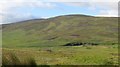
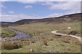
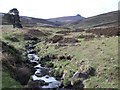
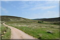
Nearby Images from Geograph Britain and Ireland:
©2015(licence)
©2017(licence)
©2008(licence)
©2023(licence)
©2023(licence)
The above images may not be of the site on this page, they are loaded from Geograph.
Please Submit an Image of this site or go out and take one for us!
Click here to see more info for this site
Nearby sites
Key: Red: member's photo, Blue: 3rd party photo, Yellow: other image, Green: no photo - please go there and take one, Grey: site destroyed
Download sites to:
KML (Google Earth)
GPX (GPS waypoints)
CSV (Garmin/Navman)
CSV (Excel)
To unlock full downloads you need to sign up as a Contributory Member. Otherwise downloads are limited to 50 sites.
Turn off the page maps and other distractions
Nearby sites listing. In the following links * = Image available
3.6km SE 146° Cairn o'Mount* Cairn (NO64938068)
7.8km SSE 157° The Ring Cairn (NO659765)
8.2km SSE 151° Green Castle Ancient Village or Settlement (NO668765)
8.5km SW 228° Colmeallie* Stone Circle (NO565781)
9.4km SSE 165° FetterCairn House Round Barrow(s) (NO653746)
9.7km S 177° Fountain Hillock Round Barrow(s) (NO634740)
9.8km NNE 18° Bucharn* Round Cairn (NO65949300)
10.4km SSE 166° FetterCairn House Round Barrow(s) (NO653736)
10.7km NNW 339° Finzean House* Chambered Cairn (NO591937)
10.8km NE 52° Midtown Ancient Village or Settlement (NO715903)
10.8km NNW 342° Corsedardar* Standing Stone (Menhir) (NO59709405)
10.8km NNW 341° Dardannus Stone* Standing Stone (Menhir) (NO595940)
10.9km ESE 118° St Palladius' Well* Holy Well or Sacred Spring (NO725784)
11.0km ESE 118° Fordoun* Class II Pictish Symbol Stone (NO72617841)
11.4km NE 52° Midtown Ancient Village or Settlement (NO720906)
11.7km NNW 339° Berrysloch* Standing Stone (Menhir) (NO588947)
11.8km NE 48° Esslie The Greater* Stone Circle (NO71729159)
12.1km NE 51° Garrol Wood* Stone Circle (NO72409117)
12.1km WNW 303° Ballochan Hut Circles Ancient Village or Settlement (NO528905)
12.4km N 351° Inchbaire Stone Circle (NO610960)
12.5km SSW 199° Dalbog Stone Circle (NO587719)
12.6km NE 47° Esslie The Lesser* Stone Circle (NO72259215)
13.0km E 100° Droop Hill Cairn (NO757813)
13.0km NE 52° Westerton Hut Circle Ancient Village or Settlement (NO733916)
13.5km NNE 23° Inchmarlo* Standing Stone (Menhir) (NO68249613)
View more nearby sites and additional images


 We would like to know more about this location. Please feel free to add a brief description and any relevant information in your own language.
 Wir möchten mehr über diese Stätte erfahren. Bitte zögern Sie nicht, eine kurze Beschreibung und relevante Informationen in Deutsch hinzuzufügen.
 Nous aimerions en savoir encore un peu sur les lieux. S'il vous plaît n'hesitez pas à ajouter une courte description et tous les renseignements pertinents dans votre propre langue.
 Quisieramos informarnos un poco más de las lugares. No dude en añadir una breve descripción y otros datos relevantes en su propio idioma.