


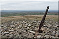
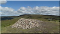
<< Our Photo Pages >> Parlick Pike Cairn - Cairn in England in Lancashire
Submitted by LivingRocks on Thursday, 31 March 2005 Page Views: 10367
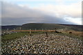
Neolithic and Bronze AgeSite Name: Parlick Pike CairnCountry: England County: Lancashire Type: Cairn
Nearest Town: Longridge Nearest Village: Chipping
Map Ref: SD59574502
Latitude: 53.899761N Longitude: 2.616779W
Condition:
| 5 | Perfect |
| 4 | Almost Perfect |
| 3 | Reasonable but with some damage |
| 2 | Ruined but still recognisable as an ancient site |
| 1 | Pretty much destroyed, possibly visible as crop marks |
| 0 | No data. |
| -1 | Completely destroyed |
| 5 | Superb |
| 4 | Good |
| 3 | Ordinary |
| 2 | Not Good |
| 1 | Awful |
| 0 | No data. |
| 5 | Can be driven to, probably with disabled access |
| 4 | Short walk on a footpath |
| 3 | Requiring a bit more of a walk |
| 2 | A long walk |
| 1 | In the middle of nowhere, a nightmare to find |
| 0 | No data. |
| 5 | co-ordinates taken by GPS or official recorded co-ordinates |
| 4 | co-ordinates scaled from a detailed map |
| 3 | co-ordinates scaled from a bad map |
| 2 | co-ordinates of the nearest village |
| 1 | co-ordinates of the nearest town |
| 0 | no data |
Internal Links:
External Links:
")
You may be viewing yesterday's version of this page. To see the most up to date information please register for a free account.
Do not use the above information on other web sites or publications without permission of the contributor.
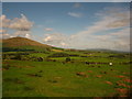
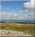
Nearby Images from Geograph Britain and Ireland:
©2011(licence)
©2018(licence)
©2019(licence)
©2007(licence)
©2013(licence)
The above images may not be of the site on this page, they are loaded from Geograph.
Please Submit an Image of this site or go out and take one for us!
Click here to see more info for this site
Nearby sites
Key: Red: member's photo, Blue: 3rd party photo, Yellow: other image, Green: no photo - please go there and take one, Grey: site destroyed
Download sites to:
KML (Google Earth)
GPX (GPS waypoints)
CSV (Garmin/Navman)
CSV (Excel)
To unlock full downloads you need to sign up as a Contributory Member. Otherwise downloads are limited to 50 sites.
Turn off the page maps and other distractions
Nearby sites listing. In the following links * = Image available
2.1km WNW 297° Bleasdale* Timber Circle (SD5771145994)
6.2km ENE 73° Fairy Holes* Cave or Rock Shelter (SD65534678)
6.7km SE 133° Jeffrey Hill Cairn Circle* Cairn (SD644404)
6.7km SE 132° Thornley Hall Fell Cairn* Round Barrow(s) (SD64524047)
7.6km SW 219° St Anne's Well (Inglewhite)* Holy Well or Sacred Spring (SD547392)
7.7km SSE 156° The Written Stone* Sculptured Stone (SD6262237892)
8.7km WSW 252° Claughton Hlaew* Round Barrow(s) (SD51274247)
9.6km ENE 60° The Knowlmere Cross* Ancient Cross (SD679498)
9.8km SW 218° Barton Cross Ancient Cross (SD5350037332)
10.1km ESE 116° Kemple End Cross* Ancient Cross (SD6864240438)
10.6km ENE 66° The Foulscales Stone (Newton)* Early Christian Sculptured Stone (SD693492)
10.6km WSW 257° Catterall Cross* Ancient Cross (SD4920242700)
10.6km W 278° Roman Milestone (Garstang)* Marker Stone (SD4907146676)
10.7km SSE 147° St Saviour's Churchyard (Stydd) Ancient Cross (SD6539435971)
11.3km SSE 152° St Wilfrid's Church (Ribchester)* Ancient Cross (SD649350)
11.6km WSW 258° Medieval Grave Covers (Churchtown)* Sculptured Stone (SD4818242808)
11.8km ESE 111° Withgill Cross (Great Mitton) Ancient Cross (SD70604062)
12.1km SSW 199° Our Lady's Well, Fernyhalgh* Holy Well or Sacred Spring (SD55613362)
12.6km ENE 75° Walloper Well (Newton) Holy Well or Sacred Spring (SD7182348265)
12.7km ENE 71° Easington Fell Ring (Newton) Ancient Village or Settlement (SD71674911)
12.8km SE 126° Billington Round Barrow(s) (SD699375)
12.8km ESE 114° Mitton Green Cross (Great Mitton) Ancient Cross (SD7121739613)
13.2km S 175° Marsden Well/Spring* Holy Well or Sacred Spring (SD607319)
13.2km E 95° Pinder Hill (Waddington) Cairn (SD72724370)
13.4km SE 124° Winckley Lowe I* Round Barrow(s) (SD7064337457)
View more nearby sites and additional images


 We would like to know more about this location. Please feel free to add a brief description and any relevant information in your own language.
 Wir möchten mehr über diese Stätte erfahren. Bitte zögern Sie nicht, eine kurze Beschreibung und relevante Informationen in Deutsch hinzuzufügen.
 Nous aimerions en savoir encore un peu sur les lieux. S'il vous plaît n'hesitez pas à ajouter une courte description et tous les renseignements pertinents dans votre propre langue.
 Quisieramos informarnos un poco más de las lugares. No dude en añadir una breve descripción y otros datos relevantes en su propio idioma.