


<< Text Pages >> St Andrew (Yetminster) - Ancient Cross in England in Dorset
Submitted by TimPrevett on Sunday, 27 May 2007 Page Views: 4574
Early Medieval (Dark Age)Site Name: St Andrew (Yetminster)Country: England
NOTE: This site is 0.5 km away from the location you searched for.
County: Dorset Type: Ancient Cross
Nearest Town: Yetminster
Map Ref: ST59421066
Latitude: 50.893986N Longitude: 2.578355W
Condition:
| 5 | Perfect |
| 4 | Almost Perfect |
| 3 | Reasonable but with some damage |
| 2 | Ruined but still recognisable as an ancient site |
| 1 | Pretty much destroyed, possibly visible as crop marks |
| 0 | No data. |
| -1 | Completely destroyed |
| 5 | Superb |
| 4 | Good |
| 3 | Ordinary |
| 2 | Not Good |
| 1 | Awful |
| 0 | No data. |
| 5 | Can be driven to, probably with disabled access |
| 4 | Short walk on a footpath |
| 3 | Requiring a bit more of a walk |
| 2 | A long walk |
| 1 | In the middle of nowhere, a nightmare to find |
| 0 | No data. |
| 5 | co-ordinates taken by GPS or official recorded co-ordinates |
| 4 | co-ordinates scaled from a detailed map |
| 3 | co-ordinates scaled from a bad map |
| 2 | co-ordinates of the nearest village |
| 1 | co-ordinates of the nearest town |
| 0 | no data |
Be the first person to rate this site - see the 'Contribute!' box in the right hand menu.
Internal Links:
External Links:
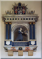
Ancient Cross in Dorset
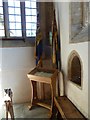
Likely 10th Century cross fragment now inside St Andrew's, Yetminster.
You may be viewing yesterday's version of this page. To see the most up to date information please register for a free account.
Do not use the above information on other web sites or publications without permission of the contributor.
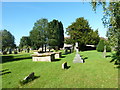
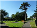
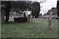
Nearby Images from Geograph Britain and Ireland:
©2012(licence)
©2012(licence)
©2012(licence)
©2020(licence)
©2011(licence)
The above images may not be of the site on this page, they are loaded from Geograph.
Please Submit an Image of this site or go out and take one for us!
Click here to see more info for this site
Nearby sites
Key: Red: member's photo, Blue: 3rd party photo, Yellow: other image, Green: no photo - please go there and take one, Grey: site destroyed
Download sites to:
KML (Google Earth)
GPX (GPS waypoints)
CSV (Garmin/Navman)
CSV (Excel)
To unlock full downloads you need to sign up as a Contributory Member. Otherwise downloads are limited to 50 sites.
Turn off the page maps and other distractions
Nearby sites listing. In the following links * = Image available
2.9km WSW 258° Closworth Cursus Cursus (ST56581008)
3.6km SE 133° Leigh Miz Maze* Turf Maze (ST62000818)
6.2km SSW 196° Evershot Stones* Standing Stones (ST57600469)
6.5km SSW 200° St John's Well (Evershot)* Holy Well or Sacred Spring (ST5721304596)
7.0km WNW 291° Holy Well (West Coker)* Holy Well or Sacred Spring (ST52951325)
7.8km SSE 151° Cross and Hand Stone* Standing Stone (Menhir) (ST632038)
8.2km SE 136° St Mary's Well (Hermitage)* Holy Well or Sacred Spring (ST651047)
8.8km SE 138° East Hill field System* Misc. Earthwork (ST65250405)
9.8km SE 138° Farm Hill Bowl Barrow Round Barrow(s) (ST65880334)
9.8km SE 139° High Cank Henge Henge (ST65720319)
9.9km SW 233° Corscombe* Standing Stones (ST514048)
10.1km SE 145° Seldon Hill Settlement Ancient Village or Settlement (ST65100235)
10.1km ESE 108° Dungeon Hill* Hillfort (ST690074)
10.2km SSE 148° Wancombe Hill Field System Misc. Earthwork (ST64790200)
10.5km SW 226° Hore Stones* Standing Stones (ST5178603403)
10.5km E 82° Holy Well (Holwell)* Holy Well or Sacred Spring (ST699121)
10.6km S 180° The Castle Hillfort (ST594001)
10.6km SW 235° Higher Ground Meadow Modern Burial Mound* Artificial Mound (ST5066904650)
10.7km SSW 200° Wraxall Cromlech Burial Chamber or Dolmen (ST557006)
10.8km SE 146° Weam Commen Hill Field System Misc. Earthwork (ST654016)
11.1km S 181° Cattistock holy well Holy Well or Sacred Spring
11.2km SSE 152° Up Cerne/Sydling St Nicholas Boundary Stone Marker Stone (ST64610078)
11.3km SE 138° Giant Hill Settlement Ancient Village or Settlement (ST66950225)
11.3km SE 137° Bowl Barrow (Dorset) Round Barrow(s) (ST67030229)
11.4km SSE 164° The Combe (Dorset) Misc. Earthwork (SY624997)
View more nearby sites and additional images


 We would like to know more about this location. Please feel free to add a brief description and any relevant information in your own language.
 Wir möchten mehr über diese Stätte erfahren. Bitte zögern Sie nicht, eine kurze Beschreibung und relevante Informationen in Deutsch hinzuzufügen.
 Nous aimerions en savoir encore un peu sur les lieux. S'il vous plaît n'hesitez pas à ajouter une courte description et tous les renseignements pertinents dans votre propre langue.
 Quisieramos informarnos un poco más de las lugares. No dude en añadir una breve descripción y otros datos relevantes en su propio idioma.