


<< Text Pages >> Crookmore - Stone Circle in Scotland in Aberdeenshire
Submitted by Anonymous on Monday, 15 July 2002 Page Views: 6366
Neolithic and Bronze AgeSite Name: CrookmoreCountry: Scotland
NOTE: This site is 1.7 km away from the location you searched for.
County: Aberdeenshire Type: Stone Circle
Map Ref: NJ588184 Landranger Map Number: 37
Latitude: 57.254414N Longitude: 2.684507W
Condition:
| 5 | Perfect |
| 4 | Almost Perfect |
| 3 | Reasonable but with some damage |
| 2 | Ruined but still recognisable as an ancient site |
| 1 | Pretty much destroyed, possibly visible as crop marks |
| 0 | No data. |
| -1 | Completely destroyed |
| 5 | Superb |
| 4 | Good |
| 3 | Ordinary |
| 2 | Not Good |
| 1 | Awful |
| 0 | No data. |
| 5 | Can be driven to, probably with disabled access |
| 4 | Short walk on a footpath |
| 3 | Requiring a bit more of a walk |
| 2 | A long walk |
| 1 | In the middle of nowhere, a nightmare to find |
| 0 | No data. |
| 5 | co-ordinates taken by GPS or official recorded co-ordinates |
| 4 | co-ordinates scaled from a detailed map |
| 3 | co-ordinates scaled from a bad map |
| 2 | co-ordinates of the nearest village |
| 1 | co-ordinates of the nearest town |
| 0 | no data |
Be the first person to rate this site - see the 'Contribute!' box in the right hand menu.
Internal Links:
External Links:
Stone Circle in Aberdeenshire
Have you visited this site? Please contribute a description or any thoughts by adding a comment.
You may be viewing yesterday's version of this page. To see the most up to date information please register for a free account.
Do not use the above information on other web sites or publications without permission of the contributor.
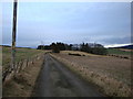
Nearby Images from Geograph Britain and Ireland:
©2007(licence)
©2007(licence)
©2016(licence)
©2007(licence)
©2009(licence)
The above images may not be of the site on this page, they are loaded from Geograph.
Please Submit an Image of this site or go out and take one for us!
Click here to see more info for this site
Nearby sites
Key: Red: member's photo, Blue: 3rd party photo, Yellow: other image, Green: no photo - please go there and take one, Grey: site destroyed
Download sites to:
KML (Google Earth)
GPX (GPS waypoints)
CSV (Garmin/Navman)
CSV (Excel)
To unlock full downloads you need to sign up as a Contributory Member. Otherwise downloads are limited to 50 sites.
Turn off the page maps and other distractions
Nearby sites listing. In the following links * = Image available
0m E 90° Crookmore Multiple Stone Rows / Avenue (NJ588184)
1.2km SW 234° Druidsfield* Multiple Stone Rows / Avenue (NJ578177)
1.2km SW 234° Druidsfield* Stone Circle (NJ578177)
1.3km NE 40° Old Keig* Stone Circle (NJ59651939)
2.0km NNE 33° Barmkyn of North Keig* Hillfort (NJ59912004)
3.2km ENE 64° Cothiemuir Wood* Stone Circle (NJ61711980)
4.1km WNW 300° Corrie Cairn* Stone Circle (NJ55222052)
4.6km S 184° North Strone* Stone Circle (NJ584138)
4.7km NE 35° Druidstone (Brackla)* Stone Circle (NJ6152922206)
5.0km WSW 256° Nether Balfour Multiple Stone Rows / Avenue (NJ539172)
5.0km WSW 256° Nether Balfour Stone Circle (NJ539172)
5.6km N 1° Leslie Stone Circle (NJ590240)
6.0km NNE 15° Loanend* Stone Circle (NJ604242)
6.3km ESE 123° Luath's Stone* Standing Stone (Menhir) (NJ64041489)
6.8km N 352° Johnston, The Ringing Stone* Standing Stone (Menhir) (NJ57902517)
7.1km N 3° Braehead Circle* Stone Circle (NJ592255)
7.2km NW 322° Clatt 1* Class I Pictish Symbol Stone (NJ54422408)
7.3km SE 131° Whitehill Stone Circle* Stone Circle (NJ643135)
7.7km ESE 114° Monymusk 2 Early Christian Sculptured Stone (NJ65801524)
7.7km S 185° Howemill* Stone Circle (NJ580107)
7.9km SSW 199° Drumfours* Stone Circle (NJ561110)
8.1km NE 35° Newton Stone Circle Stone Circle (NJ63512503)
8.2km NNE 29° Westside Stone Circle Stone Circle (NJ62832552)
8.5km NNW 333° Tofthill, Clatt Stone Circle (NJ5526)
8.6km NE 44° Tillymuick Ancient Village or Settlement (NJ649245)
View more nearby sites and additional images


 We would like to know more about this location. Please feel free to add a brief description and any relevant information in your own language.
 Wir möchten mehr über diese Stätte erfahren. Bitte zögern Sie nicht, eine kurze Beschreibung und relevante Informationen in Deutsch hinzuzufügen.
 Nous aimerions en savoir encore un peu sur les lieux. S'il vous plaît n'hesitez pas à ajouter une courte description et tous les renseignements pertinents dans votre propre langue.
 Quisieramos informarnos un poco más de las lugares. No dude en añadir una breve descripción y otros datos relevantes en su propio idioma.