


<< Text Pages >> Hardendale - Timber Circle in England in Cumbria
Submitted by vicky on Sunday, 22 December 2002 Page Views: 5500
Neolithic and Bronze AgeSite Name: HardendaleCountry: England County: Cumbria Type: Timber Circle
Map Ref: NY590137 Landranger Map Number: 91
Latitude: 54.516929N Longitude: 2.634851W
Condition:
| 5 | Perfect |
| 4 | Almost Perfect |
| 3 | Reasonable but with some damage |
| 2 | Ruined but still recognisable as an ancient site |
| 1 | Pretty much destroyed, possibly visible as crop marks |
| 0 | No data. |
| -1 | Completely destroyed |
| 5 | Superb |
| 4 | Good |
| 3 | Ordinary |
| 2 | Not Good |
| 1 | Awful |
| 0 | No data. |
| 5 | Can be driven to, probably with disabled access |
| 4 | Short walk on a footpath |
| 3 | Requiring a bit more of a walk |
| 2 | A long walk |
| 1 | In the middle of nowhere, a nightmare to find |
| 0 | No data. |
| 5 | co-ordinates taken by GPS or official recorded co-ordinates |
| 4 | co-ordinates scaled from a detailed map |
| 3 | co-ordinates scaled from a bad map |
| 2 | co-ordinates of the nearest village |
| 1 | co-ordinates of the nearest town |
| 0 | no data |
Internal Links:
External Links:
Timber Circle in Cumbria
Have you visited this site? Please add a comment below.
You may be viewing yesterday's version of this page. To see the most up to date information please register for a free account.
Do not use the above information on other web sites or publications without permission of the contributor.
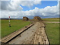
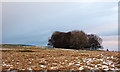
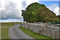
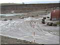
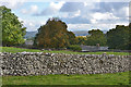
Nearby Images from Geograph Britain and Ireland:
©2021(licence)
©2014(licence)
©2015(licence)
©2008(licence)
©2015(licence)
The above images may not be of the site on this page, they are loaded from Geograph.
Please Submit an Image of this site or go out and take one for us!
Click here to see more info for this site
Nearby sites
Key: Red: member's photo, Blue: 3rd party photo, Yellow: other image, Green: no photo - please go there and take one, Grey: site destroyed
Download sites to:
KML (Google Earth)
GPX (GPS waypoints)
CSV (Garmin/Navman)
CSV (Excel)
To unlock full downloads you need to sign up as a Contributory Member. Otherwise downloads are limited to 50 sites.
Turn off the page maps and other distractions
Nearby sites listing. In the following links * = Image available
476m SE 141° Kalmott cairn circle* Ring Cairn (NY59301333)
530m SSE 158° Oddendale stone alignment* Stone Row / Alignment (NY5919113205)
814m SSE 165° Oddendale* Stone Circle (NY59201291)
1.1km SE 146° Seal Howe Iron Age/Romano British field system* Misc. Earthwork (NY5961612783)
1.1km SSE 151° Seal Howe* Cairn (NY59541272)
1.2km SE 142° Seal Howe Cairn 2* Round Cairn (NY5969912781)
1.2km SW 215° St Anne's Well (Shap)* Holy Well or Sacred Spring (NY5829412700)
1.2km NNE 31° Iron Hill South* Stone Circle (NY59641476)
1.3km NNE 29° Iron Hill North* Stone Circle (NY59631482)
1.5km ESE 121° Seal Howe Cairn 3* Round Cairn (NY6025312925)
1.7km N 351° Castlehowe Scar Stone Row* Stone Row / Alignment (NY5873615412)
1.8km N 351° Castlehowe Scar Stone Circle* Stone Circle (NY5874815472)
1.8km NNW 340° Castlehow Stones Stone Row / Alignment (NY584154)
2.0km E 96° Ewe Close* Ancient Village or Settlement (NY61021348)
2.1km NNW 336° Thunder Stone (Castlehowe Scar)* Natural Stone / Erratic / Other Natural Feature (NY5817615610)
2.2km W 259° Kemp Howe* Stone Circle (NY56801330)
2.3km W 272° Shap Avenue* Multiple Stone Rows / Avenue (NY567138)
2.3km ESE 113° Ewe Locks* Ancient Village or Settlement (NY6112512794)
2.4km SE 144° Wicker Street* Cairn (NY60411173)
2.7km SE 140° White Hag* Stone Circle (NY60721160)
2.9km S 173° Long Scar Pike* Cairn (NY5933810862)
2.9km WNW 291° The Giant's Foot (Cumbria)* Standing Stone (Menhir) (NY5630014781)
2.9km SE 136° White Hag Round cairn* Round Cairn (NY61011158)
3.1km ESE 123° Cow Green Long Barrow* Long Barrow (NY61541199)
3.1km E 84° Crosby Ravensworth Stone Row* Multiple Stone Rows / Avenue (NY6212514022)
View more nearby sites and additional images


 We would like to know more about this location. Please feel free to add a brief description and any relevant information in your own language.
 Wir möchten mehr über diese Stätte erfahren. Bitte zögern Sie nicht, eine kurze Beschreibung und relevante Informationen in Deutsch hinzuzufügen.
 Nous aimerions en savoir encore un peu sur les lieux. S'il vous plaît n'hesitez pas à ajouter une courte description et tous les renseignements pertinents dans votre propre langue.
 Quisieramos informarnos un poco más de las lugares. No dude en añadir una breve descripción y otros datos relevantes en su propio idioma.