
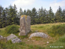

<< Our Photo Pages >> Howan Blo - Cist in Scotland in Orkney
Submitted by howar on Thursday, 23 January 2014 Page Views: 2743
Neolithic and Bronze AgeSite Name: Howan BloCountry: Scotland County: Orkney Type: Cist
Nearest Town: Kirkwall Nearest Village: Deerness
Map Ref: HY571060
Latitude: 58.939079N Longitude: 2.747111W
Condition:
| 5 | Perfect |
| 4 | Almost Perfect |
| 3 | Reasonable but with some damage |
| 2 | Ruined but still recognisable as an ancient site |
| 1 | Pretty much destroyed, possibly visible as crop marks |
| 0 | No data. |
| -1 | Completely destroyed |
| 5 | Superb |
| 4 | Good |
| 3 | Ordinary |
| 2 | Not Good |
| 1 | Awful |
| 0 | No data. |
| 5 | Can be driven to, probably with disabled access |
| 4 | Short walk on a footpath |
| 3 | Requiring a bit more of a walk |
| 2 | A long walk |
| 1 | In the middle of nowhere, a nightmare to find |
| 0 | No data. |
| 5 | co-ordinates taken by GPS or official recorded co-ordinates |
| 4 | co-ordinates scaled from a detailed map |
| 3 | co-ordinates scaled from a bad map |
| 2 | co-ordinates of the nearest village |
| 1 | co-ordinates of the nearest town |
| 0 | no data |
Internal Links:
External Links:
")
Here over the course of a few years Mr Aim, the farmer at Blow(e)s, came across internments near its crest in 1929 and 1932 (the record says 1933, but Callendar's article from that October refers the discovery to "January last"). On both occasions he covered the finds until the archaeologists came. In early March 1929 whilst digging into the clay his plough lifted the coverstone of a short cist containing an eight inch high dolomitic steatite urn and potsherds from a small urn. The cist was hollowed into a circular depresssion 4-5" deep in the centre, floored with stone flakes averaging some 5" square and ¼" thick. In plan it was approx. 20" by 16" with sides of bluish Orkney sandstone slabs each 18" deep and 1½" thick.
There was a layer of burnt human bones 5-6" deep. After excavation the farmer put the remains back and covered the find. in January 1932 Mr Aim made another find only a few feet away. This consisted of a Bronze Age cinerary urn and fragments of a smaller one, both of clay. The large urn held bone ash and potsherds. When the archaeologists came and did their excavation they found an urn-shaped cavity under a coverstone just five feet away, though it had never held an urn. It measured some 15" deep and 12" wide diminishing to 5", and was almost completely filled with the dark greasy remains of bones. Though the urn passed to the museum the rest was re-buried as before. Later attempts to locate these proved unsuccessful. It is possible that this is the site of Petrie's 1869 Milldam Farm dig that found several cists near an ancient settlement.
You may be viewing yesterday's version of this page. To see the most up to date information please register for a free account.
")
Do not use the above information on other web sites or publications without permission of the contributor.
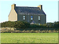
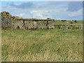
Nearby Images from Geograph Britain and Ireland:
©2021(licence)
©2013(licence)
©2006(licence)
©2006(licence)
©2006(licence)
The above images may not be of the site on this page, they are loaded from Geograph.
Please Submit an Image of this site or go out and take one for us!
Click here to see more info for this site
Nearby sites
Key: Red: member's photo, Blue: 3rd party photo, Yellow: other image, Green: no photo - please go there and take one, Grey: site destroyed
Download sites to:
KML (Google Earth)
GPX (GPS waypoints)
CSV (Garmin/Navman)
CSV (Excel)
To unlock full downloads you need to sign up as a Contributory Member. Otherwise downloads are limited to 50 sites.
Turn off the page maps and other distractions
Nearby sites listing. In the following links * = Image available
911m NNW 333° Millfield* Artificial Mound (HY56700682)
1.0km N 349° Koffer Howe* Artificial Mound (HY56920699)
1.7km E 79° Deerness Broch or Nuraghe (HY588063)
1.8km ESE 105° The Howie* Ancient Village or Settlement (HY58850550)
1.9km SSE 168° Newark (Orkney)* Souterrain (Fogou, Earth House) (HY57460413)
2.2km SSE 154° Howe o' Backland* Broch or Nuraghe (HY58040402)
2.2km W 272° Eves Howe* Broch or Nuraghe (HY54900611)
2.4km SSW 192° Mussaquoy* Artificial Mound (HY56590369)
2.5km NE 55° Riggan of Kami* Broch or Nuraghe (HY59170743)
2.6km W 277° Hurnip's Point* Chambered Cairn (HY54480634)
3.1km SSW 213° Sandaiken* Ancient Village or Settlement (HY55380346)
3.6km SW 220° Dingieshowe* Ancient Village or Settlement (HY54760330)
3.6km SW 220° Peerie Howe* Ancient Village or Settlement (HY54750324)
3.6km WSW 237° Comely* Cairn (HY54040403)
3.7km NE 41° Brough of Deerness* Promontory Fort / Cliff Castle (HY59550873)
3.7km WSW 246° St. Peter's Bay Mound* Broch or Nuraghe (HY537045)
3.8km WSW 241° Campston Cairn* Cairn (HY537042)
3.9km WSW 242° St. Peter's Kirk* Ancient Village or Settlement (HY536042)
4.7km SW 219° Stembister farm stone* Standing Stone (Menhir) (HY54130239)
4.7km WSW 245° Campston (Toab)* Broch or Nuraghe (HY528041)
4.8km NNW 327° The Brough* Ancient Village or Settlement (HY545101)
5.0km NNW 327° Castle of Hangie Bay* Stone Fort or Dun (HY54461022)
5.0km SW 220° The Cairn* Artificial Mound (HY53840223)
5.0km NW 308° Taing of Beeman* Ancient Village or Settlement (HY53210914)
5.1km W 269° Breck Farm* Standing Stones (HY520060)
View more nearby sites and additional images


 We would like to know more about this location. Please feel free to add a brief description and any relevant information in your own language.
 Wir möchten mehr über diese Stätte erfahren. Bitte zögern Sie nicht, eine kurze Beschreibung und relevante Informationen in Deutsch hinzuzufügen.
 Nous aimerions en savoir encore un peu sur les lieux. S'il vous plaît n'hesitez pas à ajouter une courte description et tous les renseignements pertinents dans votre propre langue.
 Quisieramos informarnos un poco más de las lugares. No dude en añadir una breve descripción y otros datos relevantes en su propio idioma.