


<< Our Photo Pages >> Skellaw Hill Tumulus - Round Barrow(s) in England in Cumbria
Submitted by MonumentMan on Saturday, 14 March 2020 Page Views: 1647
Neolithic and Bronze AgeSite Name: Skellaw Hill Tumulus Alternative Name: Skull Hill Bowl BarrowCountry: England County: Cumbria Type: Round Barrow(s)
Nearest Town: Penrith Nearest Village: Shap
Map Ref: NY5565015470
Latitude: 54.532552N Longitude: 2.686862W
Condition:
| 5 | Perfect |
| 4 | Almost Perfect |
| 3 | Reasonable but with some damage |
| 2 | Ruined but still recognisable as an ancient site |
| 1 | Pretty much destroyed, possibly visible as crop marks |
| 0 | No data. |
| -1 | Completely destroyed |
| 5 | Superb |
| 4 | Good |
| 3 | Ordinary |
| 2 | Not Good |
| 1 | Awful |
| 0 | No data. |
| 5 | Can be driven to, probably with disabled access |
| 4 | Short walk on a footpath |
| 3 | Requiring a bit more of a walk |
| 2 | A long walk |
| 1 | In the middle of nowhere, a nightmare to find |
| 0 | No data. |
| 5 | co-ordinates taken by GPS or official recorded co-ordinates |
| 4 | co-ordinates scaled from a detailed map |
| 3 | co-ordinates scaled from a bad map |
| 2 | co-ordinates of the nearest village |
| 1 | co-ordinates of the nearest town |
| 0 | no data |
Internal Links:
External Links:
I have visited· I would like to visit
Chappers60 saw from a distance on 9th Aug 2024 - their rating: Cond: 3 Amb: 3 Access: 4 Short walk 'near' footpath
")
See here for more detail
It is located at the northern end of the Shap Stone Row/Avenue and a line could be drawn towards the Aspers Field and Goggleby Stones but any association is not yet understood. In the wall to the south of the hill and next to the road, there lies three boulders, possibly part of this stone row.
You may be viewing yesterday's version of this page. To see the most up to date information please register for a free account.
")
")
Do not use the above information on other web sites or publications without permission of the contributor.
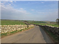
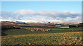
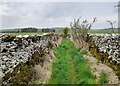
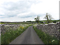
Nearby Images from Geograph Britain and Ireland:
©2018(licence)
©2014(licence)
©2023(licence)

©2026(licence)
©2015(licence)
The above images may not be of the site on this page, they are loaded from Geograph.
Please Submit an Image of this site or go out and take one for us!
Click here to see more info for this site
Nearby sites
Key: Red: member's photo, Blue: 3rd party photo, Yellow: other image, Green: no photo - please go there and take one, Grey: site destroyed
Download sites to:
KML (Google Earth)
GPX (GPS waypoints)
CSV (Garmin/Navman)
CSV (Excel)
To unlock full downloads you need to sign up as a Contributory Member. Otherwise downloads are limited to 50 sites.
Turn off the page maps and other distractions
Nearby sites listing. In the following links * = Image available
211m SSW 209° Keld Lane Stones* Standing Stone (Menhir) (NY5554615286)
324m SE 143° Aspers Field* Standing Stone (Menhir) (NY5584115208)
464m SE 144° Goggleby Stone* Standing Stone (Menhir) (NY5592215093)
572m WNW 299° Thunder Stone (Shap)* Natural Stone / Erratic / Other Natural Feature (NY55151575)
946m SE 136° The Giant's Foot (Cumbria)* Standing Stone (Menhir) (NY5630014781)
1.3km WSW 243° Stone Howe Cairn (NY545149)
2.0km SSE 147° Shap Avenue* Multiple Stone Rows / Avenue (NY567138)
2.3km NE 53° Cross Shaped Stone of Keverigg* Ancient Cross (NY5751916849)
2.3km NE 52° Cross Stone of Keverigg Ancient Cross (NY57511687)
2.5km SSE 152° Kemp Howe* Stone Circle (NY56801330)
2.5km NW 316° Benny Howe Round Barrow(s) (NY53901729)
2.5km E 86° Thunder Stone (Castlehowe Scar)* Natural Stone / Erratic / Other Natural Feature (NY5817615610)
2.6km NNE 27° Gunnerkeld* Stone Circle (NY56821775)
2.7km SW 231° Blaze Hill Round Cairn* Round Cairn (NY5355613795)
2.7km E 91° Castlehow Stones Stone Row / Alignment (NY584154)
2.8km NNW 344° Wilson Scar Stone Circle (NY549182)
3.0km SW 226° White Raise Round Cairn A* Round Cairn (NY5347313431)
3.0km SW 227° White Raise Round Cairn B* Round Cairn (NY5342913450)
3.1km E 91° Castlehowe Scar Stone Row* Stone Row / Alignment (NY5873615412)
3.1km E 89° Castlehowe Scar Stone Circle* Stone Circle (NY5874815472)
3.4km N 353° Shapbeck Plantation* Stone Circle (NY55261886)
3.6km NNW 337° Out Scar Ancient Village or Settlement (NY543188)
3.8km ESE 117° Hardendale Timber Circle (NY590137)
3.8km SE 136° St Anne's Well (Shap)* Holy Well or Sacred Spring (NY5829412700)
4.0km E 99° Iron Hill North* Stone Circle (NY59631482)
View more nearby sites and additional images


 We would like to know more about this location. Please feel free to add a brief description and any relevant information in your own language.
 Wir möchten mehr über diese Stätte erfahren. Bitte zögern Sie nicht, eine kurze Beschreibung und relevante Informationen in Deutsch hinzuzufügen.
 Nous aimerions en savoir encore un peu sur les lieux. S'il vous plaît n'hesitez pas à ajouter une courte description et tous les renseignements pertinents dans votre propre langue.
 Quisieramos informarnos un poco más de las lugares. No dude en añadir una breve descripción y otros datos relevantes en su propio idioma.