<< Our Photo Pages >> Loch of Tankerness - Ancient Village or Settlement in Scotland in Orkney
Submitted by howar on Sunday, 28 March 2004 Page Views: 7438
Multi-periodSite Name: Loch of TankernessCountry: Scotland County: Orkney Type: Ancient Village or Settlement
Nearest Town: Kirkwall
Map Ref: HY522093 Landranger Map Number: 6
Latitude: 58.968192N Longitude: 2.832951W
Condition:
| 5 | Perfect |
| 4 | Almost Perfect |
| 3 | Reasonable but with some damage |
| 2 | Ruined but still recognisable as an ancient site |
| 1 | Pretty much destroyed, possibly visible as crop marks |
| 0 | No data. |
| -1 | Completely destroyed |
| 5 | Superb |
| 4 | Good |
| 3 | Ordinary |
| 2 | Not Good |
| 1 | Awful |
| 0 | No data. |
| 5 | Can be driven to, probably with disabled access |
| 4 | Short walk on a footpath |
| 3 | Requiring a bit more of a walk |
| 2 | A long walk |
| 1 | In the middle of nowhere, a nightmare to find |
| 0 | No data. |
| 5 | co-ordinates taken by GPS or official recorded co-ordinates |
| 4 | co-ordinates scaled from a detailed map |
| 3 | co-ordinates scaled from a bad map |
| 2 | co-ordinates of the nearest village |
| 1 | co-ordinates of the nearest town |
| 0 | no data |
Internal Links:
External Links:
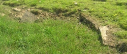
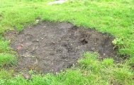
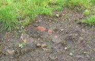
For once CANMORE provides no detail apart from this being a burnt mound below which at low water levels can be seen the tops of upright slabs forming an oval structure. This is on the same side of the loch as The Howie of The Manse and I feel excavation would reveal the area about it to be perhaps as complicated. Opposite the gate that gives entrance to the Grieves Cottage field is a gate to the field on the other side of the road, and you can see the (on this side slight) mound over by. When you approach this it seems more like two mounds - either that or at one time it was rather large. There are some big-ish stones in this, especially where it falls away to the shore, but I could discern no structures.
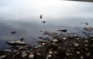
Down on the beach much of the geology seems to be flagstone pavement , including some immense slabs. Must have been low water because I could easily find various upright slabs buried about here .
Raymond Lamb in "The Archaeological Sites and Monuments of Scotland , 27..." says that the drought of 1980 not only exposed this Bronze Age structure but also an erect row of slabs fifteen metres ESE of the house beside a wall, and that the waters must have risen by at least a metre since these were built (it is only 2m deep now in most of the deeper sections). Certainly some of this doesn't require even waterproof shoes to get close to. Make a nice paddle. I'm not sure I didn't see one or two extra upright scattered about as I couldn't make out the recorded structure's outline myself. Could some of the flagstones also have been part of structures, or at the very least abutted them ? Tried to decide but was unable to do so, simply a feeling. Raymond also says many crude stone implements lie on the loch bed.
You may be viewing yesterday's version of this page. To see the most up to date information please register for a free account.






Do not use the above information on other web sites or publications without permission of the contributor.
Click here to see more info for this site
Nearby sites
Key: Red: member's photo, Blue: 3rd party photo, Yellow: other image, Green: no photo - please go there and take one, Grey: site destroyed
Download sites to:
KML (Google Earth)
GPX (GPS waypoints)
CSV (Garmin/Navman)
CSV (Excel)
To unlock full downloads you need to sign up as a Contributory Member. Otherwise downloads are limited to 50 sites.
Turn off the page maps and other distractions
Nearby sites listing. In the following links * = Image available
300m S 179° Grieves Cottage* Standing Stone (Menhir) (HY522090)
852m WSW 249° The Howie of The Manse* Broch or Nuraghe (HY514090)
1.0km E 98° Taing of Beeman* Ancient Village or Settlement (HY53210914)
1.4km SW 233° Whitecleat* Holy Well or Sacred Spring (HY511085)
1.6km SW 214° Mill Sand* Standing Stones (HY513080)
1.7km NW 306° Yinstay* Ancient Village or Settlement (HY50841031)
2.0km S 188° Loch of Messigate* Standing Stones (HY519073)
2.4km ENE 70° The Brough* Ancient Village or Settlement (HY545101)
2.4km ENE 67° Castle of Hangie Bay* Stone Fort or Dun (HY54461022)
2.6km S 190° Muckle Crofty* Stone Row / Alignment (HY517067)
2.9km SSW 208° Nearhouse* Ancient Village or Settlement (HY508068)
3.0km SSW 199° Hawell Burnt Mound* Round Barrow(s) (HY512065)
3.3km S 183° Breck Farm* Standing Stones (HY520060)
3.3km SSW 200° Stem Howe* Round Barrow(s) (HY510062)
3.3km SSW 197° Longhowe Cairn (HY512061)
3.5km SSW 198° Mine Howe* Chambered Cairn (HY5106406023)
3.5km SSW 201° Long Howe* Long Barrow (HY509060)
3.7km SSW 202° Round Howe* Broch or Nuraghe (HY50780591)
3.7km SSW 203° Burn of Langskaill* Ancient Village or Settlement (HY507059)
3.7km SE 142° Hurnip's Point* Chambered Cairn (HY54480634)
3.8km SSW 209° Brymer* Round Barrow(s) (HY503060)
3.9km SW 231° Craw Howe* Cairn (HY491069)
4.2km SE 139° Eves Howe* Broch or Nuraghe (HY54900611)
4.5km WSW 238° Staneloof* Cairn (HY48330698)
4.7km W 278° Berstane Broch* Broch or Nuraghe (HY475100)
View more nearby sites and additional images





 We would like to know more about this location. Please feel free to add a brief description and any relevant information in your own language.
 Wir möchten mehr über diese Stätte erfahren. Bitte zögern Sie nicht, eine kurze Beschreibung und relevante Informationen in Deutsch hinzuzufügen.
 Nous aimerions en savoir encore un peu sur les lieux. S'il vous plaît n'hesitez pas à ajouter une courte description et tous les renseignements pertinents dans votre propre langue.
 Quisieramos informarnos un poco más de las lugares. No dude en añadir una breve descripción y otros datos relevantes en su propio idioma.