 with our Megalithic Portal iPhone app")


<< Text Pages >> West Mains 1 & 2 (Turin Hill) - Rock Art in Scotland in Angus
Submitted by Anne T on Friday, 12 January 2018 Page Views: 1779
Rock ArtSite Name: West Mains 1 & 2 (Turin Hill)Country: Scotland
NOTE: This site is 0.8 km away from the location you searched for.
County: Angus Type: Rock Art
Nearest Town: Forfar Nearest Village: Aberlemno
Map Ref: NO52145369
Latitude: 56.672512N Longitude: 2.782597W
Condition:
| 5 | Perfect |
| 4 | Almost Perfect |
| 3 | Reasonable but with some damage |
| 2 | Ruined but still recognisable as an ancient site |
| 1 | Pretty much destroyed, possibly visible as crop marks |
| 0 | No data. |
| -1 | Completely destroyed |
| 5 | Superb |
| 4 | Good |
| 3 | Ordinary |
| 2 | Not Good |
| 1 | Awful |
| 0 | No data. |
| 5 | Can be driven to, probably with disabled access |
| 4 | Short walk on a footpath |
| 3 | Requiring a bit more of a walk |
| 2 | A long walk |
| 1 | In the middle of nowhere, a nightmare to find |
| 0 | No data. |
| 5 | co-ordinates taken by GPS or official recorded co-ordinates |
| 4 | co-ordinates scaled from a detailed map |
| 3 | co-ordinates scaled from a bad map |
| 2 | co-ordinates of the nearest village |
| 1 | co-ordinates of the nearest town |
| 0 | no data |
Be the first person to rate this site - see the 'Contribute!' box in the right hand menu.
Internal Links:
External Links:
Rock Art in Angus
The Northern Antiquarian (TNA) tell us about these cup marked stones, which are "not described in earlier surveys". For the first one, see West Mains (01), Turin Hill, Aberlemno, Angus, which includes directions for finding this stone together with a description.
For the second stone, see the TNA page for West Mains (02), Turin Hill, Aberlemno, Angus, which gives the same grid reference. TNA tells us: "The carving has just two distinct cups, as illustrated, between 2-3 inches across and half-an-inch deep. As with the adjacent carving, no other features seem to visible."
TNA adds: "this is one of two cup-marked stones close to each other along this long ridge of stone reaching across the field. The carving has three distinct cups, as shown in the photos, and another two more faded ones. No other features seemed visible when we were here. We must, however, be careful with this and other ‘cup-markings’ in the area, as a lot of the stone is conglomerate and nodules of differing forms of rock (visible on nearby stones) fall away, leaving cup-like impressions where the softer stone erodes. Some of the cup-markings listed in John Sherriff’s (1995) survey of this region seem to be purely geological in nature and not man-made."
Note: Have you visited this site? Do you have any photographs or information to add?
You may be viewing yesterday's version of this page. To see the most up to date information please register for a free account.
Do not use the above information on other web sites or publications without permission of the contributor.
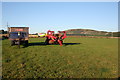
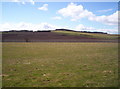
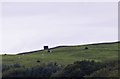
Nearby Images from Geograph Britain and Ireland:

©2025(licence)
©2007(licence)

©2025(licence)
©2006(licence)
©2020(licence)
The above images may not be of the site on this page, they are loaded from Geograph.
Please Submit an Image of this site or go out and take one for us!
Click here to see more info for this site
Nearby sites
Key: Red: member's photo, Blue: 3rd party photo, Yellow: other image, Green: no photo - please go there and take one, Grey: site destroyed
Download sites to:
KML (Google Earth)
GPX (GPS waypoints)
CSV (Garmin/Navman)
CSV (Excel)
To unlock full downloads you need to sign up as a Contributory Member. Otherwise downloads are limited to 50 sites.
Turn off the page maps and other distractions
Nearby sites listing. In the following links * = Image available
112m ENE 76° Doo'cot Woods (Turin Hill) Rock Art (NO5224953716)
1.8km WNW 296° Carsegownie Cairn* Cairn (NO50565449)
2.2km N 2° Aberlemno* Standing Stones (NO52245586)
2.2km SE 136° Westerton (Aberlemno)* Stone Circle (NO53645210)
2.4km NW 321° Finavon* Vitrified Fort (NO506556)
2.7km SW 216° Reswallie House rock art* Rock Art (NO50535154)
3.3km WSW 247° Rob's Reed Stone Fort or Dun (NO49065243)
3.8km WSW 256° Blackgate of Pitscandlie* Stone Circle (NO484528)
4.0km S 170° Girdle Stane of Dunnichen* Rock Art (NO5280849737)
4.1km S 187° Dunnichen* Class I Pictish Symbol Stone (NO516496)
5.2km W 269° Baggerton Class I Pictish Symbol Stone (NO469537)
5.9km W 270° Carse Gray* Stone Circle (NO462538)
6.5km SSE 152° Dumbarrow Hill Stone Fort or Dun (NO55154791)
7.0km ENE 63° St Murdoch's Well (Brechin) Holy Well or Sacred Spring (NO58405682)
7.3km WSW 244° Meffan Institute* Museum (NO45525062)
7.5km ESE 119° Guthrie Cursus Cursus (NO587500)
8.0km ESE 118° Guthrie Cursus Cursus (NO592499)
8.3km NNE 29° Killievair* Standing Stone (Menhir) (NO562609)
8.4km NE 42° Pictavia* Museum (NO578599)
8.4km NE 50° St Ouret's Well (Brechin) Holy Well or Sacred Spring (NO58695904)
8.9km NNW 334° Ghaist Stone (Fern) Standing Stone (Menhir) (NO48326173)
9.4km ESE 111° Kinnell Pictish Cross Slab Class III Pictish Cross Slab (NO60885028)
9.4km ESE 117° Kinnell Cursus Cursus (NO605494)
9.4km ESE 114° Kinnell Cursus Cursus (NO607497)
9.5km NE 42° Dubton Farm Iron Age settlement and Souterrain Souterrain (Fogou, Earth House) (NO58616062)
View more nearby sites and additional images


 We would like to know more about this location. Please feel free to add a brief description and any relevant information in your own language.
 Wir möchten mehr über diese Stätte erfahren. Bitte zögern Sie nicht, eine kurze Beschreibung und relevante Informationen in Deutsch hinzuzufügen.
 Nous aimerions en savoir encore un peu sur les lieux. S'il vous plaît n'hesitez pas à ajouter une courte description et tous les renseignements pertinents dans votre propre langue.
 Quisieramos informarnos un poco más de las lugares. No dude en añadir una breve descripción y otros datos relevantes en su propio idioma.