<< Our Photo Pages >> Round Howe - Broch or Nuraghe in Scotland in Orkney
Submitted by howar on Monday, 12 March 2007 Page Views: 4151
Iron Age and Later PrehistorySite Name: Round Howe Alternative Name: Howe of Langskaill, RoundhoweCountry: Scotland County: Orkney Type: Broch or Nuraghe
Nearest Town: Kirkwall Nearest Village: Toab
Map Ref: HY50780591
Latitude: 58.937590N Longitude: 2.856886W
Condition:
| 5 | Perfect |
| 4 | Almost Perfect |
| 3 | Reasonable but with some damage |
| 2 | Ruined but still recognisable as an ancient site |
| 1 | Pretty much destroyed, possibly visible as crop marks |
| 0 | No data. |
| -1 | Completely destroyed |
| 5 | Superb |
| 4 | Good |
| 3 | Ordinary |
| 2 | Not Good |
| 1 | Awful |
| 0 | No data. |
| 5 | Can be driven to, probably with disabled access |
| 4 | Short walk on a footpath |
| 3 | Requiring a bit more of a walk |
| 2 | A long walk |
| 1 | In the middle of nowhere, a nightmare to find |
| 0 | No data. |
| 5 | co-ordinates taken by GPS or official recorded co-ordinates |
| 4 | co-ordinates scaled from a detailed map |
| 3 | co-ordinates scaled from a bad map |
| 2 | co-ordinates of the nearest village |
| 1 | co-ordinates of the nearest town |
| 0 | no data |
Internal Links:
External Links:
In 1862 Petrie dug this tumulus (RCAHMS NMRS record no. HY50NW 8) and found the low (2' to 2' 6") remains of a broch measuring 19' 8" internally, with walls varying from 8-10' across containing two 1'11'-3' wide passages in them. There was ? a wallface surrounding the broch at 2' distance and the whole stood on a 90' diameter mound. Both had entrance gaps ~ENE but slightly offset. All this stood within two banked arms with a western gap of 15' and a large obstruction blocking the east end (total enclesd area 225' by 175' according to Hedges, banks 24' by 2'6" high). Between broch and embankment varied from 66-78' With its surrounding banked enclosure the nearest parallel is between here and Dingishowe where the Campston/Venikelday site is a broch with ring-ditch on current thinking.There are passages on Petrie's plans but no guard cells, which means either it survived to the base of the 2nd level as Hedges thought or only remained to the bare minimum below where they would have been. Shortly before 1880 the modern road passed through the site, though locals spoke yet of pasages beneath the road. The 1946 excavation on the Langskaill side found a "tomb with burnt bones" without saying if it came from the broch or the mound it stood on, but would have said if this were a cist, so what was it - The Howe had a Neolithic grave turned into a souterrain. From the extensive geophysics even outside of the enclosure the site seems extensive and probably multi-period, and the (2.8 by 0.7m) LBA flat-bottomed ditch dug at the mound's base this century reminds me that antiquarians thought Campston to be a henge on account of its similarity to the Ring of Bookan. Easiest to call it a broch really !
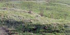
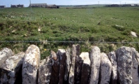
The site lies either side of the road going down to Mine Howe. Part of it lies by the plantation and looks fairly intact, but as everything is hidden under huge grass tussocks it is unrevealing, and only one trench was placed here. Might have done better to strip just the turf back over the whole area this side of the road. There is a long straight looking bank maybe a metre high, roughly parallel to the road, and then a further bank or banks behind this 'pushing' the plantation back in a curve. If this is the 'embankment' then the gap between the end of the arms should be towards the far end of what you see. In the plantation behind is a remaining section of natural burn. Before you reach the main body of the site a wide water channel goes under the road. On the Langskaill side the far bank the part by the road incorporating larger stones seems to have excessive height for the present usage, and might have been associated with Round Howe or be re-used stones from it. This RH side of the road is where the owners dug in 1946. Over the mid-19th century drystane wall from the roadside the workers left a cut alongside the wall. Perhaps one could still find part of the entrance to the broch (or that in the mound) close by this cut. Climbed a fieldgate onto the site. The start of the 'arms' should be about the lower right region as you look at it - on my last visit the land between here and the channel was water-logged. Trench remains complicate the viewing and the "Mine Howe location map" shows earthworks over an 150m wide area (unfortunately the geophysics has no scale in the Mine Howe publication). Away from the mound what looks like an inner bank is re-deposited material and the rise to the north is natural. You can still see the level area between mound and enclosure easily. There are several stumpy earthwork sections at the Round Howe end of Lang Howe which may properly belong to this site.
You may be viewing yesterday's version of this page. To see the most up to date information please register for a free account.


Do not use the above information on other web sites or publications without permission of the contributor.
Click here to see more info for this site
Nearby sites
Key: Red: member's photo, Blue: 3rd party photo, Yellow: other image, Green: no photo - please go there and take one, Grey: site destroyed
Download sites to:
KML (Google Earth)
GPX (GPS waypoints)
CSV (Garmin/Navman)
CSV (Excel)
To unlock full downloads you need to sign up as a Contributory Member. Otherwise downloads are limited to 50 sites.
Turn off the page maps and other distractions
Nearby sites listing. In the following links * = Image available
80m W 262° Burn of Langskaill* Ancient Village or Settlement (HY507059)
150m NE 52° Long Howe* Long Barrow (HY509060)
305m ENE 68° Mine Howe* Chambered Cairn (HY5106406023)
363m NE 36° Stem Howe* Round Barrow(s) (HY510062)
460m ENE 65° Longhowe Cairn (HY512061)
487m W 280° Brymer* Round Barrow(s) (HY503060)
723m NE 35° Hawell Burnt Mound* Round Barrow(s) (HY512065)
889m N 1° Nearhouse* Ancient Village or Settlement (HY508068)
1.2km NE 49° Muckle Crofty* Stone Row / Alignment (HY517067)
1.2km E 85° Breck Farm* Standing Stones (HY520060)
1.8km NE 38° Loch of Messigate* Standing Stones (HY519073)
1.9km WNW 300° Craw Howe* Cairn (HY491069)
2.2km NNE 13° Mill Sand* Standing Stones (HY513080)
2.6km N 6° Whitecleat* Holy Well or Sacred Spring (HY511085)
2.7km WNW 293° Staneloof* Cairn (HY48330698)
2.7km SE 131° Campston (Toab)* Broch or Nuraghe (HY528041)
3.1km W 278° Heathery Howes* Round Barrow(s) (HY477064)
3.1km N 11° The Howie of The Manse* Broch or Nuraghe (HY514090)
3.2km ESE 115° St. Peter's Bay Mound* Broch or Nuraghe (HY537045)
3.3km ESE 121° St. Peter's Kirk* Ancient Village or Settlement (HY536042)
3.4km ESE 120° Campston Cairn* Cairn (HY537042)
3.4km NNE 24° Grieves Cottage* Standing Stone (Menhir) (HY522090)
3.7km NNE 22° Loch of Tankerness* Ancient Village or Settlement (HY522093)
3.7km E 83° Hurnip's Point* Chambered Cairn (HY54480634)
3.8km ESE 119° Comely* Cairn (HY54040403)
View more nearby sites and additional images


 We would like to know more about this location. Please feel free to add a brief description and any relevant information in your own language.
 Wir möchten mehr über diese Stätte erfahren. Bitte zögern Sie nicht, eine kurze Beschreibung und relevante Informationen in Deutsch hinzuzufügen.
 Nous aimerions en savoir encore un peu sur les lieux. S'il vous plaît n'hesitez pas à ajouter une courte description et tous les renseignements pertinents dans votre propre langue.
 Quisieramos informarnos un poco más de las lugares. No dude en añadir una breve descripción y otros datos relevantes en su propio idioma.