


<< Our Photo Pages >> Burn of Langskaill - Ancient Village or Settlement in Scotland in Orkney
Submitted by howar on Monday, 30 August 2004 Page Views: 4832
Multi-periodSite Name: Burn of LangskaillCountry: Scotland County: Orkney Type: Ancient Village or Settlement
Nearest Town: Kirkwall Nearest Village: Toab
Map Ref: HY507059
Latitude: 58.937491N Longitude: 2.858273W
Condition:
| 5 | Perfect |
| 4 | Almost Perfect |
| 3 | Reasonable but with some damage |
| 2 | Ruined but still recognisable as an ancient site |
| 1 | Pretty much destroyed, possibly visible as crop marks |
| 0 | No data. |
| -1 | Completely destroyed |
| 5 | Superb |
| 4 | Good |
| 3 | Ordinary |
| 2 | Not Good |
| 1 | Awful |
| 0 | No data. |
| 5 | Can be driven to, probably with disabled access |
| 4 | Short walk on a footpath |
| 3 | Requiring a bit more of a walk |
| 2 | A long walk |
| 1 | In the middle of nowhere, a nightmare to find |
| 0 | No data. |
| 5 | co-ordinates taken by GPS or official recorded co-ordinates |
| 4 | co-ordinates scaled from a detailed map |
| 3 | co-ordinates scaled from a bad map |
| 2 | co-ordinates of the nearest village |
| 1 | co-ordinates of the nearest town |
| 0 | no data |
Internal Links:
External Links:
")
The lower of the two parallel lines of the burn as it passes NE of the community centre.
Unlike the other piece stone walls line the sides to a height of 1.4m at a distance apart of 4m. But where it passes under the road the bottom is lower, giving a total height of 2.5m. So the main dimensions are the same as those of the Kirk Ness Dyke and it would appear to bear the same relationship to the Round Howe "pseudo-broch" as that does to the coastal Kirk Ness mound. Which would appear to make it a drystone dyke boundary and cru also.
You may be viewing yesterday's version of this page. To see the most up to date information please register for a free account.
")
Do not use the above information on other web sites or publications without permission of the contributor.
Nearby Images from Geograph Britain and Ireland:
©2019(licence)

©2024(licence)

©2024(licence)
©2011(licence)
©2007(licence)
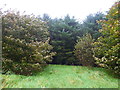
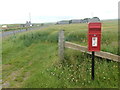
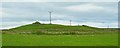
The above images may not be of the site on this page, they are loaded from Geograph.
Please Submit an Image of this site or go out and take one for us!
Click here to see more info for this site
Nearby sites
Key: Red: member's photo, Blue: 3rd party photo, Yellow: other image, Green: no photo - please go there and take one, Grey: site destroyed
Download sites to:
KML (Google Earth)
GPX (GPS waypoints)
CSV (Garmin/Navman)
CSV (Excel)
To unlock full downloads you need to sign up as a Contributory Member. Otherwise downloads are limited to 50 sites.
Turn off the page maps and other distractions
Nearby sites listing. In the following links * = Image available
80m E 82° Round Howe* Broch or Nuraghe (HY50780591)
223m ENE 63° Long Howe* Long Barrow (HY509060)
383m ENE 71° Mine Howe* Chambered Cairn (HY5106406023)
411m WNW 283° Brymer* Round Barrow(s) (HY503060)
423m NE 44° Stem Howe* Round Barrow(s) (HY510062)
537m ENE 67° Longhowe Cairn (HY512061)
779m NE 39° Hawell Burnt Mound* Round Barrow(s) (HY512065)
904m N 6° Nearhouse* Ancient Village or Settlement (HY508068)
1.3km NE 51° Muckle Crofty* Stone Row / Alignment (HY517067)
1.3km E 85° Breck Farm* Standing Stones (HY520060)
1.8km NE 40° Loch of Messigate* Standing Stones (HY519073)
1.9km WNW 301° Craw Howe* Cairn (HY491069)
2.2km NNE 15° Mill Sand* Standing Stones (HY513080)
2.6km WNW 294° Staneloof* Cairn (HY48330698)
2.6km N 8° Whitecleat* Holy Well or Sacred Spring (HY511085)
2.8km SE 130° Campston (Toab)* Broch or Nuraghe (HY528041)
3.0km W 279° Heathery Howes* Round Barrow(s) (HY477064)
3.2km NNE 12° The Howie of The Manse* Broch or Nuraghe (HY514090)
3.3km ESE 114° St. Peter's Bay Mound* Broch or Nuraghe (HY537045)
3.4km ESE 120° St. Peter's Kirk* Ancient Village or Settlement (HY536042)
3.4km NNE 25° Grieves Cottage* Standing Stone (Menhir) (HY522090)
3.4km ESE 119° Campston Cairn* Cairn (HY537042)
3.7km NNE 23° Loch of Tankerness* Ancient Village or Settlement (HY522093)
3.8km E 83° Hurnip's Point* Chambered Cairn (HY54480634)
3.8km SSW 201° Crearhowe* Artificial Mound (HY49300235)
View more nearby sites and additional images


 We would like to know more about this location. Please feel free to add a brief description and any relevant information in your own language.
 Wir möchten mehr über diese Stätte erfahren. Bitte zögern Sie nicht, eine kurze Beschreibung und relevante Informationen in Deutsch hinzuzufügen.
 Nous aimerions en savoir encore un peu sur les lieux. S'il vous plaît n'hesitez pas à ajouter une courte description et tous les renseignements pertinents dans votre propre langue.
 Quisieramos informarnos un poco más de las lugares. No dude en añadir una breve descripción y otros datos relevantes en su propio idioma.