


<< Our Photo Pages >> Charterhouse settlement - Misc. Earthwork in England in Somerset
Submitted by abuchan43 on Sunday, 01 August 2010 Page Views: 7912
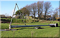
Multi-periodSite Name: Charterhouse settlement Alternative Name: Charterhouse Roman Lead mineCountry: England
NOTE: This site is 0.9 km away from the location you searched for.
County: Somerset Type: Misc. Earthwork
Nearest Town: Cheddar Nearest Village: Charterhouse
Map Ref: ST504557
Latitude: 51.298253N Longitude: 2.712798W
Condition:
| 5 | Perfect |
| 4 | Almost Perfect |
| 3 | Reasonable but with some damage |
| 2 | Ruined but still recognisable as an ancient site |
| 1 | Pretty much destroyed, possibly visible as crop marks |
| 0 | No data. |
| -1 | Completely destroyed |
| 5 | Superb |
| 4 | Good |
| 3 | Ordinary |
| 2 | Not Good |
| 1 | Awful |
| 0 | No data. |
| 5 | Can be driven to, probably with disabled access |
| 4 | Short walk on a footpath |
| 3 | Requiring a bit more of a walk |
| 2 | A long walk |
| 1 | In the middle of nowhere, a nightmare to find |
| 0 | No data. |
| 5 | co-ordinates taken by GPS or official recorded co-ordinates |
| 4 | co-ordinates scaled from a detailed map |
| 3 | co-ordinates scaled from a bad map |
| 2 | co-ordinates of the nearest village |
| 1 | co-ordinates of the nearest town |
| 0 | no data |
Internal Links:
External Links:
")
You may be viewing yesterday's version of this page. To see the most up to date information please register for a free account.
")
")
")
Do not use the above information on other web sites or publications without permission of the contributor.
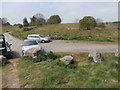
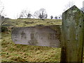
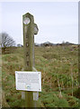
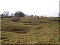
Nearby Images from Geograph Britain and Ireland:
©2017(licence)
©2016(licence)
©2016(licence)
©2016(licence)
©2010(licence)
The above images may not be of the site on this page, they are loaded from Geograph.
Please Submit an Image of this site or go out and take one for us!
Click here to see more info for this site
Nearby sites
Key: Red: member's photo, Blue: 3rd party photo, Yellow: other image, Green: no photo - please go there and take one, Grey: site destroyed
Download sites to:
KML (Google Earth)
GPX (GPS waypoints)
CSV (Garmin/Navman)
CSV (Excel)
To unlock full downloads you need to sign up as a Contributory Member. Otherwise downloads are limited to 50 sites.
Turn off the page maps and other distractions
Nearby sites listing. In the following links * = Image available
391m E 80° Nordrach Tumulus* Round Barrow(s) (ST5078755765)
962m NNW 327° Charterhouse Earthwork* Misc. Earthwork (ST49885651)
1.9km ESE 103° Whites Town Farm Tumulus* Round Barrow(s) (ST5223355265)
2.0km W 274° Gorsey Bigbury Henge* Henge (ST48435584)
2.0km W 264° Longwood Tumulus* Round Barrow(s) (ST4841955518)
2.5km E 81° Fernhill Farm* Modern Stone Circle etc (ST52865606)
2.5km NW 308° Beacon Batch* Barrow Cemetery (ST48465726)
2.6km ESE 117° Wright's Piece barrows (S)* Barrow Cemetery (ST527545)
2.9km ESE 110° Wright's Piece barrows (N)* Barrow Cemetery (ST531547)
3.0km SW 225° Totty Pot Cave or Rock Shelter (ST48255358)
3.2km S 171° Cheddar Head Stone Circle (ST509525)
3.4km WNW 294° Black Down barrows (Mendip)* Barrow Cemetery (ST473571)
3.5km W 280° Tynings Farm Barrow Group* Barrow Cemetery (ST47005635)
3.7km ENE 64° Barrow Well (Compton Martin) Holy Well or Sacred Spring (ST537573)
3.7km ESE 114° Pool Farm Cist* Rock Art (ST53745415)
4.0km NW 320° Burrington Camp* Hillfort (ST47825878)
4.0km WSW 243° Soldier's Hole Cave or Rock Shelter (ST468539)
4.0km WSW 246° Sun Hole* Cave or Rock Shelter (ST467541)
4.1km NW 316° Aveline's Hole* Cave or Rock Shelter (ST47615867)
4.1km S 171° Bristol Plain Farm Barrow Cemetery* Barrow Cemetery (ST5097951665)
4.1km WSW 244° Goughs Cave (Cheddar)* Cave or Rock Shelter (ST46715392)
4.1km WSW 244° Cheddar Museum of Prehistory* Museum (ST46655393)
4.2km SSE 164° Townsend Farm Barrow Cemetery* Barrow Cemetery (ST5152851658)
4.3km SSW 212° Batcombe Hollow north stone* Standing Stone (Menhir) (ST4810452088)
4.4km ESE 119° Priddy Circles Unfinished N* Henge (ST54215355)
View more nearby sites and additional images


 We would like to know more about this location. Please feel free to add a brief description and any relevant information in your own language.
 Wir möchten mehr über diese Stätte erfahren. Bitte zögern Sie nicht, eine kurze Beschreibung und relevante Informationen in Deutsch hinzuzufügen.
 Nous aimerions en savoir encore un peu sur les lieux. S'il vous plaît n'hesitez pas à ajouter une courte description et tous les renseignements pertinents dans votre propre langue.
 Quisieramos informarnos un poco más de las lugares. No dude en añadir una breve descripción y otros datos relevantes en su propio idioma.