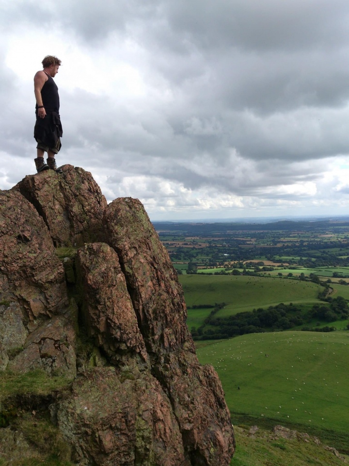
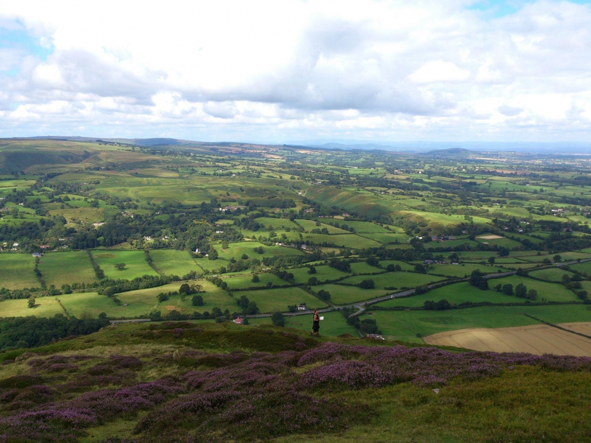
Featured: Friendly specialist tours to ancient, mystical and historical sites in the UK and beyond

Friendly specialist tours to ancient, mystical and historical sites in the UK and beyond

Random Image


Carn Euny Village

The Modern Antiquarian Reissued

The Modern Antiquarian Reissued

Who's Online

There are currently, 259 guests and 0 members online.

You are a guest. To join in, please register for free by clicking here

Sponsors

<< Our Photo Pages >> Caer Caradoc (Church Stretton) - Hillfort in England in Shropshire

Submitted by TimPrevett on Friday, 12 November 2004  Page Views: 30074

Iron Age and Later PrehistorySite Name: Caer Caradoc (Church Stretton)
Country: England County: Shropshire Type: Hillfort
Nearest Town: Church Stretton
Map Ref: SO477953  Landranger Map Number: 137
Latitude: 52.553017N  Longitude: 2.772785W
Condition:
5Perfect
4Almost Perfect
3Reasonable but with some damage
2Ruined but still recognisable as an ancient site
1Pretty much destroyed, possibly visible as crop marks
0No data.
-1Completely destroyed
4 Ambience:
5Superb
4Good
3Ordinary
2Not Good
1Awful
0No data.
5 Access:
5Can be driven to, probably with disabled access
4Short walk on a footpath
3Requiring a bit more of a walk
2A long walk
1In the middle of nowhere, a nightmare to find
0No data.
3 Accuracy:
5co-ordinates taken by GPS or official recorded co-ordinates
4co-ordinates scaled from a detailed map
3co-ordinates scaled from a bad map
2co-ordinates of the nearest village
1co-ordinates of the nearest town
0no data
3

Internal Links:
External Links:

I have visited· I would like to visit

PAB SolarMegalith would like to visit

w650marion visited on 18th Apr 2024 - their rating: Cond: 3 Amb: 5 Access: 3 Wonderful views all around! The wind was cold and very strong, but you could find good calm shelter between the ramparts and the inner rocks where the ground was level and dry - a place for hut circles?

Couplands visited on 23rd Feb 2023 - their rating: Cond: 3 Amb: 5 Access: 2

George998 visited on 12th Apr 2022 - their rating: Cond: 4 Amb: 5 Access: 2

Marko visited on 27th Sep 2014 - their rating: Cond: 3 Amb: 3 Access: 3 Another hillfort i've been meaning to visit for some time - and this time it was worth it!! Stiff climb up there,but worth the effort.I don't subscribe to the view that this was the site of Caratacus's last stand but i'm sure that he would have visited this hillfort - a site which must have been used a garrison/forward base against the Romans at Virconium.

DrewParsons TheWhiteRider TimPrevett Serenstar have visited here

Average ratings for this site from all visit loggers: Condition: 3.25 Ambience: 4.5 Access: 2.5

Caer Caradoc (Church Stretton)
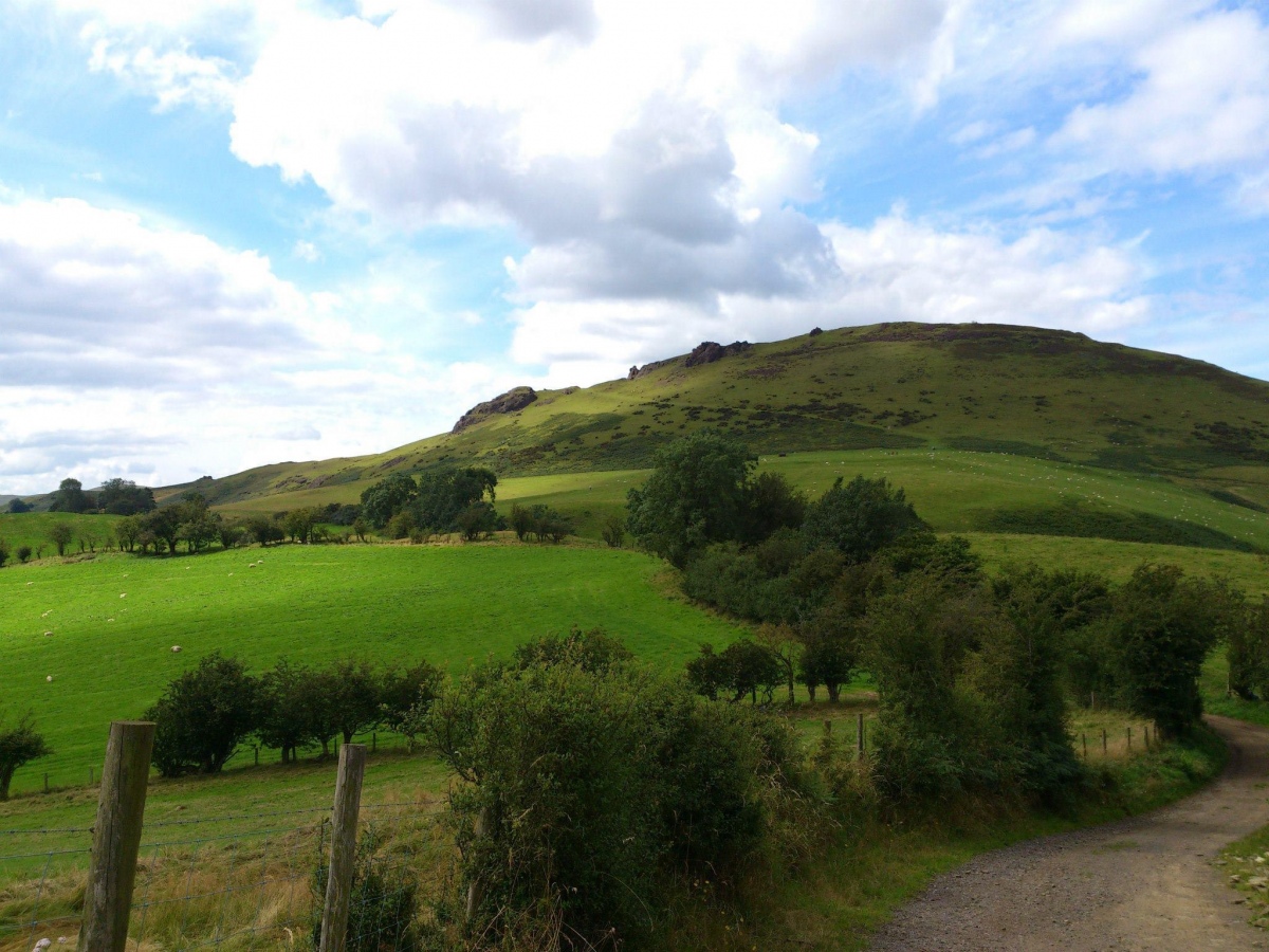
Caer Caradoc (Church Stretton) submitted by TimPrevett : Caer Caradoc, taken from a northwest angle on a lovely summer's morning. Indeed, this offers some formidable defense. If this were the place of Caratacus' last stand against the Romans, this would have indeed been something difficult to conquer, even by Roman standards. However, there is no evidence to confirm this suggestion. (Vote or comment on this photo)
Hillfort in Shropshire

Described by James Dyer a 'one of the most spectacularly sited hillforts in Britain'.

Caer Caradoc is a breathtaking location for a hillfort around the summit of this prominent hill to the south of Shrewsbury. One of two Caer Caradoc hillforts in Shropshire; the other much further to the SW.
You may be viewing yesterday's version of this page. To see the most up to date information please register for a free account.
Caer Caradoc (Church Stretton)
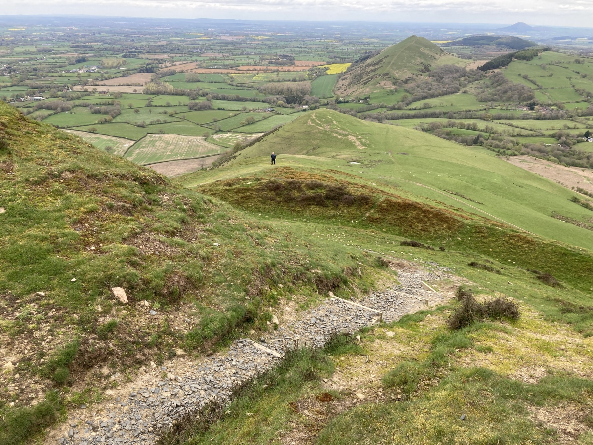
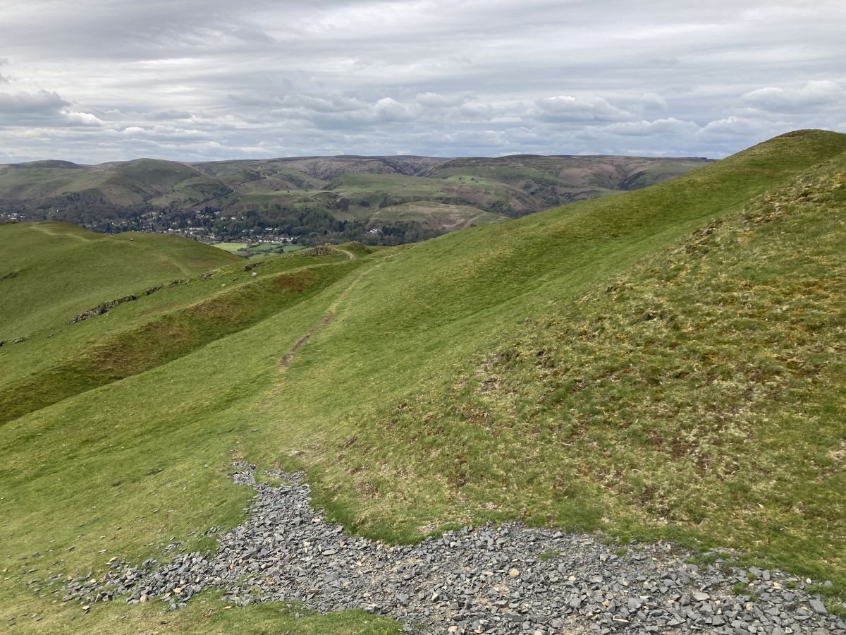
Caer Caradoc (Church Stretton) submitted by w650marion : The repair to the rampart where the well worn footpath cuts through the Northern edge. Now steps and gravel reduce erosion by walkers. Being a Hillfort enthusiast, I always prefer to use the original entrance on the east side which has a remarkable, 300m long and well engineered causeway/ramp still in place. Entrances to Hillforts are designed to impress! (Vote or comment on this photo)

Caer Caradoc (Church Stretton)
Caer Caradoc (Church Stretton) submitted by w650marion : Gravel topping on the repair to the Southern rampart. As a popular path comes through here, even though it is not a proper entrance, the rampart does get worn down. (Vote or comment on this photo)

Caer Caradoc (Church Stretton)
Caer Caradoc (Church Stretton) submitted by Antonine : Visited 2012 (Vote or comment on this photo)

Caer Caradoc (Church Stretton)
Caer Caradoc (Church Stretton) submitted by Antonine (Vote or comment on this photo)

Caer Caradoc (Church Stretton)
Caer Caradoc (Church Stretton) submitted by Antonine (Vote or comment on this photo)

Caer Caradoc (Church Stretton)
Caer Caradoc (Church Stretton) submitted by Antonine

Caer Caradoc (Church Stretton)
Caer Caradoc (Church Stretton) submitted by Bladup : Caer Caradoc (Church Stretton) - a guardian [with a bit of a hooter] looking over the South Eastern entrance to the fort. (1 comment)

Caer Caradoc (Church Stretton)
Caer Caradoc (Church Stretton) submitted by Bladup : Caer Caradoc (Church Stretton), hut circle at the Southern end of the fort.

Caer Caradoc (Church Stretton)
Caer Caradoc (Church Stretton) submitted by Bladup : Caer Caradoc (Church Stretton). Looking over the South East part of the fort, you can see the Eastern path up to the fort on the left of the photo.

Caer Caradoc (Church Stretton)
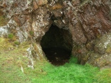
Caer Caradoc (Church Stretton) submitted by Bladup : Caer Caradoc (Church Stretton), the cave, found just outside the North West sector of the fort. (3 comments)

Caer Caradoc (Church Stretton)
Caer Caradoc (Church Stretton) submitted by Bladup : Caer Caradoc (Church Stretton), hut circle site, Eastern side of the fort.

Caer Caradoc (Church Stretton)
Caer Caradoc (Church Stretton) submitted by Bladup : Caer Caradoc (Church Stretton), Eastern side.

Caer Caradoc (Church Stretton)
Caer Caradoc (Church Stretton) submitted by Bladup : Caer Caradoc (Church Stretton), hut circle site in the North Eastern section of the fort.

Caer Caradoc (Church Stretton)
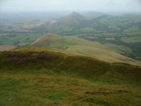
Caer Caradoc (Church Stretton) submitted by Bladup : Caer Caradoc (Church Stretton) looking North West at The Lawley from the Northern tip of this lovely fort.

Caer Caradoc (Church Stretton)
Caer Caradoc (Church Stretton) submitted by Bladup : Caer Caradoc (Church Stretton) South West defences.

Caer Caradoc (Church Stretton)
Caer Caradoc (Church Stretton) submitted by Bladup : Caer Caradoc (Church Stretton) looking South West. (2 comments)

Caer Caradoc (Church Stretton)
Caer Caradoc (Church Stretton) submitted by Bladup : Caer Caradoc (Church Stretton) - defences on the South Eastern side.

Caer Caradoc (Church Stretton)
Caer Caradoc (Church Stretton) submitted by Bladup : Caer Caradoc (Church Stretton), hut circle site on the Eastern side.

Caer Caradoc (Church Stretton)
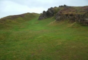
Caer Caradoc (Church Stretton) submitted by DrewParsons : Ditch at the northern end of the fort. September 2014.

Caer Caradoc (Church Stretton)
Caer Caradoc (Church Stretton) submitted by DrewParsons : Ditch running along the north western side of the fort. September 2014.

Caer Caradoc (Church Stretton)
Caer Caradoc (Church Stretton) submitted by DrewParsons : Ditch on the north western side of the fort. September 2014.

Caer Caradoc (Church Stretton)
Caer Caradoc (Church Stretton) submitted by DrewParsons : Inside the cave there are two small alcoves just large enough for use as shelves. September 2014.

Caer Caradoc (Church Stretton)
Caer Caradoc (Church Stretton) submitted by DrewParsons : The cave located at N52.55415 W02.77311 September 2014.

Caer Caradoc (Church Stretton)
Caer Caradoc (Church Stretton) submitted by DrewParsons : View north to the steep natural defensive position seen along a ditch. September 2014

Caer Caradoc (Church Stretton)
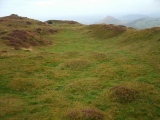
Caer Caradoc (Church Stretton) submitted by DrewParsons : View of the extensive earthworks looking towards the west. September 2014.

These are just the first 25 photos of Caer Caradoc (Church Stretton). If you log in with a free user account you will be able to see our entire collection.

Do not use the above information on other web sites or publications without permission of the contributor.
Click here to see more info for this site

Nearby sites

Click here to view sites on an interactive OS map

Key: Red: member's photo, Blue: 3rd party photo, Yellow: other image, Green: no photo - please go there and take one, Grey: site destroyed

Download sites to:
KML (Google Earth)
GPX (GPS waypoints)
CSV (Garmin/Navman)
CSV (Excel)

To unlock full downloads you need to sign up as a Contributory Member. Otherwise downloads are limited to 50 sites.


Turn off the page maps and other distractions

Nearby sites listing. In the following links * = Image available
 349m E 91° Caer Caradoc Round Barrow* Round Barrow(s) (SO48059529)
 1.4km S 177° Hope Bowdler Hill* Cairn (SO47779389)
 1.7km WNW 290° Castle Hill (Shropshire)* Hillfort (SO461959)
 2.8km NE 38° The Lawley (Summit)* Hillfort (SO49459745)
 2.9km SW 236° Stretton Sheela* Early Christian Sculptured Stone (SO45239368)
 3.2km WSW 259° Bodbury Ring* Hillfort (SO445947)
 3.7km WNW 292° High Park Cross Dyke* Ancient Village or Settlement (SO443967)
 3.9km WSW 254° The Devil's Mouth Cross Dyke* Misc. Earthwork (SO43959425)
 4.2km NE 37° The Lawley (Northern)* Hillfort (SO50289863)
 4.2km WSW 240° Ashlet Hill Bowl Barrow Round Barrow(s) (SO440932)
 4.8km WNW 284° Robin Hood's Butts (Shropshire)* Round Barrow(s) (SO43029655)
 5.1km WNW 287° Henley Knap Bowl Barrow* Round Barrow(s) (SO42799685)
 5.1km W 260° Long Mynd A* Round Barrow(s) (SO426945)
 5.4km W 272° Long Mynd C* Round Barrow(s) (SO423955)
 5.4km W 262° Boiling Well (Long Mynd)* Round Barrow(s) (SO423946)
 5.5km WNW 284° Wildmoor Bowl Barrow* Round Barrow(s) (SO42409672)
 5.6km WSW 239° Cross Dyke Bowl Barrow North* Round Barrow(s) (SO42899244)
 5.6km W 270° Shooting Box Disc Barrow* Round Barrow(s) (SO421954)
 5.6km WSW 238° Cross Dyke Bowl Barrow South* Round Barrow(s) (SO42869241)
 5.7km WSW 242° Barrister's Plain Cross Dyke* Ancient Village or Settlement (SO426927)
 6.5km WSW 251° Long Mynd B* Round Barrow(s) (SO41539330)
 6.7km WSW 257° Pole Cottage* Round Barrow(s) (SO411939)
 7.1km WNW 293° Ratlinghope Hill Bowl Barrow* Round Barrow(s) (SO41179817)
 7.3km WNW 285° Ratlinghope Hill Camp* Hillfort (SO407973)
 7.6km WNW 289° Castle Ring (Stitt Hill)* Hillfort (SO405978)
View more nearby sites and additional images

<< Is-Coed

Knossos >>

Please add your thoughts on this site

Cornwall in Prehistory

Cornwall in Prehistory

Sponsors

Auto-Translation (Google)

Translate from English into:

"Caer Caradoc (Church Stretton)" | Login/Create an Account | 5 News and Comments
  
Go back to top of page    Comments are owned by the poster. We aren't responsible for their content.
Shropshire Hills AONB Trust "Fix The Fort" Appeal by Andy B on Thursday, 03 November 2022
(User Info | Send a Message)
Shropshire Hills AONB Trust write:
We need to raise £10,000 to fix Caer Caradoc’s worn-down ramparts.

Caer Caradoc stands in the heart of the Shropshire Hills and is very popular with visitors from near and far. This iconic landmark gets its name from its link to the legendary warrior prince Caradoc, who rebelled against the Romans in the first century AD. Decades of wear has left its mark on the ramparts of this popular view point.

With your help, Shropshire Hills AONB Trust will work to Fix the Fort so it can enjoyed by generations to come.

The aim of the project is to improve access whilst protecting the archaeology from further damage.

Over time, erosion has caused a deep v-shaped notch and long erosion scar in the southern edge of the main rampart. The v-shaped notch will be repaired to allow easier access whilst hardening the path against further erosion. A similar approach will be used on the walked route where it crosses the more complex northern edge of the main ramparts.

It is unlikely that we will be able to start work until we have raised a significant part of the funding needed. Further updates will be posted on http://fixthefort.co.uk/
[ Reply to This ]
    Re: Shropshire Hills AONB Trust by w650marion on Thursday, 18 April 2024
    (User Info | Send a Message)
    The work to fix the erosion on Caer Caradoc’s worn-down ramparts has now been completed! I have added a couple of photos. It's a busy place up here, despite the steepness and the cold winds!
    [ Reply to This ]

Re: Caer Caradoc (Church Stretton) by SumDoood on Monday, 26 July 2010
(User Info | Send a Message)
15 or so images of mine here: http://bit.ly/bNROtq
[ Reply to This ]

Re: Caer Caradoc (Church Stretton) by Andy B on Thursday, 07 October 2004
(User Info | Send a Message)
Aerial photo and info:
http://www.bbc.co.uk/shropshire/history/2004/01/gallery_hill_forts_05.shtml
[ Reply to This ]

Re: Caer Caradoc (Church Stretton) by TheWhiteRider on Saturday, 31 July 2004
(User Info | Send a Message)
Condition:4
Ambience:5
Access:3

We took the steep climb up to Three Fingers Rock and then across the top to the hillfort. The defensive earthworks are clearly visible. An amazing view of the surrounding area is afforded from the top. You can clearly see Bodbury Ring Hillfort, The Lawley, The Wrekin and in the distance, The Stiperstones and Robin Hoods Butts. Well worth the difficult climb. King Caractacus is reputed to have defended the fort against the Romans and taken refuge in a cave when the fort was overwhelmed. We were pushed for time so could not do a full sweep of the hill and did not find the cave. A must for next time.
[ Reply to This ]

Your Name: Anonymous [ Register Now ]
Subject:


Add your comment or contribution to this page. Spam or offensive posts are deleted immediately, don't even bother

<<< What is five plus one as a number? (Please type the answer to this question in the little box on the left)
You can also embed videos and other things. For Youtube please copy and paste the 'embed code'.
For Google Street View please include Street View in the text.
Create a web link like this: <a href="https://www.megalithic.co.uk">This is a link</a>  

Allowed HTML is:
<p> <b> <i> <a> <img> <em> <br> <strong> <blockquote> <tt> <li> <ol> <ul> <object> <param> <embed> <iframe>

We would like to know more about this location. Please feel free to add a brief description and any relevant information in your own language.
Wir möchten mehr über diese Stätte erfahren. Bitte zögern Sie nicht, eine kurze Beschreibung und relevante Informationen in Deutsch hinzuzufügen.
Nous aimerions en savoir encore un peu sur les lieux. S'il vous plaît n'hesitez pas à ajouter une courte description et tous les renseignements pertinents dans votre propre langue.
Quisieramos informarnos un poco más de las lugares. No dude en añadir una breve descripción y otros datos relevantes en su propio idioma.