


<< Our Photo Pages >> Tynings Farm Barrow Group - Barrow Cemetery in England in Somerset
Submitted by SolarMegalith on Saturday, 03 December 2011 Page Views: 3528
Neolithic and Bronze AgeSite Name: Tynings Farm Barrow GroupCountry: England County: Somerset Type: Barrow Cemetery
Nearest Town: Cheddar Nearest Village: Shipham
Map Ref: ST47005635
Latitude: 51.303790N Longitude: 2.761656W
Condition:
| 5 | Perfect |
| 4 | Almost Perfect |
| 3 | Reasonable but with some damage |
| 2 | Ruined but still recognisable as an ancient site |
| 1 | Pretty much destroyed, possibly visible as crop marks |
| 0 | No data. |
| -1 | Completely destroyed |
| 5 | Superb |
| 4 | Good |
| 3 | Ordinary |
| 2 | Not Good |
| 1 | Awful |
| 0 | No data. |
| 5 | Can be driven to, probably with disabled access |
| 4 | Short walk on a footpath |
| 3 | Requiring a bit more of a walk |
| 2 | A long walk |
| 1 | In the middle of nowhere, a nightmare to find |
| 0 | No data. |
| 5 | co-ordinates taken by GPS or official recorded co-ordinates |
| 4 | co-ordinates scaled from a detailed map |
| 3 | co-ordinates scaled from a bad map |
| 2 | co-ordinates of the nearest village |
| 1 | co-ordinates of the nearest town |
| 0 | no data |
Internal Links:
External Links:
I have visited· I would like to visit
TheCaptain has visited here
")
The cemetery includes five barrows which are listed as "West-Cheddar", "North", "South" "East" and "Central".
You may be viewing yesterday's version of this page. To see the most up to date information please register for a free account.
")
Do not use the above information on other web sites or publications without permission of the contributor.
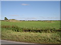
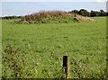
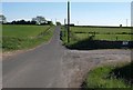
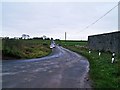
Nearby Images from Geograph Britain and Ireland:
©2016(licence)
©2016(licence)
©2010(licence)
©2011(licence)
©2017(licence)
The above images may not be of the site on this page, they are loaded from Geograph.
Please Submit an Image of this site or go out and take one for us!
Click here to see more info for this site
Nearby sites
Key: Red: member's photo, Blue: 3rd party photo, Yellow: other image, Green: no photo - please go there and take one, Grey: site destroyed
Download sites to:
KML (Google Earth)
GPX (GPS waypoints)
CSV (Garmin/Navman)
CSV (Excel)
To unlock full downloads you need to sign up as a Contributory Member. Otherwise downloads are limited to 50 sites.
Turn off the page maps and other distractions
Nearby sites listing. In the following links * = Image available
807m NNE 21° Black Down barrows (Mendip)* Barrow Cemetery (ST473571)
1.5km WNW 297° Cuck Hill Barrow Round Barrow(s) (ST4567057030)
1.5km ESE 109° Gorsey Bigbury Henge* Henge (ST48435584)
1.6km ESE 120° Longwood Tumulus* Round Barrow(s) (ST4841955518)
1.7km ENE 57° Beacon Batch* Barrow Cemetery (ST48465726)
2.3km S 187° Sun Hole* Cave or Rock Shelter (ST467541)
2.4km NNE 14° Aveline's Hole* Cave or Rock Shelter (ST47615867)
2.4km S 188° Cheddar Museum of Prehistory* Museum (ST46655393)
2.4km S 186° Goughs Cave (Cheddar)* Cave or Rock Shelter (ST46715392)
2.5km S 184° Soldier's Hole Cave or Rock Shelter (ST468539)
2.6km NNE 18° Burrington Camp* Hillfort (ST47825878)
2.6km SSW 195° Flint Jack's Cave Cave or Rock Shelter (ST463538)
2.9km NW 313° Barrow at Rowberrow* Round Barrow(s) (ST44925834)
2.9km E 86° Charterhouse Earthwork* Misc. Earthwork (ST49885651)
3.0km SSE 155° Totty Pot Cave or Rock Shelter (ST48255358)
3.2km NW 321° Dolebury Camp* Hillfort (ST450589)
3.5km E 100° Charterhouse settlement* Misc. Earthwork (ST504557)
3.8km E 98° Nordrach Tumulus* Round Barrow(s) (ST5078755765)
4.2km WSW 245° Axbridge Church Wells* Holy Well or Sacred Spring (ST432546)
4.2km WNW 300° The Wimblestone* Standing Stone (Menhir) (ST43355848)
4.4km SSE 165° Batcombe Hollow north stone* Standing Stone (Menhir) (ST4810452088)
4.6km S 169° Batcombe Hollow south standing stone* Standing Stone (Menhir) (ST4782451823)
5.3km E 101° Whites Town Farm Tumulus* Round Barrow(s) (ST5223355265)
5.5km SE 134° Cheddar Head Stone Circle (ST509525)
5.7km SSE 157° Westbury Camp* Hillfort (ST49205112)
View more nearby sites and additional images


 We would like to know more about this location. Please feel free to add a brief description and any relevant information in your own language.
 Wir möchten mehr über diese Stätte erfahren. Bitte zögern Sie nicht, eine kurze Beschreibung und relevante Informationen in Deutsch hinzuzufügen.
 Nous aimerions en savoir encore un peu sur les lieux. S'il vous plaît n'hesitez pas à ajouter une courte description et tous les renseignements pertinents dans votre propre langue.
 Quisieramos informarnos un poco más de las lugares. No dude en añadir una breve descripción y otros datos relevantes en su propio idioma.