


<< Our Photo Pages >> Twi Ness - Cairn in Scotland in Orkney
Submitted by howar on Tuesday, 22 October 2013 Page Views: 2482
Neolithic and Bronze AgeSite Name: Twi NessCountry: Scotland County: Orkney Type: Cairn
Nearest Town: Kirkwall Nearest Village: Balfour Village
Map Ref: HY46761625
Latitude: 59.029954N Longitude: 2.929217W
Condition:
| 5 | Perfect |
| 4 | Almost Perfect |
| 3 | Reasonable but with some damage |
| 2 | Ruined but still recognisable as an ancient site |
| 1 | Pretty much destroyed, possibly visible as crop marks |
| 0 | No data. |
| -1 | Completely destroyed |
| 5 | Superb |
| 4 | Good |
| 3 | Ordinary |
| 2 | Not Good |
| 1 | Awful |
| 0 | No data. |
| 5 | Can be driven to, probably with disabled access |
| 4 | Short walk on a footpath |
| 3 | Requiring a bit more of a walk |
| 2 | A long walk |
| 1 | In the middle of nowhere, a nightmare to find |
| 0 | No data. |
| 5 | co-ordinates taken by GPS or official recorded co-ordinates |
| 4 | co-ordinates scaled from a detailed map |
| 3 | co-ordinates scaled from a bad map |
| 2 | co-ordinates of the nearest village |
| 1 | co-ordinates of the nearest town |
| 0 | no data |
Internal Links:
External Links:
")
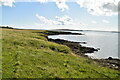
HY41NE 19 is a slightly hollowed 7mD cairn a mere point-six metres high, with an orthostat on the north side that might be, or have been, part of a cist. This upright slab actually runs radial to the mound centre, which sounds like it might be summat else to me, more a divider than an encloser - wheelhouse partition ?? Anyways the slab position is now a small grassy peak. Are the large stones in the cliff face part of a stoney outcrop on which the mound is placed or placed stone ? If it were one of these then the mound goes deeper than 0.6m or sits on something earlier.
You may be viewing yesterday's version of this page. To see the most up to date information please register for a free account.
")
")
Do not use the above information on other web sites or publications without permission of the contributor.
Nearby Images from Geograph Britain and Ireland:
©2024(licence)
©2007(licence)
©2024(licence)
©2024(licence)
©2024(licence)
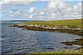
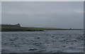
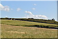
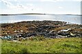
The above images may not be of the site on this page, they are loaded from Geograph.
Please Submit an Image of this site or go out and take one for us!
Click here to see more info for this site
Nearby sites
Key: Red: member's photo, Blue: 3rd party photo, Yellow: other image, Green: no photo - please go there and take one, Grey: site destroyed
Download sites to:
KML (Google Earth)
GPX (GPS waypoints)
CSV (Garmin/Navman)
CSV (Excel)
To unlock full downloads you need to sign up as a Contributory Member. Otherwise downloads are limited to 50 sites.
Turn off the page maps and other distractions
Nearby sites listing. In the following links * = Image available
540m E 93° Setter Noost* Ancient Village or Settlement (HY47301621)
1.9km ESE 103° Helliar Holm Broch or Nuraghe (HY48591579)
2.9km SE 146° Head of Work* Chambered Cairn (HY48341382)
3.4km E 88° Broch of Steiro* Broch or Nuraghe (HY50191635)
4.4km E 93° Howe Hill (Howe Farm)* Ancient Village or Settlement (HY51171599)
4.6km SW 224° Lower Saverock* Not Known (by us) (HY43511300)
4.7km SW 223° Saverock (2)* Ancient Village or Settlement (HY43481280)
4.8km NE 53° Odin Stone* Standing Stone (Menhir) (HY506191)
5.0km WSW 240° Ramberry Cairn Chambered Cairn (HY42401383)
5.2km SSW 209° Grain Earth House* Souterrain (Fogou, Earth House) (HY442117)
5.4km SSW 198° Kirkwall Sculptured Stone (HY450111)
5.6km ESE 103° Hacksness (Shapinsay) Cairn (HY52181491)
5.6km NW 311° Knowe of Dishero* Broch or Nuraghe (HY42561998)
5.7km E 83° Mor Stein* Standing Stone (Menhir) (HY52401685)
5.7km SSW 198° Kirkwall Sculptured Stone (HY44941087)
5.7km SSW 199° Tankerness House Museum* Museum (HY44851086)
5.7km SSW 207° Pickaquoy* Ancient Village or Settlement (HY44071116)
5.8km SSW 199° The Orkney Museum* Museum (HY448108)
5.9km NW 318° Holm of Rendall* Cairn (HY4283220735)
6.1km SW 236° Quanterness* Chambered Cairn (HY417129)
6.3km S 172° Berstane Broch* Broch or Nuraghe (HY475100)
6.4km NNW 343° Gairsay Cairn (HY44942237)
6.4km SW 229° Wideford Hill Cairn* Cairn (HY419121)
6.7km ENE 57° Unyatuak* Artificial Mound (HY52451983)
6.7km S 178° Tower Hill (Orkney)* Round Barrow(s) (HY469095)
View more nearby sites and additional images


 We would like to know more about this location. Please feel free to add a brief description and any relevant information in your own language.
 Wir möchten mehr über diese Stätte erfahren. Bitte zögern Sie nicht, eine kurze Beschreibung und relevante Informationen in Deutsch hinzuzufügen.
 Nous aimerions en savoir encore un peu sur les lieux. S'il vous plaît n'hesitez pas à ajouter une courte description et tous les renseignements pertinents dans votre propre langue.
 Quisieramos informarnos un poco más de las lugares. No dude en añadir una breve descripción y otros datos relevantes en su propio idioma.