


<< Text Pages >> Borthwick Mains - Class I Pictish Symbol Stone in Scotland in Scottish Borders
Submitted by alligator on Monday, 24 March 2003 Page Views: 9021
Early Medieval (Dark Age)Site Name: Borthwick MainsCountry: Scotland
NOTE: This site is 7.6 km away from the location you searched for.
County: Scottish Borders Type: Class I Pictish Symbol Stone
Nearest Town: Hawick Nearest Village: Roberton
Map Ref: NT4372814111 Landranger Map Number: 79
Latitude: 55.417667N Longitude: 2.890479W
Condition:
| 5 | Perfect |
| 4 | Almost Perfect |
| 3 | Reasonable but with some damage |
| 2 | Ruined but still recognisable as an ancient site |
| 1 | Pretty much destroyed, possibly visible as crop marks |
| 0 | No data. |
| -1 | Completely destroyed |
| 5 | Superb |
| 4 | Good |
| 3 | Ordinary |
| 2 | Not Good |
| 1 | Awful |
| 0 | No data. |
| 5 | Can be driven to, probably with disabled access |
| 4 | Short walk on a footpath |
| 3 | Requiring a bit more of a walk |
| 2 | A long walk |
| 1 | In the middle of nowhere, a nightmare to find |
| 0 | No data. |
| 5 | co-ordinates taken by GPS or official recorded co-ordinates |
| 4 | co-ordinates scaled from a detailed map |
| 3 | co-ordinates scaled from a bad map |
| 2 | co-ordinates of the nearest village |
| 1 | co-ordinates of the nearest town |
| 0 | no data |
Be the first person to rate this site - see the 'Contribute!' box in the right hand menu.
Internal Links:
External Links:
I have visited· I would like to visit
Anne T couldn't find on 29th Aug 2018 Borthwick Mains Possible Pictish Symbol Stone: We got the location of this symbol stone completely wrong, and whilst we found Borthwick Mains, did not find the symbol stone. Its now high on my 'wish list' to return to. A lot of building work had been happening here, with the entrance to the farm in the process of being widened, and the house nearest the road empty and almost derelict. I did venture into the garden, but not having any phone signal, did not have the photo of the stone on Canmore to refer to.
This possible Pictish Symbol Stone is recorded as Canmore ID 54197, where it is documented as part of the Early Medieval Carved Stones Project.
The stone is described as being 'set upright in the garden of Borthwick Mains, near Hawick ... local tradition traces the origin of the stone to Commonside where it stood in the River Teviot as a nilometer at a ford. A secondary hole drilled towards the top of the stone suggests that it has also been used as a gatepost." Described as being 'worn and damaged', the Canmore entry adds: "Incised by pecking on one face of this squared pillar is a large fish set upright on its tail, 0.94m in length. Its left side seen in profile, clearly depicted details are an eye, the gills, all four fins and an arc separating the body from the splayed tail. No mouth is shown but otherwise this appears to be a salmon."
You may be viewing yesterday's version of this page. To see the most up to date information please register for a free account.
Do not use the above information on other web sites or publications without permission of the contributor.
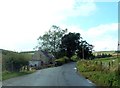
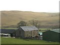
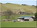
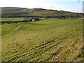
Nearby Images from Geograph Britain and Ireland:
©2012(licence)
©2008(licence)
©2015(licence)
©2009(licence)
©2023(licence)
The above images may not be of the site on this page, they are loaded from Geograph.
Please Submit an Image of this site or go out and take one for us!
Click here to see more info for this site
Nearby sites
Key: Red: member's photo, Blue: 3rd party photo, Yellow: other image, Green: no photo - please go there and take one, Grey: site destroyed
Download sites to:
KML (Google Earth)
GPX (GPS waypoints)
CSV (Garmin/Navman)
CSV (Excel)
To unlock full downloads you need to sign up as a Contributory Member. Otherwise downloads are limited to 50 sites.
Turn off the page maps and other distractions
Nearby sites listing. In the following links * = Image available
1.7km SSE 167° Whitcastle Hill* Hillfort (NT44101245)
2.1km S 171° Whitcastle Sike* Ancient Village or Settlement (NT44011207)
6.2km E 90° Hawick Mote* Misc. Earthwork (NT4994314073)
6.3km SE 135° Lord's Tree (Hawick)* Cairn (NT48090957)
6.5km SE 139° Ca Knowe (Hawick)* Cairn (NT4793409075)
8.5km SSE 158° Burgh Hill Hillfort* Hillfort (NT46810616)
8.5km SSE 157° Burgh Hill Stone Circle* Stone Circle (NT47010624)
8.8km SSE 156° The Dod* Ancient Village or Settlement (NT47260600)
9.6km W 271° Black Rig Standing Stone (Menhir) (NT34151437)
10.2km ENE 69° Midshiels Cairn* Cairn (NT53311770)
10.3km ENE 69° Midshiels Standing Stone* Standing Stone (Menhir) (NT53391774)
10.4km E 81° Cavers Cross* Ancient Cross (NT54071564)
11.7km ESE 122° Stonedge Stone Circle (NT536077)
12.7km N 359° Tamlane's Well (Carterhaugh)* Holy Well or Sacred Spring (NT43742681)
13.2km E 98° Hawthornside Farm (Bonchester Bridge)* Holy Well or Sacred Spring (NT5678612089)
14.3km NNE 14° Mungo's Well (Selkirk)* Holy Well or Sacred Spring (NT47342795)
14.3km E 83° Rubers Law* Hillfort (NT58031557)
14.5km NNE 16° Caulks Well (Selkirk)* Holy Well or Sacred Spring (NT4789127983)
15.2km SSW 203° Wrangway Burn* Rock Art (NT377001)
15.9km NNW 327° Glebe Stone* Standing Stone (Menhir) (NT3526227603)
15.9km NNW 328° Warrior's Rest* Standing Stone (Menhir) (NT35452775)
16.0km NW 326° The Yarrow Stone* Standing Stone (Menhir) (NT3480627444)
16.2km ENE 76° Bedrule Sculptured Stone (NT59501793)
16.3km ENE 75° Fast Castle (Bedrule)* Misc. Earthwork (NT59531822)
16.6km ENE 76° Bedrule Parish Church* Sculptured Stone (NT5992217925)
View more nearby sites and additional images


 We would like to know more about this location. Please feel free to add a brief description and any relevant information in your own language.
 Wir möchten mehr über diese Stätte erfahren. Bitte zögern Sie nicht, eine kurze Beschreibung und relevante Informationen in Deutsch hinzuzufügen.
 Nous aimerions en savoir encore un peu sur les lieux. S'il vous plaît n'hesitez pas à ajouter une courte description et tous les renseignements pertinents dans votre propre langue.
 Quisieramos informarnos un poco más de las lugares. No dude en añadir una breve descripción y otros datos relevantes en su propio idioma.