Featured: Current Archaeology Book of the Year 2019!

Current Archaeology Book of the Year 2019!

The Modern Antiquarian Reissued

The Modern Antiquarian Reissued

Who's Online

There are currently, 200 guests and 3 members online.

You are a guest. To join in, please register for free by clicking here

Sponsors

<< Our Photo Pages >> Goldcliff East Mesolithic Site - Ancient Trackway in Wales in Monmouthshire

Submitted by SolarMegalith on Tuesday, 19 March 2013  Page Views: 23007

Mesolithic, Palaeolithic and EarlierSite Name: Goldcliff East Mesolithic Site
Country: Wales County: Monmouthshire Type: Ancient Trackway
Nearest Town: Newport  Nearest Village: Goldcliff
Map Ref: ST3771582063
Latitude: 51.534020N  Longitude: 2.899358W
Condition:
5Perfect
4Almost Perfect
3Reasonable but with some damage
2Ruined but still recognisable as an ancient site
1Pretty much destroyed, possibly visible as crop marks
0No data.
-1Completely destroyed
2 Ambience:
5Superb
4Good
3Ordinary
2Not Good
1Awful
0No data.
4 Access:
5Can be driven to, probably with disabled access
4Short walk on a footpath
3Requiring a bit more of a walk
2A long walk
1In the middle of nowhere, a nightmare to find
0No data.
2 Accuracy:
5co-ordinates taken by GPS or official recorded co-ordinates
4co-ordinates scaled from a detailed map
3co-ordinates scaled from a bad map
2co-ordinates of the nearest village
1co-ordinates of the nearest town
0no data
5

Internal Links:
External Links:

I have visited· I would like to visit

SolarMegalith visited on 10th Mar 2012 - their rating: Cond: 2 Amb: 4 Access: 2

Goldcliff East Mesolithic Site
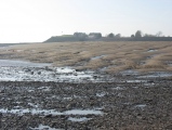
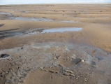
Goldcliff East Mesolithic Site submitted by SolarMegalith : General view of the Goldcliff East foreshore. The dark area is a peat deposit (photo taken on March 2012). (Vote or comment on this photo)
Mesolithic site in Monmouthshire (Sir Fynwy). Mesolithic footprints, trees from the submerged forest (5th millenium BC), remains of a fishtrap, occupation sites and the Iron Age trackways have been discovered on a foreshore and the area of former island near Goldcliff. Most of the site is accessible only during low tide.

The Mesolithic footprints are visible on exposed lamination beds, usually disturbing the lamination. Most of the footprints are in mediocre and poor condition. In 2001 total number of 61 footprints was recorded, among them 35 human footprints (some of them uncertain). The other footprints are bird (gull and crane) and reindeer ones. In some places they form footprint-tracks, couple of which were removed using block-lifting technique. On a foreshore in the nearby there are also remains of the trees from the Mesolithic submerged forest (one of the trunks was dated to 4100 BC) and Mesolithic occupation sites where flint tools (mainly microliths) were discovered.

The hill with remains of a priory which is located west from the foreshore sites is a former island. Remains of the Iron Age trackways were discovered in the nearby.

Reference:
Bell, M. et al. 2001. "Mesolithic to Neolithic coastal environmental change c. 6500-3500 cal BC". Archaeology in the Severn Estuary volume 12, p. 27-53.


Note: Two reports from the University of Reading research at Goldcliff East
You may be viewing yesterday's version of this page. To see the most up to date information please register for a free account.
Goldcliff East Mesolithic Site
Goldcliff East Mesolithic Site submitted by SolarMegalith : Goldcliff East - a Mesolithic deer footprint (photo taken on March 2012). (Vote or comment on this photo)

Goldcliff East Mesolithic Site
Goldcliff East Mesolithic Site submitted by SolarMegalith : Perfectly preserved Mesolithic crane footprints on a lamination bed (photo taken on March 2012). (2 comments - Vote or comment on this photo)

Goldcliff East Mesolithic Site
Goldcliff East Mesolithic Site submitted by SolarMegalith : Poorly preserved Mesolithic human footprint at Goldcliff East foreshore (photo taken on March 2012). (Vote or comment on this photo)

Goldcliff East Mesolithic Site
Goldcliff East Mesolithic Site submitted by SolarMegalith : Probable Mesolithic human footprint at the foreshore. You can make out shape of the heel (photo taken on March 2012). (1 comment - Vote or comment on this photo)

Goldcliff East Mesolithic Site
Goldcliff East Mesolithic Site submitted by SolarMegalith : Tree trunk from the submerged forest - this one is dated for 4100 BC (photo taken on March 2012). (Vote or comment on this photo)

Goldcliff East Mesolithic Site
Goldcliff East Mesolithic Site submitted by SolarMegalith : View from the foreshore towards former island where the Iron Age trackways and Mesolithic occupation sites were discovered (photo taken on March 2012).

Goldcliff East Mesolithic Site
Goldcliff East Mesolithic Site submitted by SolarMegalith : In the foreground there is a site of the Mesolithic fishtrap, now completely vanished (photo taken on March 2012).

Do not use the above information on other web sites or publications without permission of the contributor.
Click here to see more info for this site

Nearby sites

Click here to view sites on an interactive OS map

Key: Red: member's photo, Blue: 3rd party photo, Yellow: other image, Green: no photo - please go there and take one, Grey: site destroyed

Download sites to:
KML (Google Earth)
GPX (GPS waypoints)
CSV (Garmin/Navman)
CSV (Excel)

To unlock full downloads you need to sign up as a Contributory Member. Otherwise downloads are limited to 50 sites.


Turn off the page maps and other distractions

Nearby sites listing. In the following links * = Image available
 2.2km NW 311° Goldcliff Earthwork Misc. Earthwork (ST361835)
 4.9km W 276° Mesolithic Human Footprints at Uskmouth* Natural Stone / Erratic / Other Natural Feature (ST32808260)
 5.7km ENE 69° Caldicot Level Ancient Trackway (ST431841)
 6.6km NNE 30° Wilcrick Hill Fort* Hillfort (ST411877)
 6.8km NNE 28° Wilcrick Wishing Well* Holy Well or Sacred Spring (ST4097088044)
 7.1km N 3° Langstone (Bishton)* Round Barrow(s) (ST382891)
 7.5km ENE 66° Upton Ancient Trackway Ancient Trackway (ST446850)
 7.5km N 359° Lang Stone (Newport)* Standing Stone (Menhir) (ST37698961)
 7.6km ENE 66° Chapel Tump Ancient Village or Settlement (ST447851)
 8.0km NW 324° Maindee Camp Ancient Village or Settlement (ST3304588604)
 8.0km NW 324° Maindy Hill Camp Misc. Earthwork (ST3304588604)
 8.0km NNW 332° St Julian's Wood Hillfort (ST340892)
 8.2km NE 50° Undy Earthwork Misc. Earthwork (ST441873)
 8.6km N 4° Tre-Garn Round Cairn (ST384906)
 8.7km NW 312° Newport Museum and Art Gallery* Museum (ST31278791)
 8.8km NE 49° Llanfihangel Rogiet* Standing Stone (Menhir) (ST44518775)
 9.2km NNW 336° Caerleon Roman Fortress and Baths* Ancient Village or Settlement (ST34039050)
 9.4km NE 51° Llanfihangel Rogiet Churchyard Cross* Ancient Cross (ST4512087850)
 9.4km N 360° Coed y Caerau* Ancient Village or Settlement (ST378915)
 9.7km NE 34° The Larches Camp* Hillfort (ST433900)
 9.8km NNE 32° Carrow Hill Round Barrow Pair Round Barrow(s) (ST42999029)
 9.8km SSE 148° Walton-in-Gordano Banjo Enclosure* Misc. Earthwork (ST42847373)
 9.8km ESE 117° Battery Point* Modern Stone Circle etc (ST46437756)
 9.9km WNW 298° Tredegar Hillfort* Hillfort (ST290868)
 10.0km SSE 160° Walton St Mary Cross Ancient Cross (ST4096172635)
View more nearby sites and additional images

<< Allée couverte de Menguen-Lanvaux

Kanai Kofun >>

Please add your thoughts on this site

Ritual and Domestic Life in Prehistoric Europe, Bradley

Ritual and Domestic Life in Prehistoric Europe, Bradley

Sponsors

Auto-Translation (Google)

Translate from English into:

"Goldcliff East Mesolithic Site" | Login/Create an Account | 7 News and Comments
  
Go back to top of page    Comments are owned by the poster. We aren't responsible for their content.
Footprints on the sands of time - the archaeology of the Severn Estuary by Andy B on Wednesday, 08 January 2014
(User Info | Send a Message)
The Severn Estuary has been a focus for human settlement and subsistence for millennia. Sediments and tides have alternately preserved and uncovered a wide range of archaeological sites and finds from many different periods. At Porlock and Blue Anchor Bays, Lydney and Goldcliff there are submerged forests with waterlogged roots and trunks still surviving under intertidal muds. Some buried trees are associated with flints, animal bones and even wooden tools left by Mesolithic people (c . 10 000–4000 BC), who gathered plant foods and deliberately set fire to reeds and woodland to encourage new shoots for grazing game animals. They hunted and fished at a time when sea levels were much lower and Flat Holm and Steep Holm were rocky outcrops within a broad, shallow river valley.

Neolithic, Bronze Age and Iron Age people left artefacts, animal bones and human remains. As sea levels gradually rose, peat deposits and salt marshes developed and wetlands such as the Somerset and Gwent Levels formed diverse mixes of alder and birch carr, peat bog, marsh and standing water, rich in resources. Prehistoric wooden trackways have been found in areas like the Gwent and Somerset Levels, and Bronze Age and Iron Age timber buildings have been excavated at Redwick, Goldcliff and Greenmoor Arch. Brean Down was a dramatic setting for Bronze Age occupation.

Human and animal footprints are evocative yet ephemeral traces of prehistoric lives, pressed into fine silts, sealed by later sediments then exposed once more by erosion. At Uskmouth, Magor and Goldcliff there are prints of Mesolithic women, men and children, animals such as aurochs (wild cattle), deer and wolves, and many bird species.

At Oldbury, Neolithic human footprints were found alongside domestic cattle hoof prints, and similar hoof prints were associated with the later prehistoric buildings at Redwick and Goldcliff. Prehistoric and Romano-British people used the estuary for seasonal activities including summer livestock grazing and salt production. Drainage of the Gwent and Somerset Levels and riverside areas in Gloucestershire probably began during the Roman period, and continued during the medieval period and the 18th and 19th centuries.

This identified 928 new features and updated 373 existing records. The next stage of the project from April 2009 will consist of GPS-based survey to identify new archaeology and assess the threat to known features.

Adrian M. Chadwick, Gloucestershire County Council Archaeology Service
More at
http://www.academia.edu/5587115/Chadwick_A.M._2009._The_archaeology_of_the_Severn_Estuary

1. Lives of great men all remind us We can make our lives sublime, And, departing, leave behind us Footprints on the sands of time.
H.W. Longfellow. 1812. A Psalm of Life
[ Reply to This ]
    Re: Footprints on the sands of time - the archaeology of the Severn Estuary by sem on Wednesday, 14 June 2017
    (User Info | Send a Message)
    "1. Lives of great men all remind us We can make our lives sublime, And, departing, leave behind us Footprints on the sands of time.
    H.W. Longfellow. 1812. A Psalm of Life"

    Longfellow? And there's me thinking it was Hawkwind.
    [ Reply to This ]

Severn Estuary fossils reveal Stone Age fire starting by Andy B on Tuesday, 19 March 2013
(User Info | Send a Message)
Stone Age fossil finds in the Severn Estuary suggest hunter-gatherers were shaping the environment long before farming started, say researchers.

Flint "tools" dating back 7,500 years as well as bones and campfire debris were found at Goldcliff, near Newport.

University of Reading academics said the finds pointed to Mesolithic people using fire to encourage plant growth.

Fossil footprints found in the estuary include those of children as young as four helping with food production.

The Mesolithic, or Middle Stone Age, started in about 10,000BC, as the last Ice Age ended.

They show youngsters as young as four were actively engaged in the productive activities of the community”

They believe this indicates fire was used to encourage the growth of plants, such as hazelnuts, crab apples and raspberries, all which were eaten at the site.

The university archaeology department head, Prof Martin Bell, said the Severn Estuary was exceptional in its evidence of the plants used by Mesolithic people, thousands of years before farming began.

He said: "Previously it was thought that these people were mainly hunting deer and simply responding to the spectacular environmental changes around them, such as sea level rise."

"Now there is increasing evidence that they were adept at manipulating their environment to increase valued plant resources".

"Combining our finds with the trees, pollen and insects from the area we can build a picture of the environmental relationships of Mesolithic hunter-gatherers".

"These people were highly adaptable and continued using the same site as the environment changed dramatically from old woodland to reedswamp, to saltmarsh and back to fen woodland."
Researchers in the estuary The university researchers have held field studies at the site for the past two summers

Footprints of animals and birds are among those being found by the researchers, he said, along with those of people.

Prof Bell said: "The footprints include those made by children, which is extremely exciting as the role of children tends not to be visible in the archaeological record.

"They show youngsters as young as four were actively engaged in the productive activities of the community."

Prof Bell said the proposed Severn tidal barrage would have "very serious consequences" on a site that was "giving archaeologists an unparalleled glimpse into the life of a Stone Age settlement".

More at BBC News
http://www.bbc.co.uk/news/uk-wales-south-east-wales-20914482
[ Reply to This ]

Mesolithic people adapted their environment in Severn Estuary by davidmorgan on Thursday, 31 January 2013
(User Info | Send a Message)
New and exciting evidence has been found at a threatened archaeological site on the Severn Estuary that seems to show Mesolithic people knew how to adapt their environment to suit their needs.

Researchers from the University of Reading found 7500 year-old worked flint tools, bones, charcoal and hazelnut shells while working at Goldcliff, near Newport, south Wales, in September 2012.

Charcoal remains discovered on the site suggest these people used fire to encourage the growth of particular plants, such as hazelnuts, crab apples and raspberries. This evidence may indicate that Mesolithic people were deliberately manipulating the environment to increase their resources, thousands of years before farming began.

Most evidence for hunter-gatherer diet relates to the meat gained by hunting. This is easier to recognise and study than plant based foodstuffs, due to the greater survival of bone in the archaeological record. The Severn Estuary sites are however exceptional in providing evidence for a wide range of plant resources.

Professor Martin Bell, Head of the University of Reading’s Department of Archaeology, who is leading the Severn Estuary project, said: “Previously it was thought that these people were mainly hunting deer and simply responding to the spectacular environmental changes around them, such as sea level rise. Now there is increasing evidence that they were adept at manipulating their environment to increase valued plant resources.

“Combining our finds with the trees, pollen and insects from the area we can build a picture of the environmental relationships of Mesolithic hunter-gatherers. These people were highly adaptable and continued using the same site as the environment changed dramatically from old woodland to reedswamp, to saltmarsh and back to fen woodland.”

Over the last two summers researchers from the University of Reading have found Mesolithic footprints at Goldcliff. New finds, including the tracks of animals and birds, are frequently being made in the Severn Estuary.

Professor Bell continued: “The 7500 year old footprint trails show how the activity areas represented by flint tools and bones articulated together as parts of a living prehistoric landscape. The footprints include those made by children, which is extremely exciting as the role of children tends not to be visible in the archaeological record. They show children as young as four were actively engaged in the productive activities of the community.”

The UK House of Commons Select Committee on Climate Change is once again considering a Severn Tidal Barrage. This scheme would have a major impact on the rich archaeological resource of the Severn Estuary.

“From an archaeological point of view construction of a Severn Tidal Barrage would have very serious consequences alongside the more widely recognised ecological risks to fish, birds and many other organisms,” continued Professor Bell. “The tidal range will be reduced, sites will be permanently submerged, sedimentation will increase in some areas and, as patterns of erosion change, some site, including those with exceptional preservation of organic artefacts, may be rapidly destroyed.”

Source: Reading University http://www.pasthorizonspr.com/index.php/archives/01/2013/mesolithic-people-adapted-their-environment-in-severn-estuary

Submitted by coldrum.
[ Reply to This ]

Goldcliff Mesolithic Archaeology by Andy B on Thursday, 01 November 2012
(User Info | Send a Message)
At Goldcliff 9km south-east of Newport, Monmouthshire, a promontory projects into the estuary. This marks the site of a former island, the greater part of which has now been eroded away by the sea. Round the edge of this island in the intertidal zone hunter-gatherer Mesolithic sites were excavated in 1992-4 and 2001-3.

The sites were occupied at a time of lower sea level and were buried and preserved by silts and peats as sea level rose. At the base of the sequence is a substantial oak forest which existed c. 6000 cal BC. Occupation on the site took place between then and 4700 cal BC. Activity is represented by scatters of flint, chert and tuff artefacts as well as wood, bone and antler tools. Bones of deer, extinct wild cattle, pig, otter and fish (especially eels) represent the animal resources exploited. Animal and plant remains show that activity on these sites took place particularly in the autumn but there is also some activity in spring, at the height of summer and on one site in winter.

Stratified within estuarine silts around the edge of the former island are human footprints, many of them children, some as young as 4 or 5. Clearly, children were fully involved in the life of this Mesolithic community. The site has also produced the earliest evidence for human intestinal parasites, showing that the fringes of the settlement area were used for defaecation. The latest Mesolithic occupation is covered by a thick peat and another submerged forest which grew between 4400-4200 cal BC.

More at the Severn Estuary Levels Research Committee (SELRC)
http://www.selrc.org.uk/maplocation.php?location_id=38
[ Reply to This ]

Re: Goldcliff East Mesolithic Site by cerrig on Tuesday, 20 March 2012
(User Info | Send a Message)
I believe Time Team did a program on this site, but I don't know when. It was aired on the tele.
[ Reply to This ]
    Re: Goldcliff East Mesolithic Site by Anonymous on Tuesday, 19 May 2015
    First broadcast Feb 2004
    [ Reply to This ]

Your Name: Anonymous [ Register Now ]
Subject:


Add your comment or contribution to this page. Spam or offensive posts are deleted immediately, don't even bother

<<< What is five plus one as a number? (Please type the answer to this question in the little box on the left)
You can also embed videos and other things. For Youtube please copy and paste the 'embed code'.
For Google Street View please include Street View in the text.
Create a web link like this: <a href="https://www.megalithic.co.uk">This is a link</a>  

Allowed HTML is:
<p> <b> <i> <a> <img> <em> <br> <strong> <blockquote> <tt> <li> <ol> <ul> <object> <param> <embed> <iframe>

We would like to know more about this location. Please feel free to add a brief description and any relevant information in your own language.
Wir möchten mehr über diese Stätte erfahren. Bitte zögern Sie nicht, eine kurze Beschreibung und relevante Informationen in Deutsch hinzuzufügen.
Nous aimerions en savoir encore un peu sur les lieux. S'il vous plaît n'hesitez pas à ajouter une courte description et tous les renseignements pertinents dans votre propre langue.
Quisieramos informarnos un poco más de las lugares. No dude en añadir una breve descripción y otros datos relevantes en su propio idioma.