

<< Our Photo Pages >> Midhowe Chambered Cairn - Chambered Cairn in Scotland in Orkney
Submitted by jeffrep on Monday, 18 February 2019 Page Views: 14394
Neolithic and Bronze AgeSite Name: Midhowe Chambered CairnCountry: Scotland County: Orkney Type: Chambered Cairn
Nearest Town: Rousay (Island)
Map Ref: HY37223051 Landranger Map Number: 6
Latitude: 59.156691N Longitude: 3.099469W
Condition:
| 5 | Perfect |
| 4 | Almost Perfect |
| 3 | Reasonable but with some damage |
| 2 | Ruined but still recognisable as an ancient site |
| 1 | Pretty much destroyed, possibly visible as crop marks |
| 0 | No data. |
| -1 | Completely destroyed |
| 5 | Superb |
| 4 | Good |
| 3 | Ordinary |
| 2 | Not Good |
| 1 | Awful |
| 0 | No data. |
| 5 | Can be driven to, probably with disabled access |
| 4 | Short walk on a footpath |
| 3 | Requiring a bit more of a walk |
| 2 | A long walk |
| 1 | In the middle of nowhere, a nightmare to find |
| 0 | No data. |
| 5 | co-ordinates taken by GPS or official recorded co-ordinates |
| 4 | co-ordinates scaled from a detailed map |
| 3 | co-ordinates scaled from a bad map |
| 2 | co-ordinates of the nearest village |
| 1 | co-ordinates of the nearest town |
| 0 | no data |
Internal Links:
External Links:
I have visited· I would like to visit
coin whese001 would like to visit
drolaf visited on 9th Jun 2022 - their rating: Cond: 3 Amb: 4 Access: 3
bishop_pam visited on 23rd Apr 2018 - their rating: Cond: 3 Amb: 4 Access: 3
Jansold visited on 6th Jun 2013 - their rating: Cond: 3 Amb: 3 Access: 2
jeffrep visited on 26th Jun 2010 - their rating: Cond: 3 Amb: 5 Access: 2 First visited on August 16, 2007. Second Visit on June 26, 2010.
PAB SandyG DrewParsons TimPrevett Redfun have visited here
Average ratings for this site from all visit loggers: Condition: 3 Ambience: 4 Access: 2.5
")
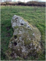
Today, the tomb is protected under a large shed. An overhead walkway allows visitors to view the cairn from above and its sophisticated structure can be viewed also from a overhead walkway. Despite the protective shed and the internal overhead walkway, the site is superb.
Note: Prof. Colin Richards chambered tombs talk free via video/audio conference from Orkney, 28th Feb 1pm. Prof Richards will argue that archaeologists have misunderstood the role of Neolithic chambered tomb monuments and the role and participation of the dead. Title: Decaying flesh and instability of substances: rethinking Neolithic chambered tombs. More details in the comments on our page
You may be viewing yesterday's version of this page. To see the most up to date information please register for a free account.
")
")
")
")
")
")
")
")
")
")
")
")
")
")
")
")
")
")
")
")
")
")
")
")
These are just the first 25 photos of Midhowe Chambered Cairn. If you log in with a free user account you will be able to see our entire collection.
Do not use the above information on other web sites or publications without permission of the contributor.
Click here to see more info for this site
Nearby sites
Key: Red: member's photo, Blue: 3rd party photo, Yellow: other image, Green: no photo - please go there and take one, Grey: site destroyed
Download sites to:
KML (Google Earth)
GPX (GPS waypoints)
CSV (Garmin/Navman)
CSV (Excel)
To unlock full downloads you need to sign up as a Contributory Member. Otherwise downloads are limited to 50 sites.
![]()
Turn off the page maps and other distractions
Nearby sites listing. In the following links * = Image available
92m NNW 347° Midhowe Broch* Broch or Nuraghe (HY372306)
271m NW 321° North Howe Broch* Broch or Nuraghe (HY3705130722)
737m S 171° Knowe of Rowiegar* Chambered Cairn (HY37332978)
903m SSE 159° Knowe of Swandro* Chambered Cairn (HY37532966)
1.7km N 6° Knowe of Dale* Misc. Earthwork (HY37423217)
1.9km SE 141° Westness Chambererd Tomb* Chambered Tomb (HY38402898)
3.1km NE 51° Knowe of Lingro Cairn (HY3964832378)
3.1km SE 140° Viera Lodge Broch or Nuraghe (HY392281)
3.5km SW 215° Burgar* Broch or Nuraghe (HY352277)
3.6km SSW 205° Knowe of Grugar* Broch or Nuraghe (HY35642730)
3.6km SW 221° West Broch of Burgar* Chambered Cairn (HY34822782)
3.7km NE 37° Wasbister* Crannog (HY395334)
3.7km NE 41° Bretta Ness* Ancient Village or Settlement (HY39723324)
3.7km SE 132° Knowe of Lairo* Chambered Cairn (HY39922796)
3.8km SE 131° Knowe of Ramsay* Chambered Cairn (HY40042800)
3.8km SSE 164° Aikerness Class I Pictish Symbol Stone (HY38182685)
3.8km SSE 164° Gurness* Broch or Nuraghe (HY3818926842)
3.8km SSW 191° Knowe of Stenso* Broch or Nuraghe (HY3639426747)
3.9km WSW 242° Peterkirk* Broch or Nuraghe (HY337287)
4.0km SSW 208° Grugar* Carving (HY353270)
4.1km SE 127° Knowe of Yarso* Chambered Cairn (HY40482795)
4.2km SE 136° Knowe of Burrian (Frotoft)* Broch or Nuraghe (HY40062745)
4.4km SE 133° Langstane (Orkney)* Standing Stone (Menhir) (HY404275)
4.8km ENE 77° Knowe of Craie* Chambered Cairn (HY41963153)
5.0km WSW 243° Vinquin* Broch or Nuraghe (HY32682830)
View more nearby sites and additional images


 We would like to know more about this location. Please feel free to add a brief description and any relevant information in your own language.
 Wir möchten mehr über diese Stätte erfahren. Bitte zögern Sie nicht, eine kurze Beschreibung und relevante Informationen in Deutsch hinzuzufügen.
 Nous aimerions en savoir encore un peu sur les lieux. S'il vous plaît n'hesitez pas à ajouter une courte description et tous les renseignements pertinents dans votre propre langue.
 Quisieramos informarnos un poco más de las lugares. No dude en añadir una breve descripción y otros datos relevantes en su propio idioma.