 with our Megalithic Portal iPhone app")

<< Our Photo Pages >> Pennerley Barrows - Round Barrow(s) in England in Shropshire
Submitted by TimPrevett on Wednesday, 29 December 2004 Page Views: 4412
Neolithic and Bronze AgeSite Name: Pennerley BarrowsCountry: England County: Shropshire Type: Round Barrow(s)
Nearest Town: Bishops Castle Nearest Village: Pennerley
Map Ref: SO349993
Latitude: 52.587588N Longitude: 2.962329W
Condition:
| 5 | Perfect |
| 4 | Almost Perfect |
| 3 | Reasonable but with some damage |
| 2 | Ruined but still recognisable as an ancient site |
| 1 | Pretty much destroyed, possibly visible as crop marks |
| 0 | No data. |
| -1 | Completely destroyed |
| 5 | Superb |
| 4 | Good |
| 3 | Ordinary |
| 2 | Not Good |
| 1 | Awful |
| 0 | No data. |
| 5 | Can be driven to, probably with disabled access |
| 4 | Short walk on a footpath |
| 3 | Requiring a bit more of a walk |
| 2 | A long walk |
| 1 | In the middle of nowhere, a nightmare to find |
| 0 | No data. |
| 5 | co-ordinates taken by GPS or official recorded co-ordinates |
| 4 | co-ordinates scaled from a detailed map |
| 3 | co-ordinates scaled from a bad map |
| 2 | co-ordinates of the nearest village |
| 1 | co-ordinates of the nearest town |
| 0 | no data |
Internal Links:
External Links:
I have visited· I would like to visit
TheWhiteRider TimPrevett have visited here
")
Details to Follow.
You may be viewing yesterday's version of this page. To see the most up to date information please register for a free account.
")
")
")
Do not use the above information on other web sites or publications without permission of the contributor.
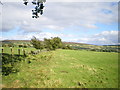
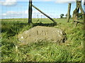
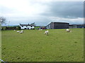
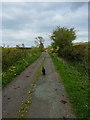
Nearby Images from Geograph Britain and Ireland:
©2008(licence)

©2008(licence)
©2008(licence)
©2014(licence)
©2014(licence)
The above images may not be of the site on this page, they are loaded from Geograph.
Please Submit an Image of this site or go out and take one for us!
Click here to see more info for this site
Nearby sites
Key: Red: member's photo, Blue: 3rd party photo, Yellow: other image, Green: no photo - please go there and take one, Grey: site destroyed
Download sites to:
KML (Google Earth)
GPX (GPS waypoints)
CSV (Garmin/Navman)
CSV (Excel)
To unlock full downloads you need to sign up as a Contributory Member. Otherwise downloads are limited to 50 sites.
Turn off the page maps and other distractions
Nearby sites listing. In the following links * = Image available
859m NE 54° Pennerley Circle* Stone Circle (SO356998)
1.1km W 274° Shelve* Stone Circle (SO338994)
1.7km SSW 195° Ritton Castle* Hillfort (SO34449765)
1.9km ESE 104° The Stiperstones* Cairn (SO36799880)
2.6km WNW 283° Hoarstones* Stone Circle (SO32419990)
2.9km NE 53° Castle Ring (Stiperstones)* Hillfort (SJ372010)
3.1km NNW 330° Lord's Stone* Standing Stone (Menhir) (SJ33400200)
3.2km W 268° Giant's Grave (Shropshire)* Burial Chamber or Dolmen (SO31659925)
3.4km WNW 285° Holywell Brook (Rorrington)* Holy Well or Sacred Spring (SJ316002)
3.6km WNW 289° Castle Ring (Rorrington)* Hillfort (SJ315005)
3.6km W 265° Stapeley Hill Cairn* Cairn (SO31279904)
3.6km ENE 60° The Paddocks Stone Row / Alignment (SJ38100107)
3.7km W 262° Stapeley Hill Earthworks* Misc. Earthwork (SO312988)
4.0km W 263° Cow Stone (Shropshire)* Standing Stone (Menhir) (SO30919888)
4.1km SSE 161° Linley Hill Camp* Misc. Earthwork (SO362954)
4.5km WSW 254° Druid's Castle* Stone Circle (SO305981)
4.6km WSW 257° Mitchell's Fold* Stone Circle (SO30429837)
4.6km WSW 256° Mitchell's Fold outlier* Standing Stone (Menhir) (SO30429828)
4.7km WSW 237° Corndon Hill 4* Cairn (SO30949680)
4.7km W 262° Middleton Hill Round Barrow(s) (SO302987)
4.7km WSW 237° Corndon Hill 3* Cairn (SO30909676)
4.8km WSW 248° The Whetstones* Stone Circle (SO30429753)
4.9km WSW 240° Corndon Hill 2* Cairn (SO30609693)
5.0km SW 233° Corndon Hill 5* Cairn (SO30869632)
5.1km SSW 197° Heath Mynd Bronze Age Homestead* Misc. Earthwork (SO33369447)
View more nearby sites and additional images

")
 We would like to know more about this location. Please feel free to add a brief description and any relevant information in your own language.
 Wir möchten mehr über diese Stätte erfahren. Bitte zögern Sie nicht, eine kurze Beschreibung und relevante Informationen in Deutsch hinzuzufügen.
 Nous aimerions en savoir encore un peu sur les lieux. S'il vous plaît n'hesitez pas à ajouter une courte description et tous les renseignements pertinents dans votre propre langue.
 Quisieramos informarnos un poco más de las lugares. No dude en añadir una breve descripción y otros datos relevantes en su propio idioma.