


<< Our Photo Pages >> St Gwytherine's Grave Stone - Early Christian Sculptured Stone in Wales in Monmouthshire
Submitted by Sunny100 on Thursday, 24 June 2010 Page Views: 5004
Early Medieval (Dark Age)Site Name: St Gwytherine's Grave Stone Alternative Name: The Veterinus Stone, The Priest StoneCountry: Wales
NOTE: This site is 2.6 km away from the location you searched for.
County: Monmouthshire Type: Early Christian Sculptured Stone
Nearest Town: Abergavenny Nearest Village: Llanvetherine
Map Ref: SO364172
Latitude: 51.849755N Longitude: 2.92473W
Condition:
| 5 | Perfect |
| 4 | Almost Perfect |
| 3 | Reasonable but with some damage |
| 2 | Ruined but still recognisable as an ancient site |
| 1 | Pretty much destroyed, possibly visible as crop marks |
| 0 | No data. |
| -1 | Completely destroyed |
| 5 | Superb |
| 4 | Good |
| 3 | Ordinary |
| 2 | Not Good |
| 1 | Awful |
| 0 | No data. |
| 5 | Can be driven to, probably with disabled access |
| 4 | Short walk on a footpath |
| 3 | Requiring a bit more of a walk |
| 2 | A long walk |
| 1 | In the middle of nowhere, a nightmare to find |
| 0 | No data. |
| 5 | co-ordinates taken by GPS or official recorded co-ordinates |
| 4 | co-ordinates scaled from a detailed map |
| 3 | co-ordinates scaled from a bad map |
| 2 | co-ordinates of the nearest village |
| 1 | co-ordinates of the nearest town |
| 0 | no data |
Internal Links:
External Links:
")
The tall slab, some 6-7 feet tall, has a carving of a priest with his right hand raised to give a blessing. In his left hand, although the detail is much worn, he seems to hold a bible and what looks like a sword. This crudely carved figure is said to be St Gwytherine (Veterinus), the founder of the first church on this site back in the so-called Dark Ages.
A second slab-stone at its side is more recent, probably Medieval. The saint's gravestone used to stand in the churchyard, but it was recently brought inside to protect it from the elements.
St Gwytherine (Veterinus in Latin) was the son of St Dingat. He was a monk at St Cadoc's monastic college of Llancarfan, and later joined Cadoc in his missionary travels through Monmouthshire. He founded a church at Llanvetherine and is said to have died there. There are several churches dedicated to St Cadoc in this area.
You may be viewing yesterday's version of this page. To see the most up to date information please register for a free account.
")
Do not use the above information on other web sites or publications without permission of the contributor.
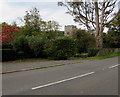
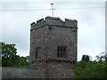
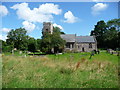
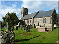
Nearby Images from Geograph Britain and Ireland:
©2017(licence)

©2016(licence)
©2012(licence)
©2012(licence)
©2014(licence)
The above images may not be of the site on this page, they are loaded from Geograph.
Please Submit an Image of this site or go out and take one for us!
Click here to see more info for this site
Nearby sites
Key: Red: member's photo, Blue: 3rd party photo, Yellow: other image, Green: no photo - please go there and take one, Grey: site destroyed
Download sites to:
KML (Google Earth)
GPX (GPS waypoints)
CSV (Garmin/Navman)
CSV (Excel)
To unlock full downloads you need to sign up as a Contributory Member. Otherwise downloads are limited to 50 sites.
Turn off the page maps and other distractions
Nearby sites listing. In the following links * = Image available
313m ESE 120° Llanvetherine Holy Well* Holy Well or Sacred Spring (SO36671704)
3.5km WNW 288° Ysgyryd Fawr* Hillfort (SO331183)
4.5km NNE 33° Grosmont Fawr Hillfort (SO389210)
5.0km W 273° Trillech Stone Row / Alignment (SO314175)
5.3km W 260° St Teilo's Church (Llantilio Pertholey)* Ancient Cross (SO31141633)
6.8km W 262° Twyn yr Allt* Ancient Village or Settlement (SO296163)
7.0km WSW 241° Priory Well (Abergavenny)* Holy Well or Sacred Spring (SO30231387)
7.2km WSW 242° Abergavenny Museum* Museum (SO2995913943)
7.2km NW 323° Pen-Twyn Hillfort (SO321230)
7.7km WNW 286° Blaenawey Well (Bettws)* Holy Well or Sacred Spring (SO290194)
8.2km NNE 29° Grosmont Churchyard Cross* Ancient Cross (SO40462432)
8.3km WSW 245° Llanfoist Standing Stone* Standing Stone (Menhir) (SO28781379)
8.5km WNW 303° Twyn-y-Gaer (Monmouthshire) Hillfort (SO2938721948)
9.0km NW 313° St Martin's Church (Cwmyoy)* Ancient Cross (SO29902340)
9.3km S 187° Llanover Fawr Round Barrow(s) (SO351080)
9.7km SSE 163° Camp Hill Bryngwyn Ancient Village or Settlement (SO391079)
9.9km SSW 210° Ffynnon Gofer (Llanover)* Holy Well or Sacred Spring (SO313087)
9.9km ENE 76° Llangattock Barrow Round Barrow(s) (SO461194)
10.0km WNW 301° Partrishow Churchyard Cross* Ancient Cross (SO2788822434)
10.0km WNW 301° Ffynnon Ishow* Holy Well or Sacred Spring (SO2784322428)
10.0km ENE 72° St Ffraed's Well* Holy Well or Sacred Spring (SO45972023)
10.4km S 179° Coed y Bwynydd Camp* Hillfort (SO36500680)
10.7km SSE 152° Raglan Cross* Ancient Cross (SO4134007660)
10.8km WSW 240° Blorenge Cairn* Round Cairn (SO270119)
10.8km NNW 339° St. Clodock's Well* Holy Well or Sacred Spring (SO32692738)
View more nearby sites and additional images
Wadi Paran ancient agriculture terraces, matseboth and Rock art >>


 We would like to know more about this location. Please feel free to add a brief description and any relevant information in your own language.
 Wir möchten mehr über diese Stätte erfahren. Bitte zögern Sie nicht, eine kurze Beschreibung und relevante Informationen in Deutsch hinzuzufügen.
 Nous aimerions en savoir encore un peu sur les lieux. S'il vous plaît n'hesitez pas à ajouter une courte description et tous les renseignements pertinents dans votre propre langue.
 Quisieramos informarnos un poco más de las lugares. No dude en añadir una breve descripción y otros datos relevantes en su propio idioma.