Featured: Ark of Secrets - Neolithic spirit alive in the Middle Ages

Ark of Secrets - Neolithic spirit alive in the Middle Ages

Random Image


Barpa nam Feannag

Stone Circles, A Modern Builder's Guide

Stone Circles, A Modern Builder's Guide

Who's Online

There are currently, 225 guests and 2 members online.

You are a guest. To join in, please register for free by clicking here

Sponsors

<< Our Photo Pages >> Worlebury Camp - Hillfort in England in Somerset

Submitted by vicky on Wednesday, 13 July 2011  Page Views: 28203

Iron Age and Later PrehistorySite Name: Worlebury Camp Alternative Name: Weston Woods
Country: England
NOTE: This site is 0.9 km away from the location you searched for.

County: Somerset Type: Hillfort
Nearest Town: Weston-super-Mare  Nearest Village: Worlebury
Map Ref: ST315625  Landranger Map Number: 182
Latitude: 51.357424N  Longitude: 2.985153W
Condition:
5Perfect
4Almost Perfect
3Reasonable but with some damage
2Ruined but still recognisable as an ancient site
1Pretty much destroyed, possibly visible as crop marks
0No data.
-1Completely destroyed
4 Ambience:
5Superb
4Good
3Ordinary
2Not Good
1Awful
0No data.
4 Access:
5Can be driven to, probably with disabled access
4Short walk on a footpath
3Requiring a bit more of a walk
2A long walk
1In the middle of nowhere, a nightmare to find
0No data.
3 Accuracy:
5co-ordinates taken by GPS or official recorded co-ordinates
4co-ordinates scaled from a detailed map
3co-ordinates scaled from a bad map
2co-ordinates of the nearest village
1co-ordinates of the nearest town
0no data
4

Internal Links:
External Links:

I have visited· I would like to visit

SolarMegalith would like to visit

Arjessa hevveh have visited here

Worlebury camp
Worlebury camp submitted by Arjessa : Worlebury hill-fort, Weston-super-Mare, North Somerset. (In reference to article, "The Origins of the Dobunni"). (Vote or comment on this photo)
On the hill that overlooks Weston-super-Mare there are the remains of Worlebury hillfort, described by James Dyer as 'one of the most notable hillforts in Somerset'.

This ancient stronghold was built over 2,000 years ago in the Iron Age, on the site of earlier Bronze Age remains. A lot was found out about the hillfort during excavations in the 1850s, including the presence of many large and deep pits cut into the underlying rock.

These pits were probably used for the storage of grain. Some were later re-used for burying people.These human remains, some of which show evidence of a violent death with sword cut-marks, are the most famous finds from Worlebury.

Finds from the site can be found in Woodspring Museum in Weston-super-Mare.

More Weston-super-Mare history here

Note: Worlebury Hillfort Guided Walk, Sat 16 July
You may be viewing yesterday's version of this page. To see the most up to date information please register for a free account.

Worlebury Camp
Worlebury Camp submitted by AngieLake : A rather nice watercolour interpretation of Worlebury Camp by Ken Poole, on display in Weston super Mare Museum. (Vote or comment on this photo)

Worlebury Camp
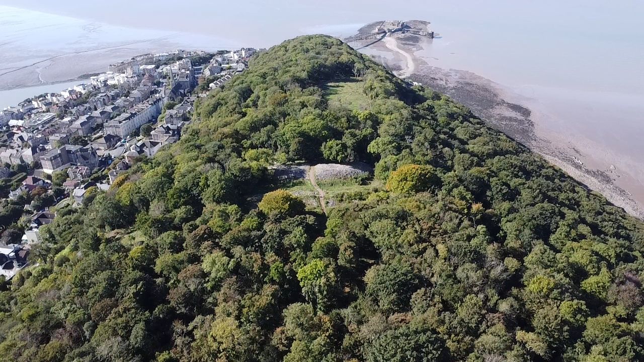
Worlebury Camp submitted by camperman : An aerial view looking west along the ridge towards the Bristol Channel with the stone ramparts of Worlebury bisecting the ridge. (Vote or comment on this photo)

Worlebury Camp
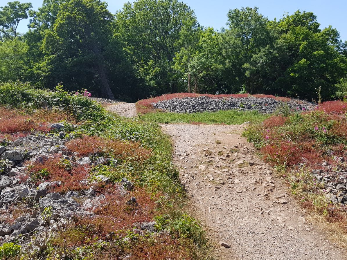
Worlebury Camp submitted by camperman : The main entrance looking west towards the ramparts. (Vote or comment on this photo)

Worlebury Camp
Worlebury Camp submitted by camperman : A good view of the three sets of stone ramparts. (Vote or comment on this photo)

Worlebury Camp
Worlebury Camp submitted by camperman : Looking south across the stone ramparts.

Worlebury Camp
Worlebury Camp submitted by camperman : Looking south across the ridge towards Weston Bay.

Worlebury Camp
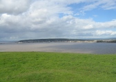
Worlebury Camp submitted by AngieLake : Worlebury Camp viewed across the bay at Weston Super Mare, from the summit of Brean Down.

Worlebury Camp
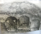
Worlebury Camp submitted by AngieLake : Photo from Museum display: Another drawing of Iron Age pit burials at Weston super Mare, this time found in 1901 when making Upper Church Road. Presumably part of Worlebury hill fort then. (Caption from little Worlebury book on sale in Museum.)

Worlebury Camp
Worlebury Camp submitted by AngieLake : Photo taken on 23 May at Weston super Mare Museum. Shows Iron Age pit burial found in Stafford Place in 1885. Imaginative drawing made at the time by E.Y. Poole. (That description taken from little Worlebury book on sale in Museum.) I believe the Museum display captioned them 'Grove Park' burials? [Oddly enough we'd parked in that road before walking to the Museum!] (1 comment)

Worlebury Camp
Worlebury Camp submitted by AngieLake : This plan of Worlebury is based on Dymond's plan of 1880 and comes from a small booklet about the camp which is currently available from the Museum in Weston super Mare. (Only 50p). 'Worlebury The Story of the Iron Age hill-fort at Weston super Mare', A Woodspring Museum Publication.

Worlebury camp
Worlebury camp submitted by caradoc68 : ST 315 472,Worlebury camp. This picture is one of the rampart's that is curving round. There is two very large stone ramparts and for banks in front of that, a heavily wooded Hillfort be careful waking though the wood has there is 98 grain pits that have been left open.

Worlebury Camp
Worlebury Camp submitted by Arjessa : Worlebury Camp hill-fort, showing more of stone ramparts, Weston-super-Mare, North Somerset. (Re; article "The Origins of the Dobunni?") (1 comment)

Do not use the above information on other web sites or publications without permission of the contributor.
Click here to see more info for this site

Nearby sites

Click here to view sites on an interactive OS map

Key: Red: member's photo, Blue: 3rd party photo, Yellow: other image, Green: no photo - please go there and take one, Grey: site destroyed

Download sites to:
KML (Google Earth)
GPX (GPS waypoints)
CSV (Garmin/Navman)
CSV (Excel)

To unlock full downloads you need to sign up as a Contributory Member. Otherwise downloads are limited to 50 sites.


Turn off the page maps and other distractions

Nearby sites listing. In the following links * = Image available
 1.1km SE 144° Weston-super-Mare Museum* Museum (ST3217061568)
 1.2km SE 144° North Somerset Museum Museum (ST322615)
 4.6km S 178° Walborough Barrows Round Barrow(s) (ST31615791)
 4.6km SW 219° Brean Down* Hillfort (ST28535898)
 5.2km NE 34° Woodspring Priory Field System Misc. Earthwork (ST345668)
 5.3km NE 36° Middle Hope Round Barrow(s) (ST34656676)
 5.9km ENE 60° Wick St Lawrence Village Cross* Ancient Cross (ST3660565388)
 6.2km SSE 154° Bleadon Cross* Ancient Cross (ST3411056921)
 7.3km E 99° Rolstone* Standing Stone (Menhir) (ST38736120)
 7.4km SE 136° Loxton Hill Barrows Round Barrow(s) (ST36565704)
 8.0km SE 127° Flagstaff Hill* Stone Circle (ST3785257630)
 8.9km ESE 121° Wook's Quoit* Standing Stone (Menhir) (ST39045783)
 9.1km SE 137° Loxton Churchyard Cross* Ancient Cross (ST3762455813)
 9.6km ENE 62° Kingston Seymour Churchyard Cross* Ancient Cross (ST4010166846)
 9.8km ENE 62° Kingston Seymour Village Cross* Ancient Cross (ST4022366941)
 10.0km WNW 284° Flatholm glacial erratic* Natural Stone / Erratic / Other Natural Feature (ST21826496)
 10.0km ESE 110° Banwell Camp Hillfort (ST409590)
 10.8km SE 131° Compton Bishop Church Cross* Ancient Cross (ST3959955378)
 11.0km SSE 164° East Brent Churchyard Cross* Ancient Cross (ST3439051891)
 11.1km NE 42° Wain's Hill* Promontory Fort / Cliff Castle (ST39087066)
 11.3km SE 143° Biddisham Churchyard Cross* Ancient Cross (ST3819353429)
 11.3km SE 125° Wavering Down cairn* Round Cairn (ST40705590)
 11.4km NE 43° St Andrews Churchyard Cross* Ancient Cross (ST3936470808)
 11.5km NE 43° Clevedon Sheila Na Gig* Carving (ST3938370827)
 11.8km SSE 167° Brent Knoll Camp* Hillfort (ST34115097)
View more nearby sites and additional images

<< Helman Tor

The Bulwarks (Breedon on the Hill) >>

Please add your thoughts on this site

Understanding the Neolithic

Understanding the Neolithic

Sponsors

Auto-Translation (Google)

Translate from English into:

"Worlebury Camp" | Login/Create an Account | 5 News and Comments
  
Go back to top of page    Comments are owned by the poster. We aren't responsible for their content.
Volunteers needed for hillfort project by Andy B on Wednesday, 12 September 2018
(User Info | Send a Message)
07 Sep 2018

Local residents are being given the opportunity to get involved in a project to help preserve Worlebury Hillfort in Weston-super-Mare.

Volunteer members of the Worlebury Hillfort Group have been working hard over the last two years clearing vegetation from the site, resulting in opening up new areas of the hillfort for visitors to see.

These volunteers have recently taken on a new project to dismantle the large cairn and playforts that have been illegally constructed out of material from the hillfort and more help is needed with this work.

As the Iron Age hillfort is a scheduled monument, the work can only be undertaken with special permission from Historic England and the Secretary of State.

It’s a criminal offence under the Ancient Monuments and Archaeological Areas Act 1979 to carry out unauthorised works, or to allow unauthorised works to be carried out, on a scheduled monument.

The recent archaeological condition survey of the hillfort highlights several instances of unlawful damage to the monument, including the removal of stones to create a modern cairn.

North Somerset Council manages the hillfort and has gained Scheduled Monument Consent to dismantle these unlawful features. It is now asking local residents for help in carrying out this work.

“By creating cairns, shelters and playforts, people are causing irreparable damage to the hillfort, making it very difficult for archaeologists to examine and investigate this incredibly important monument,” said Cllr Peter Bryant, the council’s executive member responsible for parks and green spaces.

“Having successfully gained Scheduled Monument Consent to dismantle these unlawful features, this will hopefully go some way to preventing further damage to the hillfort through the removal and moving of stones from the defensive ramparts.

“We are looking for more willing volunteers to help undertake some of this work. This is an opportunity to become involved with an exciting project, right in the historical heart of Weston-super-Mare.”

If you would like to volunteer contact the council’s archaeologist Cat Lodge at dm.archaeology@n-somerset.gov.uk or on 01934 888 811.

Source:
http://www.n-somerset.gov.uk/news/volunteers-needed-for-hillfort-project/
[ Reply to This ]

Re: Worlebury Iron Age Hillfort burials by AngieLake on Tuesday, 11 June 2013
(User Info | Send a Message)
To quote excerpts from 'Worlebury - The Story of the Iron Age Hill-fort at Weston super Mare' [a Woodspring Museum Publication on sale for only 50p at the Museum in May 2013]:
"..... "
"The end came for the Iron Age hill-fort in a dramatic manner. Unable to defend itself from a hostile attack, it fell to the enemy. Maybe the attackers took the fort by surprise. The walls were breached, the gates burned and the flanking towers knocked down. The enemy, not content with massacring the inhabitants, including women and children, continued hacking at the bodies even after they were dead. The houses and granaries were pillaged and fired."

"The poignant evidence of this grisly episode was found in the excavations of 1851-2.............."
"......"
"The great questions are, who were the enemy and when did the event take place. Were they Roman* soldiers in the general Vespasian's campaign to establish his position as conqueror of lowland Britain in about AD 45? Or was it an earlier attack by another Iron Age tribe?...."
"Although we cannot pin-point the year of the Worlebury massacre, we can at least guess the season was autumn. There was grain in some of the pits, and there were sheaves awaiting threshing."

"After the massacre survivors of the tribe crept back to the smouldering ruins when all was quiet, gathered up their dead and buried them hastily in the burned-out grain pits, throwing stones from the pit walls in on top to prevent the wolves from scavenging the bodies.

Burial of the dead in pits was normal practice. The pits were similar to the grain-storage pits and the body was placed crouched and lying on its side, the head pointing to the north or north-north-east. As the graves are not marked with barrows (...) the discovery of the graves of the Iron Age is a matter of chance."

"In 1901 when building the eastern end of Upper Church Road (then called Coronation Road), workmen discovered three such pits sunk to a depth of 1.8m (6ft). In Pit 1 were the skeletons of a man and woman with many slingstones, fragments of pottery, bones of horse, ox and sheep and lumps of ochre. Pit 2 contained part of the skull of a very small child, some animal bones and pottery. Pit 3 had only animal bones - horse, ox, sheep, pig and possibly a dog's jaw." ......" The find of yellow ochre is interesting as, at Haywood's Shelter, Hutton, similar lumps had been placed in the mouths of the dead. Probably the ochre was used to paint the bodies simulating life-giving blood, a ritual practised since the Old Stone Age."

"Further proof that here was the area for the main cemetery for Worlebury is provided by Jackson's reference (1871) to 'a number of skeletons found buried in an upright half-sitting position in a garden above Church Road', and also at Combe Cottage."

"In 1885 a solitary pit burial '3 ft deep and 3 feet square' was found in Stafford Place. The individual was accompanied by horns of Bos longifrons, which the local antiquarian at the time, E. Y. Poole, considered were part of the warrior's head-dress. Other burials had been found near Christchurch in 1861."

[I wonder if Ken Poole who painted the watercolour of Worlebury on display in the Museum is related to E. Y. Poole?]

*Regarding the Romans: the little port of Uphill near Brean Down at the south of Weston Bay was once very important to the Romans. "..lead and silver from the Roman mines on the Mendips was transported along [traces of] a Roman road from Sarum through Glastonbury and on to Banwell, Hutton and Uphill. A good stretch of this road still exists on Bleadon Hill..." "In Roman times the sea undoubtedly still washed inland as far as Congresbury to the north-east and almost to Street and Glastonbury in the south, covering a large area from the estuary of the River Parrett round what is now Bridgwater. The little port of Uphill would have been the only way to approach Glastonbury from the west and the near

Read the rest of this post...
[ Reply to This ]

Worlebury Hillfort Guided Walk, Sat 16 July 14.30 by Andy B on Saturday, 18 June 2011
(User Info | Send a Message)
Worlebury Hillfort Guided Walk & Guided Town Walk (Mendip Hills Festival of Archaeology)

Sat 16 July 14.30

Worlebury Hillfort Guided Walk & Guided Town Walk. Free.

Location: Nearest parking: Grove Park or Sovereign Centre, Weston-super-Mare.

Org: Weston-super-Mare Archaeological and Natural History Society
Name: Rosemary Dowie
Tel: 01934 620006
Web: http://www.wanhs.org

Part of the Festival of British Archaeology 2011
[ Reply to This ]

Pastscape Entry by coldrum on Monday, 30 May 2011
(User Info | Send a Message)
http://www.pastscape.org.uk/hob.aspx?hob_id=192721
[ Reply to This ]

Trees threaten Iron Age hill fort by Andy B on Wednesday, 12 January 2005
(User Info | Send a Message)
Conservation work is to be carried out on an Iron Age hillfort in North Somerset to save an ancient monument.
The site at Weston Woods near Weston-super-Mare is being destroyed by trees planted on the hillside in the early 19th Century.

There are concerns that the roots are prising apart the important archaeological structures.

The Forestry Commission has given North Somerset Council permission to fell the trees, which will take two months.

Christopher Richards from North Somerset Council said: "If we had a storm up here and these trees came down then the entire hillfort could be destroyed."

Tree surgeon John Flannigan said: "We've got permission from the Forestry Commission to fell up to 300 trees and archaeologists have selected the most vulnerable areas."

Source: BBC Somerset
[ Reply to This ]

Your Name: Anonymous [ Register Now ]
Subject:


Add your comment or contribution to this page. Spam or offensive posts are deleted immediately, don't even bother

<<< What is five plus one as a number? (Please type the answer to this question in the little box on the left)
You can also embed videos and other things. For Youtube please copy and paste the 'embed code'.
For Google Street View please include Street View in the text.
Create a web link like this: <a href="https://www.megalithic.co.uk">This is a link</a>  

Allowed HTML is:
<p> <b> <i> <a> <img> <em> <br> <strong> <blockquote> <tt> <li> <ol> <ul> <object> <param> <embed> <iframe>

We would like to know more about this location. Please feel free to add a brief description and any relevant information in your own language.
Wir möchten mehr über diese Stätte erfahren. Bitte zögern Sie nicht, eine kurze Beschreibung und relevante Informationen in Deutsch hinzuzufügen.
Nous aimerions en savoir encore un peu sur les lieux. S'il vous plaît n'hesitez pas à ajouter une courte description et tous les renseignements pertinents dans votre propre langue.
Quisieramos informarnos un poco más de las lugares. No dude en añadir una breve descripción y otros datos relevantes en su propio idioma.