


<< Our Photo Pages >> Binn Hill - Round Cairn in Scotland in Moray
Submitted by vicky on Tuesday, 12 August 2003 Page Views: 7431
Neolithic and Bronze AgeSite Name: Binn HillCountry: Scotland
NOTE: This site is 0.7 km away from the location you searched for.
County: Moray Type: Round Cairn
Nearest Village: Lochhill
Map Ref: NJ30166532 Landranger Map Number: 28
Latitude: 57.672307N Longitude: 3.172528W
Condition:
| 5 | Perfect |
| 4 | Almost Perfect |
| 3 | Reasonable but with some damage |
| 2 | Ruined but still recognisable as an ancient site |
| 1 | Pretty much destroyed, possibly visible as crop marks |
| 0 | No data. |
| -1 | Completely destroyed |
| 5 | Superb |
| 4 | Good |
| 3 | Ordinary |
| 2 | Not Good |
| 1 | Awful |
| 0 | No data. |
| 5 | Can be driven to, probably with disabled access |
| 4 | Short walk on a footpath |
| 3 | Requiring a bit more of a walk |
| 2 | A long walk |
| 1 | In the middle of nowhere, a nightmare to find |
| 0 | No data. |
| 5 | co-ordinates taken by GPS or official recorded co-ordinates |
| 4 | co-ordinates scaled from a detailed map |
| 3 | co-ordinates scaled from a bad map |
| 2 | co-ordinates of the nearest village |
| 1 | co-ordinates of the nearest town |
| 0 | no data |
Be the first person to rate this site - see the 'Contribute!' box in the right hand menu.
Internal Links:
External Links:
I have visited· I would like to visit
stolinskie would like to visit
")
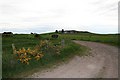
A surprisingly large burial cairn, but rather difficult to find. Divinatory skills required.
The OS maps are accurate in its position, but overgrown trees make it difficult to see from the woodland path. Overgrown with bracken, even in winter, when discovered - numerous accumulations of old weathered stones become apparent, traceable into a ring structure, almost like a kerb cairn, albeit the stones are few in number, but make up for in size, in an otherwise woodland area barren of large stones. Aron Bowers
You may be viewing yesterday's version of this page. To see the most up to date information please register for a free account.
")
")
Do not use the above information on other web sites or publications without permission of the contributor.
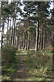
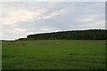
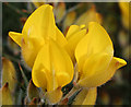
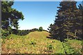
Nearby Images from Geograph Britain and Ireland:
©2014(licence)
©2006(licence)
©2014(licence)
©2005(licence)
©2006(licence)
The above images may not be of the site on this page, they are loaded from Geograph.
Please Submit an Image of this site or go out and take one for us!
Click here to see more info for this site
Nearby sites
Key: Red: member's photo, Blue: 3rd party photo, Yellow: other image, Green: no photo - please go there and take one, Grey: site destroyed
Download sites to:
KML (Google Earth)
GPX (GPS waypoints)
CSV (Garmin/Navman)
CSV (Excel)
To unlock full downloads you need to sign up as a Contributory Member. Otherwise downloads are limited to 50 sites.
Turn off the page maps and other distractions
Nearby sites listing. In the following links * = Image available
1.7km SW 223° Innesmill* Stone Circle (NJ28956407)
3.8km E 98° Browland* Stone Circle (NJ339647)
3.8km WSW 257° Urquart Stones* Stone Circle (NJ26456450)
5.3km SSW 210° Bogton Mill* Stone Circle (NJ2743060765)
6.4km SSW 210° Errol circle Stone Circle (NJ26905984)
7.3km ESE 107° Cowiemuir* Stone Circle (NJ37096310)
8.3km WSW 253° Elgin symbol stone* Class II Pictish Symbol Stone (NJ2219263057)
8.4km SE 136° Bellie Round Barrow(s) (NJ359592)
8.7km WSW 252° Elgin Museum* Museum (NJ218628)
8.8km WNW 296° Drainie 3, 13, 26 Class III Pictish Cross Slab (NJ223694)
10.3km SSE 167° St Mary's Well (Inchberry)* Holy Well or Sacred Spring (NJ323552)
11.4km SW 232° Birnie Roundhouses* Misc. Earthwork (NJ210585)
11.4km WNW 287° Gordonstoun Ogston Cross* Ancient Cross (NJ19276892)
11.4km E 98° Arradoul Stone Circle Stone Circle (NJ415635)
11.6km SW 234° Birnie Pictish Stone* Class I Pictish Symbol Stone (NJ20645872)
11.8km WSW 258° Quarry Wood* Henge (NJ185631)
12.1km SSW 208° Netherglen* Standing Stone (Menhir) (NJ24315476)
12.3km WNW 286° Gordounstoun Class II Pictish Symbol Stone (NJ184689)
13.7km WNW 292° Sculptor's Cave* Class I Pictish Symbol Stone (NJ175707)
13.8km SW 235° Upper Manbeen* Class I Pictish Symbol Stone (NJ1868957615)
14.1km W 259° Alves Stone Circle* Stone Circle (NJ162628)
14.9km WNW 288° Clasach Cove* Class I Pictish Symbol Stone (NJ16007013)
15.1km WNW 282° Inverugie* Round Cairn (NJ154687)
15.1km W 281° Camus Stone* Standing Stone (Menhir) (NJ15306840)
15.1km W 281° Inverugie Cup marked stone* Rock Art (NJ15296838)
View more nearby sites and additional images


 We would like to know more about this location. Please feel free to add a brief description and any relevant information in your own language.
 Wir möchten mehr über diese Stätte erfahren. Bitte zögern Sie nicht, eine kurze Beschreibung und relevante Informationen in Deutsch hinzuzufügen.
 Nous aimerions en savoir encore un peu sur les lieux. S'il vous plaît n'hesitez pas à ajouter une courte description et tous les renseignements pertinents dans votre propre langue.
 Quisieramos informarnos un poco más de las lugares. No dude en añadir una breve descripción y otros datos relevantes en su propio idioma.