

<< Our Photo Pages >> Skae Frue - Round Barrow(s) in Scotland in Orkney
Submitted by howar on Thursday, 24 August 2006 Page Views: 5847
Neolithic and Bronze AgeSite Name: Skae Frue Alternative Name: Skeldro, Wasbuster, BuckanCountry: Scotland County: Orkney Type: Round Barrow(s)
Nearest Town: Stromness Nearest Village: Stenness
Map Ref: HY28241440
Latitude: 59.010630N Longitude: 3.251168W
Condition:
| 5 | Perfect |
| 4 | Almost Perfect |
| 3 | Reasonable but with some damage |
| 2 | Ruined but still recognisable as an ancient site |
| 1 | Pretty much destroyed, possibly visible as crop marks |
| 0 | No data. |
| -1 | Completely destroyed |
| 5 | Superb |
| 4 | Good |
| 3 | Ordinary |
| 2 | Not Good |
| 1 | Awful |
| 0 | No data. |
| 5 | Can be driven to, probably with disabled access |
| 4 | Short walk on a footpath |
| 3 | Requiring a bit more of a walk |
| 2 | A long walk |
| 1 | In the middle of nowhere, a nightmare to find |
| 0 | No data. |
| 5 | co-ordinates taken by GPS or official recorded co-ordinates |
| 4 | co-ordinates scaled from a detailed map |
| 3 | co-ordinates scaled from a bad map |
| 2 | co-ordinates of the nearest village |
| 1 | co-ordinates of the nearest town |
| 0 | no data |
Internal Links:
External Links:
I have visited· I would like to visit
whese001 would like to visit
")
On the Black Hill of Warbuster RCAHMS NMRS record no. HY21SE 8 is downhill of the Ring of Bookan, seperated by a hill-dyke and (formerly) the old road to Sandwick and Birsay (which also passed through the lower third of the Wasbister disc barrow).This is the mound excavated by Thomas, as shown by a comparison of his report with that of the first grave in the "John O' Groat's Journal".
In 1848 or earlier a trench dug by Dr.Wall of Skaill from the SW to the centre of this 71½ by 10' tumulus found nothing. And on July 30th 1849 Thomas first trench of 3 or 4' across that came from the south was similarly fruitless, even when the central pit was dug out to 6' or 7' diameter. The barrow presented a very different appearance then, with "but little earth in comparison with the many large angular pieces of stone" (now it looks a partly turf-covered mound of earth with some loose stones in exposed areas and a few earthfast stones barely peeking up from the top). It was built up with topsoil from the moors about. On the second day digging through several large stones from the SE and lifting an outsize flagstone lid revealed a "parallelogram, regularly built on stone" 26x27x18" containing a skeleton. The grave lay W/E and came from 4' above the natural, 10' from the centre, with the skeleton lying diagonally and head facing west. Later in the year Thomas was called back again to aid the "Woodlark"in its explorations. Two more crouched inhumations were found in cists, one in a trench from the N to the centre and another in a cut on the east side. Though roughly the same distance from the centre as the first they were much cruder burials and came from much further up within the mound, 6-7' above the natural, only about a foot below the mound top. A fourth burial was expected to be somewhere on the W, but all the debris from their excavations having been dumped there they consequently didn't have enough time left to look for it.
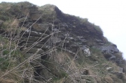
Coming from the Bro[i]dgar direction just past the field containing the Ring of Bookan leaning against the roadside fence are a pair of disparate gates held together with rope that are entry to the next field. After carefully hefting this out of the way and replacing it there is then an 'Orkney gate'; watch out for the barbed wire round the gateposts as you go this way. Now follow the Ring field boundary fence to the site. This is one of few sites that actually look better in summer, as it needs vegetation to bring the shapes out. Stll not by any means photogenic, and now some big rabbit holes have appeared in the large southern exposure of material. On the downhill side there appears to be a slight lip at the base of the downhill side of the mound maybe a metre across. Perhaps this was a smaller version of the Ring of Bookan itself - presently it is thought to be a natural mound, but antiquarians noticed the soil was topsoil from elsewhere. A natural assumption is that it is a satellite rather than of a piece with the mounds that used to lie nearer the loch. I wonder if it could be the other way about ; three burials were found around the outside of Skae Frue but not the expected one in the centre, and the Ring of Bookan had a central 'chamber' of some kind. From the way the burials were arranged the excavators also expected another to square the circle. What if a fourth individual had been due to take that place only they achieved so much in their life that they were able to have the Ring of Bookan built instead ? Of course even if there is still datable material deeper in the mound the rabbit activity could critically disturb the stratigraphy here. Skae Frue as presently exposed stands a mound of mostly earth with very few stones, mostly debris. It struck me that surely they would have dug straight down the middle for the central burial if they really wanted to find one.
You may be viewing yesterday's version of this page. To see the most up to date information please register for a free account.
")
")
")
")
")
Do not use the above information on other web sites or publications without permission of the contributor.
Click here to see more info for this site
Nearby sites
Key: Red: member's photo, Blue: 3rd party photo, Yellow: other image, Green: no photo - please go there and take one, Grey: site destroyed
Download sites to:
KML (Google Earth)
GPX (GPS waypoints)
CSV (Garmin/Navman)
CSV (Excel)
To unlock full downloads you need to sign up as a Contributory Member. Otherwise downloads are limited to 50 sites.
Turn off the page maps and other distractions
Nearby sites listing. In the following links * = Image available
116m NNE 30° Ring of Bookan* Henge (HY283145)
372m ESE 104° The Brecks* Cairn (HY286143)
467m SE 129° Bookan* Chambered Tomb (HY286141)
712m SE 126° Wasbister Cairn* Cairn (HY28811397)
758m ESE 116° Bookan Stones* Standing Stones (HY28921406)
826m SE 126° Bookan Cairns* Cairn (HY289139)
948m SE 130° Wasbister Burnt Mound* Artificial Mound (HY28961378)
960m SE 136° Wasbister Disc Barrow* Round Barrow(s) (HY289137)
960m SE 136° Dyke o'Sean* Ancient Village or Settlement (HY289137)
1.3km WNW 301° Stackrue* Broch or Nuraghe (HY271151)
1.3km WNW 302° Stackrue-Lyking Mound* Misc. Earthwork (HY27121514)
1.4km WNW 298° Burroughston 2* Broch or Nuraghe (HY270151)
1.5km SE 135° Salt Knowe* Round Barrow(s) (HY293133)
1.5km SE 125° Plumcake Mound* Round Barrow(s) (HY295135)
1.6km SE 130° Ring of Brodgar* Stone Circle (HY29451335)
1.6km SE 133° South Knowe* Artificial Mound (HY29411328)
1.7km SE 126° Fresh Knowe* Long Barrow (HY29601339)
1.8km SE 127° Comet Stone (Orkney)* Standing Stone (Menhir) (HY2963413318)
1.8km SE 142° Possible large stone circle in Loch of Stenness Stone Circle (HY2933112934)
1.8km SE 139° Fairy Well (Stenness)* Holy Well or Sacred Spring (HY2943212982)
2.2km WNW 282° Voy Crannogs* Crannog (HY261149)
2.5km SE 126° Brodgar Farm Chambered Tomb Chambered Tomb (HY302129)
2.5km SE 125° Ness of Brodgar* Ancient Village or Settlement (HY3024312941)
2.6km SE 127° Brodgar Farm Standing Stones* Standing Stones (HY303128)
2.6km S 180° Diamond Cottage* Promontory Fort / Cliff Castle (HY28211176)
View more nearby sites and additional images


 We would like to know more about this location. Please feel free to add a brief description and any relevant information in your own language.
 Wir möchten mehr über diese Stätte erfahren. Bitte zögern Sie nicht, eine kurze Beschreibung und relevante Informationen in Deutsch hinzuzufügen.
 Nous aimerions en savoir encore un peu sur les lieux. S'il vous plaît n'hesitez pas à ajouter une courte description et tous les renseignements pertinents dans votre propre langue.
 Quisieramos informarnos un poco más de las lugares. No dude en añadir una breve descripción y otros datos relevantes en su propio idioma.