

<< Our Photo Pages >> St Matthew's Well (Roslin) - Holy Well or Sacred Spring in Scotland in Midlothian
Submitted by KiwiBetsy on Friday, 06 October 2006 Page Views: 10159
Springs and Holy WellsSite Name: St Matthew's Well (Roslin)Country: Scotland County: Midlothian Type: Holy Well or Sacred Spring
Nearest Town: Edinburgh Nearest Village: Roslin
Map Ref: NT27326298
Latitude: 55.854515N Longitude: 3.162554W
Condition:
| 5 | Perfect |
| 4 | Almost Perfect |
| 3 | Reasonable but with some damage |
| 2 | Ruined but still recognisable as an ancient site |
| 1 | Pretty much destroyed, possibly visible as crop marks |
| 0 | No data. |
| -1 | Completely destroyed |
| 5 | Superb |
| 4 | Good |
| 3 | Ordinary |
| 2 | Not Good |
| 1 | Awful |
| 0 | No data. |
| 5 | Can be driven to, probably with disabled access |
| 4 | Short walk on a footpath |
| 3 | Requiring a bit more of a walk |
| 2 | A long walk |
| 1 | In the middle of nowhere, a nightmare to find |
| 0 | No data. |
| 5 | co-ordinates taken by GPS or official recorded co-ordinates |
| 4 | co-ordinates scaled from a detailed map |
| 3 | co-ordinates scaled from a bad map |
| 2 | co-ordinates of the nearest village |
| 1 | co-ordinates of the nearest town |
| 0 | no data |
Internal Links:
External Links:
I have visited· I would like to visit
coinblar would like to visit
Anne T visited on 15th Jul 2018 - their rating: Cond: 3 Amb: 3 Access: 4 St. Matthew's Well, Roslin: Getting to this well was interesting! Parking in Roslyn Chapel car park at NT 27405 63109, we took the gate from the south east of the car park through the cemetery, then out of the cemetery down a very overgrown lane, with very tall nettles on either side. About 50m from the grid reference for the well, we needed to head off south west into the wood. There were some tracks through here, but obviously not regularly used. We could see a green, mossy mounds/structure through the trees, but couldn’t find a way of getting down to them. In the end, I realised the track had been covered by a heavy, large dead tree branch, which Andrew and I managed to haul away from the path with a little difficulty. Having cleared the track, we used the tree roots as stepping stones at first, then slide the 20m or so down the slope to the well (I told myself it was always easier going up!).
At first we thought there was only one dome here, but looking harder, there was a second one, a few metres up the slope. The front face of the second dome (nearest the river Esk) had a hole in the front, which I poked the camera through to take a photograph. The was a large iron pipe which gushed water into the well chamber. A continuation of this pipe could be seen in a small gully which headed towards the river from the well chambers, although the gloom and all the detitus made it difficult to capture the location.
Heading back to look at the ruins of St. Michael’s church, we looked over the western end of the graveyard, looking south west, and realised we could not only see the well houses, but it also looked as if there were the remains of a wall and steps, as there were cut blocks of stone lying around.
I went back to photograph the 'Spooky Angel' I'd seen when I visited with my friend two years ago (hidden under a bush by the small outbuildings) - she much reminded me of an episode of Dr. Who, where the angels only moved when you didn't look at them.
 (PID:24709)")
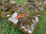
St Matthew’s Well lies to the southwest of Roslin Chapel and near to a graveyard in which are the scanty remains of a chapel, probably dedicated to St Matthew and predating the existing Roslin Chapel. The well is situated over the southwest wall of the graveyard. To reach it climb over the wall and enter a muddy, slippery, midgy and nettle filled world. The well is located about 10 yards downhill from the graveyard fence and fairly much in line with the chapel ruins.
For more information see Canmore ID 51813 which adds: "St Matthew's Well lies outside the W wall of the burial ground. It is fed by a copious spring which forms the main water supply for Roslin ... At the spot indicated are two concrete domes, 1.2m x 1.0m x 0.6m high, 0.6m apart, each having a small wooden door."
You may be viewing yesterday's version of this page. To see the most up to date information please register for a free account.
 (PID:184229)")
 (PID:184228)")
 (PID:184227)")
 (PID:184226)")
 (PID:184225)")
 (PID:184224)")
 (PID:24710)")
Do not use the above information on other web sites or publications without permission of the contributor.
Click here to see more info for this site
Nearby sites
Key: Red: member's photo, Blue: 3rd party photo, Yellow: other image, Green: no photo - please go there and take one, Grey: site destroyed
Download sites to:
KML (Google Earth)
GPX (GPS waypoints)
CSV (Garmin/Navman)
CSV (Excel)
To unlock full downloads you need to sign up as a Contributory Member. Otherwise downloads are limited to 50 sites.
Turn off the page maps and other distractions
Nearby sites listing. In the following links * = Image available
2.7km W 261° Glencorse Cup and Ring Marked Stone* Rock Art (NT24676261)
4.3km NW 318° Hillend (Loanhead)* Hillfort (NT24526620)
4.4km WNW 283° Castle Knowe (Glencorse)* Ancient Village or Settlement (NT22996404)
4.5km W 280° Castle Law* Hillfort (NT2290063870)
4.7km WSW 258° Marchwell (Glencourse) Stone Circle (NT22646211)
4.8km NW 311° Caerketton Hill* Cairn (NT23706621)
5.4km N 359° Balm Well* Holy Well or Sacred Spring (NT2732268363)
5.7km NNW 339° Galachlaw Cairn* Cairn (NT25366831)
6.0km NNW 331° Fairmiliehead (Edinburgh) Cairn (NT24466828)
6.2km NNW 329° Caiy Stane* Standing Stone (Menhir) (NT2424368357)
6.5km NNW 332° 1, West Camus Road* Modern Stone Circle etc (NT2441068763)
6.8km NNW 335° Buck Stane* Standing Stone (Menhir) (NT24506922)
7.0km W 260° Carnethy Hill cairn* Cairn (NT20386192)
7.6km N 6° Ravenswood Avenue* Standing Stone (Menhir) (NT2828270502)
7.7km N 0° Cat Stane (Inch)* Standing Stone (Menhir) (NT27457068)
8.1km NNW 339° Hanging Stanes (Braid Road)* Marker Stone (NT24517061)
8.2km SE 145° Yorkston Erratic Natural Stone / Erratic / Other Natural Feature (NT31875620)
8.4km NNW 327° Craiglockart Hill Vitrified Fort Hillfort (NT22827006)
8.6km NNE 16° Niddrie House* Standing Stone (Menhir) (NT29877125)
8.7km WSW 246° Braidwood Fort* Hillfort (NT1928059630)
8.7km SW 231° Gowk Stone Standing Stone (Menhir) (NT20425764)
8.7km WSW 247° Camp Hill Burnt Mound North* Artificial Mound (NT19185973)
8.8km WSW 247° Camp Hill Burnt Mound South* Artificial Mound (NT19145970)
8.8km N 353° Penny Well (Edinburgh)* Holy Well or Sacred Spring (NT26367177)
9.0km NNW 341° The Bore Stone* Marker Stone (NT2450871568)
View more nearby sites and additional images


 We would like to know more about this location. Please feel free to add a brief description and any relevant information in your own language.
 Wir möchten mehr über diese Stätte erfahren. Bitte zögern Sie nicht, eine kurze Beschreibung und relevante Informationen in Deutsch hinzuzufügen.
 Nous aimerions en savoir encore un peu sur les lieux. S'il vous plaît n'hesitez pas à ajouter une courte description et tous les renseignements pertinents dans votre propre langue.
 Quisieramos informarnos un poco más de las lugares. No dude en añadir una breve descripción y otros datos relevantes en su propio idioma.