


<< Other Photo Pages >> Burroughston 2 - Broch or Nuraghe in Scotland in Orkney
Submitted by howar on Thursday, 25 March 2004 Page Views: 4932
Iron Age and Later PrehistorySite Name: Burroughston 2 Alternative Name: StackrueCountry: Scotland County: Orkney Type: Broch or Nuraghe
Nearest Town: Stromness
Map Ref: HY270151 Landranger Map Number: 6
Latitude: 59.016704N Longitude: 3.272984W
Condition:
| 5 | Perfect |
| 4 | Almost Perfect |
| 3 | Reasonable but with some damage |
| 2 | Ruined but still recognisable as an ancient site |
| 1 | Pretty much destroyed, possibly visible as crop marks |
| 0 | No data. |
| -1 | Completely destroyed |
| 5 | Superb |
| 4 | Good |
| 3 | Ordinary |
| 2 | Not Good |
| 1 | Awful |
| 0 | No data. |
| 5 | Can be driven to, probably with disabled access |
| 4 | Short walk on a footpath |
| 3 | Requiring a bit more of a walk |
| 2 | A long walk |
| 1 | In the middle of nowhere, a nightmare to find |
| 0 | No data. |
| 5 | co-ordinates taken by GPS or official recorded co-ordinates |
| 4 | co-ordinates scaled from a detailed map |
| 3 | co-ordinates scaled from a bad map |
| 2 | co-ordinates of the nearest village |
| 1 | co-ordinates of the nearest town |
| 0 | no data |
Internal Links:
External Links:
Broch in Orkney
Broch occupied till Viking times, broch wall still exposed on at least one end as several courses of large stone , site surrounded by large deep ditch. Lies in field other side of wall from Lyking road from which it is easily visible.
You may be viewing yesterday's version of this page. To see the most up to date information please register for a free account.
Do not use the above information on other web sites or publications without permission of the contributor.
coldrum has found this location on Google Street View:
Nearby Images from Geograph Britain and Ireland:
©2009(licence)
©2007(licence)
©2009(licence)
©2024(licence)

©2009(licence)
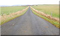
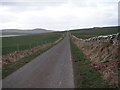
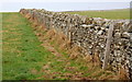
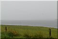
The above images may not be of the site on this page, they are loaded from Geograph.
Please Submit an Image of this site or go out and take one for us!
Click here to see more info for this site
Nearby sites
Key: Red: member's photo, Blue: 3rd party photo, Yellow: other image, Green: no photo - please go there and take one, Grey: site destroyed
Download sites to:
KML (Google Earth)
GPX (GPS waypoints)
CSV (Garmin/Navman)
CSV (Excel)
To unlock full downloads you need to sign up as a Contributory Member. Otherwise downloads are limited to 50 sites.
Turn off the page maps and other distractions
Nearby sites listing. In the following links * = Image available
100m E 89° Stackrue* Broch or Nuraghe (HY271151)
126m ENE 70° Stackrue-Lyking Mound* Misc. Earthwork (HY27121514)
919m WSW 256° Voy Crannogs* Crannog (HY261149)
1.3km NW 311° Via Mound* Round Cairn (HY26011598)
1.3km NW 311° Stones of Via* Ancient Village or Settlement (HY260160)
1.4km ESE 118° Skae Frue* Round Barrow(s) (HY28241440)
1.4km ESE 114° Ring of Bookan* Henge (HY283145)
1.5km WNW 301° Fiddlerhouse* Standing Stones (HY25771588)
1.5km NW 309° Via Barrow* Round Barrow(s) (HY25841609)
1.6km W 264° Voy.* Ancient Village or Settlement (HY25351497)
1.8km ESE 116° The Brecks* Cairn (HY286143)
1.9km ESE 121° Bookan* Chambered Tomb (HY286141)
2.1km ESE 121° Wasbister Cairn* Cairn (HY28811397)
2.2km ESE 117° Bookan Stones* Standing Stones (HY28921406)
2.2km ESE 121° Bookan Cairns* Cairn (HY289139)
2.4km SE 125° Wasbister Disc Barrow* Round Barrow(s) (HY289137)
2.4km SE 125° Dyke o'Sean* Ancient Village or Settlement (HY289137)
2.4km ESE 123° Wasbister Burnt Mound* Artificial Mound (HY28961378)
2.9km SE 127° Salt Knowe* Round Barrow(s) (HY293133)
3.0km ESE 122° Plumcake Mound* Round Barrow(s) (HY295135)
3.0km SE 124° Ring of Brodgar* Stone Circle (HY29451335)
3.0km SE 126° South Knowe* Artificial Mound (HY29411328)
3.0km NNW 328° Hurkisgarth* Round Barrow(s) (HY25451770)
3.1km ESE 122° Fresh Knowe* Long Barrow (HY29601339)
3.2km ESE 123° Comet Stone (Orkney)* Standing Stone (Menhir) (HY2963413318)
View more nearby sites and additional images


 We would like to know more about this location. Please feel free to add a brief description and any relevant information in your own language.
 Wir möchten mehr über diese Stätte erfahren. Bitte zögern Sie nicht, eine kurze Beschreibung und relevante Informationen in Deutsch hinzuzufügen.
 Nous aimerions en savoir encore un peu sur les lieux. S'il vous plaît n'hesitez pas à ajouter une courte description et tous les renseignements pertinents dans votre propre langue.
 Quisieramos informarnos un poco más de las lugares. No dude en añadir una breve descripción y otros datos relevantes en su propio idioma.