 with our Megalithic Portal iPhone app")


<< Other Photo Pages >> Via Barrow - Round Barrow(s) in Scotland in Orkney
Submitted by howar on Thursday, 05 May 2005 Page Views: 4403
Neolithic and Bronze AgeSite Name: Via BarrowCountry: Scotland County: Orkney Type: Round Barrow(s)
Nearest Town: Stromness Nearest Village: Dounby
Map Ref: HY25841609
Latitude: 59.025392N Longitude: 3.293512W
Condition:
| 5 | Perfect |
| 4 | Almost Perfect |
| 3 | Reasonable but with some damage |
| 2 | Ruined but still recognisable as an ancient site |
| 1 | Pretty much destroyed, possibly visible as crop marks |
| 0 | No data. |
| -1 | Completely destroyed |
| 5 | Superb |
| 4 | Good |
| 3 | Ordinary |
| 2 | Not Good |
| 1 | Awful |
| 0 | No data. |
| 5 | Can be driven to, probably with disabled access |
| 4 | Short walk on a footpath |
| 3 | Requiring a bit more of a walk |
| 2 | A long walk |
| 1 | In the middle of nowhere, a nightmare to find |
| 0 | No data. |
| 5 | co-ordinates taken by GPS or official recorded co-ordinates |
| 4 | co-ordinates scaled from a detailed map |
| 3 | co-ordinates scaled from a bad map |
| 2 | co-ordinates of the nearest village |
| 1 | co-ordinates of the nearest town |
| 0 | no data |
Internal Links:
External Links:
Round Barrow(s) in Orkney
RCAHMS NMRS record no. HY21NE 2 is a tumulus that lies between the road and Via, it being 30m N of the house of Via. A 2'x1'x1' cist excavated around 1860 was still visible two decades later. Further excavation in 1879 produced nothing of note that has been related. A large depression in the centre is now filled by rubbish, and at the western end what now looks like a cist merely shows where a wireless aerial used to be. Pre-war another cist, 0.7x0.4m, was found nearby at HY25841610 but had nothing within.
You may be viewing yesterday's version of this page. To see the most up to date information please register for a free account.
Do not use the above information on other web sites or publications without permission of the contributor.
coldrum has found this location on Google Street View:
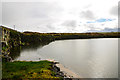
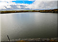
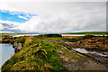
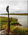
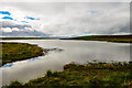
Nearby Images from Geograph Britain and Ireland:
©2013(licence)
©2013(licence)
©2013(licence)
©2013(licence)
©2013(licence)
The above images may not be of the site on this page, they are loaded from Geograph.
Please Submit an Image of this site or go out and take one for us!
Click here to see more info for this site
Nearby sites
Key: Red: member's photo, Blue: 3rd party photo, Yellow: other image, Green: no photo - please go there and take one, Grey: site destroyed
Download sites to:
KML (Google Earth)
GPX (GPS waypoints)
CSV (Garmin/Navman)
CSV (Excel)
To unlock full downloads you need to sign up as a Contributory Member. Otherwise downloads are limited to 50 sites.
Turn off the page maps and other distractions
Nearby sites listing. In the following links * = Image available
183m ESE 118° Stones of Via* Ancient Village or Settlement (HY260160)
202m ESE 122° Via Mound* Round Cairn (HY26011598)
221m SSW 197° Fiddlerhouse* Standing Stones (HY25771588)
1.2km SSE 167° Voy Crannogs* Crannog (HY261149)
1.2km SSW 202° Voy.* Ancient Village or Settlement (HY25351497)
1.5km SE 129° Burroughston 2* Broch or Nuraghe (HY270151)
1.6km SE 126° Stackrue-Lyking Mound* Misc. Earthwork (HY27121514)
1.6km SE 127° Stackrue* Broch or Nuraghe (HY271151)
1.7km NNW 345° Hurkisgarth* Round Barrow(s) (HY25451770)
2.5km W 275° South Seatter Round Barrow(s) (HY23391637)
2.6km WNW 294° Knowe of Angerow* Round Barrow(s) (HY235172)
2.9km ESE 122° Ring of Bookan* Henge (HY283145)
2.9km SE 124° Skae Frue* Round Barrow(s) (HY28241440)
3.0km WNW 297° Knowe of Nebigarth* Barrow Cemetery (HY23161750)
3.3km ESE 122° The Brecks* Cairn (HY286143)
3.4km SE 125° Bookan* Chambered Tomb (HY286141)
3.5km W 280° Broch of Borwick* Broch or Nuraghe (HY2241416777)
3.5km WNW 300° Knowe of Geoso* Chambered Cairn (HY22821792)
3.6km SE 124° Wasbister Cairn* Cairn (HY28811397)
3.7km ESE 122° Bookan Stones* Standing Stones (HY28921406)
3.7km SSW 195° Una* Artificial Mound (HY24841254)
3.8km NNE 28° Hackland* Standing Stone (Menhir) (HY27691936)
3.8km SE 125° Bookan Cairns* Cairn (HY289139)
3.8km NW 313° Skara Brae* Ancient Village or Settlement (HY2312518745)
3.9km SE 125° Wasbister Burnt Mound* Artificial Mound (HY28961378)
View more nearby sites and additional images


 We would like to know more about this location. Please feel free to add a brief description and any relevant information in your own language.
 Wir möchten mehr über diese Stätte erfahren. Bitte zögern Sie nicht, eine kurze Beschreibung und relevante Informationen in Deutsch hinzuzufügen.
 Nous aimerions en savoir encore un peu sur les lieux. S'il vous plaît n'hesitez pas à ajouter une courte description et tous les renseignements pertinents dans votre propre langue.
 Quisieramos informarnos un poco más de las lugares. No dude en añadir una breve descripción y otros datos relevantes en su propio idioma.