


<< Text Pages >> Hill of Ballunie - Stone Circle in Scotland in Perth and Kinross
Submitted by BigSweetie on Thursday, 25 March 2004 Page Views: 4254
Neolithic and Bronze AgeSite Name: Hill of BallunieCountry: Scotland
NOTE: This site is 2.9 km away from the location you searched for.
County: Perth and Kinross Type: Stone Circle
Nearest Town: Coupar Angus Nearest Village: Newtyle
Map Ref: NO265389 Landranger Map Number: 53
Latitude: 56.536339N Longitude: 3.196699W
Condition:
| 5 | Perfect |
| 4 | Almost Perfect |
| 3 | Reasonable but with some damage |
| 2 | Ruined but still recognisable as an ancient site |
| 1 | Pretty much destroyed, possibly visible as crop marks |
| 0 | No data. |
| -1 | Completely destroyed |
| 5 | Superb |
| 4 | Good |
| 3 | Ordinary |
| 2 | Not Good |
| 1 | Awful |
| 0 | No data. |
| 5 | Can be driven to, probably with disabled access |
| 4 | Short walk on a footpath |
| 3 | Requiring a bit more of a walk |
| 2 | A long walk |
| 1 | In the middle of nowhere, a nightmare to find |
| 0 | No data. |
| 5 | co-ordinates taken by GPS or official recorded co-ordinates |
| 4 | co-ordinates scaled from a detailed map |
| 3 | co-ordinates scaled from a bad map |
| 2 | co-ordinates of the nearest village |
| 1 | co-ordinates of the nearest town |
| 0 | no data |
Internal Links:
External Links:
Stone Circle in Perthshire
This now destroyed stone circle is described on The Northern Antiquarian's page for Hill of Ballunie, Kettins, Perthshire, which shows a photograph of where the site used to be (now on a dead straight road from the Hill of Ballunie to Leys).
Whilst the stone circle no longer exists, TNA adds: "However, ley-hunters will love this place. Not only was this lost circle located at the edge of a dead straight road, running from the Keillor standing stone a short distant east, but as it runs downhill it reaches, a couple of miles below, the hamlet called Leys."
This site is also recorded as Canmore ID 30549, which says A. Jervise in 1879 reported "the remains of stone circles exist upon the Hill of Ballunie." The site was visited in 1970 and 1989, but no trace of any stone circles were found.
You may be viewing yesterday's version of this page. To see the most up to date information please register for a free account.
Do not use the above information on other web sites or publications without permission of the contributor.
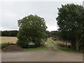
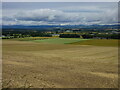
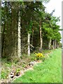
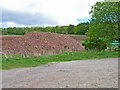
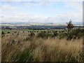
Nearby Images from Geograph Britain and Ireland:
©2013(licence)
©2021(licence)
©2006(licence)
©2006(licence)
©2013(licence)
The above images may not be of the site on this page, they are loaded from Geograph.
Please Submit an Image of this site or go out and take one for us!
Click here to see more info for this site
Nearby sites
Key: Red: member's photo, Blue: 3rd party photo, Yellow: other image, Green: no photo - please go there and take one, Grey: site destroyed
Download sites to:
KML (Google Earth)
GPX (GPS waypoints)
CSV (Garmin/Navman)
CSV (Excel)
To unlock full downloads you need to sign up as a Contributory Member. Otherwise downloads are limited to 50 sites.
Turn off the page maps and other distractions
Nearby sites listing. In the following links * = Image available
1.2km NE 43° Keillor* Class I Pictish Symbol Stone (NO2733139760)
2.4km NE 40° Kinpurnie Castle (Newtyle) Cairn (NO2807740693)
2.7km W 272° Kettins Burn* Class II Pictish Symbol Stone (NO23783906)
4.0km N 353° Arthurstone Standing Stone (Menhir) (NO261429)
4.5km NNW 346° Bankhead of Kinloch Barrow Cemetery (NO2551443333)
4.8km NNE 17° Macbeth's Stone* Standing Stone (Menhir) (NO27994346)
5.2km NNE 23° Seward's Stone Standing Stone (Menhir) (NO28584366)
6.1km NNE 20° Meigle Sculptured Stone Museum* Museum (NO28724459)
6.1km NNE 20° Vanora's Mound* Round Barrow(s) (NO28734462)
6.5km SSW 200° Stockmuir* Stone Circle (NO242328)
8.0km E 87° Auchterhouse Standing Stones (NO345392)
8.1km E 86° Witches Stone (Auchterhouse) Stone Circle (NO34603928)
8.1km SW 224° Collace Pictish Stone* Class I Pictish Symbol Stone (NO20693319)
8.4km SE 125° Liff and Benvie Cursus Cursus (NO33263396)
8.5km SE 125° Liff and Benvie Cursus Cursus (NO33403391)
8.5km SSE 161° Rossie Priory Class II Pictish Symbol Stone (NO292308)
8.5km SSW 209° Long Man's Grave (Abernyte)* Marker Stone (NO22183153)
8.5km SSE 158° Falcon Stone* Standing Stone (Menhir) (NO295309)
8.6km SSE 161° Rossie Loupin-on Stane* Standing Stone (Menhir) (NO2917630741)
8.6km SSE 161° Rossie Mercat Cross 1746 Ancient Cross (NO2920830732)
8.6km WNW 303° The Welton Stone Circle (NO1937243766)
8.8km SSE 153° Longforgan Cursus Cursus (NO30353100)
8.9km NW 310° Rattray Cursus Cursus (NO19744479)
9.0km SE 131° Hurly Hawkins* Broch or Nuraghe (NO332328)
9.3km NW 317° Drumend* Holy Well or Sacred Spring (NO202458)
View more nearby sites and additional images


 We would like to know more about this location. Please feel free to add a brief description and any relevant information in your own language.
 Wir möchten mehr über diese Stätte erfahren. Bitte zögern Sie nicht, eine kurze Beschreibung und relevante Informationen in Deutsch hinzuzufügen.
 Nous aimerions en savoir encore un peu sur les lieux. S'il vous plaît n'hesitez pas à ajouter une courte description et tous les renseignements pertinents dans votre propre langue.
 Quisieramos informarnos un poco más de las lugares. No dude en añadir una breve descripción y otros datos relevantes en su propio idioma.