


<< Our Photo Pages >> Brygolen Cairn 3 - Cairn in Wales in Denbighshire
Submitted by TimPrevett on Thursday, 02 February 2006 Page Views: 4309
Neolithic and Bronze AgeSite Name: Brygolen Cairn 3Country: Wales
NOTE: This site is 1.7 km away from the location you searched for.
County: Denbighshire Type: Cairn
Nearest Town: Llangollen
Map Ref: SJ23794378
Latitude: 52.985916N Longitude: 3.136658W
Condition:
| 5 | Perfect |
| 4 | Almost Perfect |
| 3 | Reasonable but with some damage |
| 2 | Ruined but still recognisable as an ancient site |
| 1 | Pretty much destroyed, possibly visible as crop marks |
| 0 | No data. |
| -1 | Completely destroyed |
| 5 | Superb |
| 4 | Good |
| 3 | Ordinary |
| 2 | Not Good |
| 1 | Awful |
| 0 | No data. |
| 5 | Can be driven to, probably with disabled access |
| 4 | Short walk on a footpath |
| 3 | Requiring a bit more of a walk |
| 2 | A long walk |
| 1 | In the middle of nowhere, a nightmare to find |
| 0 | No data. |
| 5 | co-ordinates taken by GPS or official recorded co-ordinates |
| 4 | co-ordinates scaled from a detailed map |
| 3 | co-ordinates scaled from a bad map |
| 2 | co-ordinates of the nearest village |
| 1 | co-ordinates of the nearest town |
| 0 | no data |
Internal Links:
External Links:
I have visited· I would like to visit
TimPrevett has visited here
")
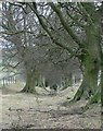
A huge (19.5 by 15.5 metres) but heavily disturbed cairn on top of a ridge.
You may be viewing yesterday's version of this page. To see the most up to date information please register for a free account.
")
Do not use the above information on other web sites or publications without permission of the contributor.
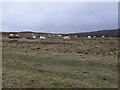
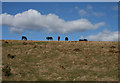
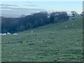
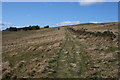
Nearby Images from Geograph Britain and Ireland:
©2008(licence)
©2009(licence)
©2021(licence)
©2009(licence)
©2008(licence)
The above images may not be of the site on this page, they are loaded from Geograph.
Please Submit an Image of this site or go out and take one for us!
Click here to see more info for this site
Nearby sites
Key: Red: member's photo, Blue: 3rd party photo, Yellow: other image, Green: no photo - please go there and take one, Grey: site destroyed
Download sites to:
KML (Google Earth)
GPX (GPS waypoints)
CSV (Garmin/Navman)
CSV (Excel)
To unlock full downloads you need to sign up as a Contributory Member. Otherwise downloads are limited to 50 sites.
Turn off the page maps and other distractions
Nearby sites listing. In the following links * = Image available
131m W 260° Brygolen Cairn 2 Cairn (SJ23664376)
423m W 261° Bryngolen Cairn 1* Cairn (SJ23374372)
575m NW 308° Eglwyseg Plantation Cairn 2 Cairn (SJ23344414)
760m WNW 288° Eglwyseg Plantation Cairn 1* Cairn (SJ23074403)
1.5km NW 318° Eglwyseg stone (2)* Standing Stone (Menhir) (SJ22774494)
1.6km NW 309° Eglwyseg Stone* Natural Stone / Erratic / Other Natural Feature (SJ22574478)
1.6km WNW 295° Eglwyseg Plantation Barrow* Round Barrow(s) (SJ22364446)
1.6km NNW 330° Eglwyseg Mountain* Standing Stone (Menhir) (SJ22994519)
1.7km NW 323° Eglwyseg Cairn Circle* Cairn (SJ22824513)
1.7km NNW 329° Creigiau Eglwyseg Boundary* Cairn (SJ22944522)
1.7km NW 319° Eglwyseg Kerb Cairn A* Cairn (SJ22704509)
1.7km WSW 244° Dinas Bran* Hillfort (SJ2224043060)
1.7km NW 320° Eglwyseg Kerb Cairn B* Cairn (SJ227451)
2.0km NW 306° Creigiau Eglwyseg 1* Round Barrow(s) (SJ22214495)
2.3km NNW 343° Eglwyseg mountain cairns (1,2 and 3)* Cairn (SJ23154597)
2.9km SW 233° Llangollen Museum Museum (SJ2145642103)
2.9km SW 222° Plas Newydd Gorsedd Stone circle* Modern Stone Circle etc (SJ2181041661)
3.6km W 281° Pillar of Eliseg* Early Christian Sculptured Stone (SJ20264452)
4.2km SSW 198° Careg y Big (Llangollen)* Standing Stone (Menhir) (SJ224398)
4.6km SE 135° Cae Carreg Lwyd Standing Stone (Menhir) (SJ270405)
5.0km SW 236° Ffynnon Las Round Barrow(s) (SJ19574099)
5.4km N 2° Cefn-y-Gader cairn 1* Cairn (SJ241492)
5.5km SSW 197° Llwynmawr* Standing Stone (Menhir) (SJ2211138530)
5.8km E 88° Offa's Dyke west of Ruabon Misc. Earthwork (SJ29564386)
5.9km N 356° Aber Sychnant* Cairn (SJ23454963)
View more nearby sites and additional images


 We would like to know more about this location. Please feel free to add a brief description and any relevant information in your own language.
 Wir möchten mehr über diese Stätte erfahren. Bitte zögern Sie nicht, eine kurze Beschreibung und relevante Informationen in Deutsch hinzuzufügen.
 Nous aimerions en savoir encore un peu sur les lieux. S'il vous plaît n'hesitez pas à ajouter une courte description et tous les renseignements pertinents dans votre propre langue.
 Quisieramos informarnos un poco más de las lugares. No dude en añadir una breve descripción y otros datos relevantes en su propio idioma.