


<< Our Photo Pages >> The Monk's Well - Holy Well or Sacred Spring in Wales in Powys
Submitted by coin on Tuesday, 08 March 2011 Page Views: 7115
Springs and Holy WellsSite Name: The Monk's WellCountry: Wales County: Powys Type: Holy Well or Sacred Spring
Nearest Town: Hay-on-Wye Nearest Village: Clyro
Map Ref: SO225432
Latitude: 52.081709N Longitude: 3.132364W
Condition:
| 5 | Perfect |
| 4 | Almost Perfect |
| 3 | Reasonable but with some damage |
| 2 | Ruined but still recognisable as an ancient site |
| 1 | Pretty much destroyed, possibly visible as crop marks |
| 0 | No data. |
| -1 | Completely destroyed |
| 5 | Superb |
| 4 | Good |
| 3 | Ordinary |
| 2 | Not Good |
| 1 | Awful |
| 0 | No data. |
| 5 | Can be driven to, probably with disabled access |
| 4 | Short walk on a footpath |
| 3 | Requiring a bit more of a walk |
| 2 | A long walk |
| 1 | In the middle of nowhere, a nightmare to find |
| 0 | No data. |
| 5 | co-ordinates taken by GPS or official recorded co-ordinates |
| 4 | co-ordinates scaled from a detailed map |
| 3 | co-ordinates scaled from a bad map |
| 2 | co-ordinates of the nearest village |
| 1 | co-ordinates of the nearest town |
| 0 | no data |
Internal Links:
External Links:
I have visited· I would like to visit
AJHL visited on 31st Dec 2022 - their rating: Cond: 1 Amb: 2 Access: 5 The well is not where the symbol appears on the interactive map. See comment at bottom of listing for further info.
Anne T couldn't find on 12th Jul 2021 Monk's Well, Clyro: Despite having the grid reference and the Coflein information, we were unable to find this well, which appears to be on private land.
geoffstickland have visited here
")
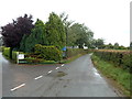
Site of a spring in Powys
It has been turned into a water supply and capped with concrete.
Not worth visiting.
You may be viewing yesterday's version of this page. To see the most up to date information please register for a free account.
")
Do not use the above information on other web sites or publications without permission of the contributor.
Nearby Images from Geograph Britain and Ireland:
©2007(licence)
©2010(licence)
©2013(licence)
©2018(licence)
©2012(licence)
The above images may not be of the site on this page, they are loaded from Geograph.
Please Submit an Image of this site or go out and take one for us!
Click here to see more info for this site
Nearby sites
Key: Red: member's photo, Blue: 3rd party photo, Yellow: other image, Green: no photo - please go there and take one, Grey: site destroyed
Download sites to:
KML (Google Earth)
GPX (GPS waypoints)
CSV (Garmin/Navman)
CSV (Excel)
To unlock full downloads you need to sign up as a Contributory Member. Otherwise downloads are limited to 50 sites.
Turn off the page maps and other distractions
Nearby sites listing. In the following links * = Image available
1000m S 179° The Walk Well* Holy Well or Sacred Spring (SO225422)
1.3km W 267° Clyro Court* Chambered Tomb (SO21234315)
2.6km NNW 345° Crossfoot Farm Standing Stone* Standing Stone (Menhir) (SO21874573)
3.3km S 179° Pen-y-Wyrlod* Chambered Tomb (SO22483987)
3.6km WSW 244° St Maelog's Cross* Ancient Cross (SO1923941704)
4.2km WSW 245° Brynrhydd Common* Misc. Earthwork (SO18644145)
4.9km SSE 159° Twyn-Y-Beddau* Round Barrow(s) (SO2414838610)
5.6km SSE 165° Maes-Coch Chambered Cairn (SO239378)
6.0km SSE 165° Pen Y Beacon* Stone Circle (SO23933735)
6.1km NE 44° St Peter's Well, Whitney on Wye* Holy Well or Sacred Spring (SO268475)
6.4km WSW 252° Ffynnon Gynydd* Holy Well or Sacred Spring (SO1641241282)
6.6km SW 221° Coed-y-Polyn Cairn (SO18083832)
6.7km SW 219° Little Lodge* Chambered Tomb (SO18223806)
7.5km SW 221° Gweryfed Park* Hillfort (SO17503759)
7.6km SW 227° Bronllys 2* Round Barrow(s) (SO16783811)
8.2km SW 229° Spread Eagle Cursus Cursus (SO16203795)
8.2km SW 228° Spread Eagle Cursus Cursus (SO16283784)
8.3km E 95° The Golden Well (Dorstone) Holy Well or Sacred Spring (SO30804228)
8.7km SW 227° Pipton* Chambered Tomb (SO16043729)
9.3km SW 216° Croes-llechau (Bronllys) Long Barrow (SO169357)
9.4km E 90° Arthur's Stone* Chambered Tomb (SO3188843124)
9.4km SSW 208° Ffostil North Chambered Long Barrow* Chambered Tomb (SO17913495)
9.5km SSW 208° Ffostil South Chambered Long Barrow* Chambered Tomb (SO179349)
9.8km SE 126° Wern Derys* Standing Stone (Menhir) (SO30363726)
9.9km E 83° Chapel field Hillfort (SO32404425)
View more nearby sites and additional images


 We would like to know more about this location. Please feel free to add a brief description and any relevant information in your own language.
 Wir möchten mehr über diese Stätte erfahren. Bitte zögern Sie nicht, eine kurze Beschreibung und relevante Informationen in Deutsch hinzuzufügen.
 Nous aimerions en savoir encore un peu sur les lieux. S'il vous plaît n'hesitez pas à ajouter une courte description et tous les renseignements pertinents dans votre propre langue.
 Quisieramos informarnos un poco más de las lugares. No dude en añadir una breve descripción y otros datos relevantes en su propio idioma.