

, Aubrey Burl")
<< Our Photo Pages >> Hardknott Round Cairn - Round Cairn in England in Cumbria
Submitted by MonumentMan on Saturday, 07 November 2020 Page Views: 646
Neolithic and Bronze AgeSite Name: Hardknott Round CairnCountry: England County: Cumbria Type: Round Cairn
Nearest Town: Ambleside Nearest Village: Eskdale
Map Ref: NY2171701328
Latitude: 54.401372N Longitude: 3.207387W
Condition:
| 5 | Perfect |
| 4 | Almost Perfect |
| 3 | Reasonable but with some damage |
| 2 | Ruined but still recognisable as an ancient site |
| 1 | Pretty much destroyed, possibly visible as crop marks |
| 0 | No data. |
| -1 | Completely destroyed |
| 5 | Superb |
| 4 | Good |
| 3 | Ordinary |
| 2 | Not Good |
| 1 | Awful |
| 0 | No data. |
| 5 | Can be driven to, probably with disabled access |
| 4 | Short walk on a footpath |
| 3 | Requiring a bit more of a walk |
| 2 | A long walk |
| 1 | In the middle of nowhere, a nightmare to find |
| 0 | No data. |
| 5 | co-ordinates taken by GPS or official recorded co-ordinates |
| 4 | co-ordinates scaled from a detailed map |
| 3 | co-ordinates scaled from a bad map |
| 2 | co-ordinates of the nearest village |
| 1 | co-ordinates of the nearest town |
| 0 | no data |
Internal Links:
External Links:
")
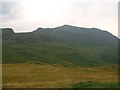
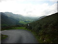
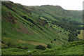
Situated on a false crest overlooking Eskdale, some
140 m to the SW of Hardknott Roman fort, there is a circular mound of stones, partly turf covered, which measures 12 m in diameter and up to 0.4 m high. Its centre is hollowed out to ground level, though it contains some loose stone. A path, possibly on the line of the Roman road, cuts across the S tangent. The size,form and position suggests this feature may be a Bronze Age Round cairn. Alternatively some suggest a ruined sheep fold, although the location is poorly defined for shepherding sheep on the rocky outcrop.
This is a link
You may be viewing yesterday's version of this page. To see the most up to date information please register for a free account.
")
")
Do not use the above information on other web sites or publications without permission of the contributor.
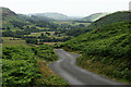
Nearby Images from Geograph Britain and Ireland:
©2008(licence)
©2012(licence)
©2013(licence)
©2014(licence)
©2014(licence)
The above images may not be of the site on this page, they are loaded from Geograph.
Please Submit an Image of this site or go out and take one for us!
Click here to see more info for this site
Nearby sites
Key: Red: member's photo, Blue: 3rd party photo, Yellow: other image, Green: no photo - please go there and take one, Grey: site destroyed
Download sites to:
KML (Google Earth)
GPX (GPS waypoints)
CSV (Garmin/Navman)
CSV (Excel)
To unlock full downloads you need to sign up as a Contributory Member. Otherwise downloads are limited to 50 sites.
Turn off the page maps and other distractions
Nearby sites listing. In the following links * = Image available
187m NE 40° Hardknott Roman Fort (MEDIOBOGDUM)* Promontory Fort / Cliff Castle (NY2184001469)
3.7km WSW 253° St Catherine's Well (Boot)* Holy Well or Sacred Spring (NY18150030)
4.0km SE 124° Ring Cairn, Tarn Brow, Seathwaite Tarn Ring Cairn (SD250990)
4.1km W 277° Boot cairn circle* Cairn (NY17630189)
4.2km SE 136° Lead Pike, Seathwaite* Ring Cairn (SD246982)
4.3km SE 137° Ring Bank Enclosure, Lead Pike, Seathwaite Tarn Ring Cairn (SD246981)
4.4km WNW 301° Eskdale Moor Stone* Standing Stone (Menhir) (NY1801903675)
4.4km SE 136° Ring Cairn, Lead Pike, Seathwaite Tarn Ring Cairn (SD247981)
4.5km WNW 282° Brat's Hill* Stone Circle (NY17370234)
4.5km WNW 283° White Moss NE* Stone Circle (NY17300241)
4.5km WNW 295° Boat How Enclosure* Ancient Village or Settlement (NY17620330)
4.6km ESE 118° Round Cairn at Raven Nest Howe, Seathwaite Tarn Ring Cairn (SD257991)
4.6km WNW 282° White Moss SW* Stone Circle (NY17250239)
4.7km SE 128° Ring Cairn at Woody Crag, Seathwaite Tarn Ring Cairn (SD254984)
4.7km WNW 286° Low Longrigg SW* Stone Circle (NY172027)
4.7km WNW 287° Low Longrigg NE* Stone Circle (NY172028)
5.2km NW 321° Maiden Castle (Eskdale)* Cairn (NY18480543)
6.0km SSW 212° Wormkragg Stiner Stone Row / Alignment (SD184963)
6.4km SSW 213° Brown Rigg Round Cairn* Round Cairn (SD1812396059)
6.6km ESE 123° Old Man of Coniston and Goat Hawes* Cairn (SD272977)
7.3km SW 235° Devoke Water and Water Crag* Ring Cairn (SD1563397273)
7.4km NNE 13° Chapel Well, Smardale Holy Well or Sacred Spring (NY2350008550)
7.5km SE 133° Torver Beck Homestead* Ancient Village or Settlement (SD271961)
7.9km NNW 338° Viking Timbers at St Olaf's Church Wasdale Head* Museum (NY18830869)
7.9km SE 129° Little Arrow* Stone Circle (SD278962)
View more nearby sites and additional images


 We would like to know more about this location. Please feel free to add a brief description and any relevant information in your own language.
 Wir möchten mehr über diese Stätte erfahren. Bitte zögern Sie nicht, eine kurze Beschreibung und relevante Informationen in Deutsch hinzuzufügen.
 Nous aimerions en savoir encore un peu sur les lieux. S'il vous plaît n'hesitez pas à ajouter une courte description et tous les renseignements pertinents dans votre propre langue.
 Quisieramos informarnos un poco más de las lugares. No dude en añadir una breve descripción y otros datos relevantes en su propio idioma.