


<< Our Photo Pages >> Forse House Hut Circles - Ancient Village or Settlement in Scotland in Caithness
Submitted by SolarMegalith on Tuesday, 16 August 2011 Page Views: 4771
Multi-periodSite Name: Forse House Hut CirclesCountry: Scotland County: Caithness Type: Ancient Village or Settlement
Nearest Town: Wick Nearest Village: Latheron
Map Ref: ND205348
Latitude: 58.294586N Longitude: 3.357837W
Condition:
| 5 | Perfect |
| 4 | Almost Perfect |
| 3 | Reasonable but with some damage |
| 2 | Ruined but still recognisable as an ancient site |
| 1 | Pretty much destroyed, possibly visible as crop marks |
| 0 | No data. |
| -1 | Completely destroyed |
| 5 | Superb |
| 4 | Good |
| 3 | Ordinary |
| 2 | Not Good |
| 1 | Awful |
| 0 | No data. |
| 5 | Can be driven to, probably with disabled access |
| 4 | Short walk on a footpath |
| 3 | Requiring a bit more of a walk |
| 2 | A long walk |
| 1 | In the middle of nowhere, a nightmare to find |
| 0 | No data. |
| 5 | co-ordinates taken by GPS or official recorded co-ordinates |
| 4 | co-ordinates scaled from a detailed map |
| 3 | co-ordinates scaled from a bad map |
| 2 | co-ordinates of the nearest village |
| 1 | co-ordinates of the nearest town |
| 0 | no data |
Internal Links:
External Links:
I have visited· I would like to visit
SumDoood would like to visit
SolarMegalith visited on 17th Jul 2011 - their rating: Cond: 2 Amb: 4 Access: 3
")
South and SW from Wag of Forse dun there is significant number of hut circles, probably associated with the nearby field system. One of the hut circles is located just SW from the dun, below slope of the hill, the other ones are located further to the SW, south from the hill, below the field system.
Read More at ScotlandsPlaces.
You may be viewing yesterday's version of this page. To see the most up to date information please register for a free account.
")
")
Do not use the above information on other web sites or publications without permission of the contributor.
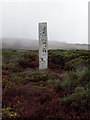
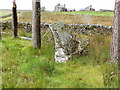
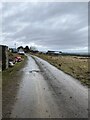
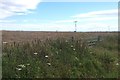
Nearby Images from Geograph Britain and Ireland:
©2008(licence)
©2008(licence)
©2023(licence)
©2015(licence)
©2023(licence)
The above images may not be of the site on this page, they are loaded from Geograph.
Please Submit an Image of this site or go out and take one for us!
Click here to see more info for this site
Nearby sites
Key: Red: member's photo, Blue: 3rd party photo, Yellow: other image, Green: no photo - please go there and take one, Grey: site destroyed
Download sites to:
KML (Google Earth)
GPX (GPS waypoints)
CSV (Garmin/Navman)
CSV (Excel)
To unlock full downloads you need to sign up as a Contributory Member. Otherwise downloads are limited to 50 sites.
Turn off the page maps and other distractions
Nearby sites listing. In the following links * = Image available
208m NE 54° Forse House Chambered Cairns* Chambered Cairn (ND20673492)
215m NNE 21° Forse House Burnt Mounds* Artificial Mound (ND20583500)
400m N 356° Wag of Forse* Stone Fort or Dun (ND20483520)
674m ENE 60° Forse House Standing Stone* Standing Stone (Menhir) (ND21093513)
761m NNE 18° Usshilly Tulloch* Broch or Nuraghe (ND2075035520)
1.2km SSW 207° Latheron Standing Stone* Standing Stone (Menhir) (ND19923374)
1.2km SSW 203° Buldoo* Standing Stone (Menhir) (ND20003369)
1.3km NNE 31° Appnag Tulloch* Broch or Nuraghe (ND2121035910)
1.5km SSW 202° Latheron 2* Class I Pictish Symbol Stone (ND19903343)
1.5km N 9° Forse House Stone Circle* Stone Circle (ND2076136315)
2.4km W 276° Guidebest* Stone Circle (ND181351)
2.5km SW 229° Latheronwheel Stone Circle (ND186332)
2.6km NNE 16° Rumster Broch* Broch or Nuraghe (ND21253725)
2.7km N 0° Golsary* Broch or Nuraghe (ND20573749)
2.9km ENE 60° Rhianrivach* Broch or Nuraghe (ND23033617)
2.9km WSW 248° Smerral Broch or Nuraghe (ND17803379)
3.4km ENE 67° Lybster* Early Christian Sculptured Stone (ND237361)
3.7km SW 230° Latheronwheel Mains Broch or Nuraghe (ND17623251)
3.7km SSW 212° Latheronwheel Chambered Cairn Chambered Cairn (ND18443168)
4.7km SW 216° Knockinnon* Broch or Nuraghe (ND17643105)
4.9km W 263° Houstry* Standing Stone (Menhir) (ND156343)
4.9km ENE 75° The Tullochs* Broch or Nuraghe (ND25293597)
5.0km WSW 242° Achnagoul circle Stone Circle (ND16013256)
5.2km WSW 237° Achnagoul* Standing Stone (Menhir) (ND16023207)
5.3km W 273° Tiantulloch* Broch or Nuraghe (ND15243522)
View more nearby sites and additional images


 We would like to know more about this location. Please feel free to add a brief description and any relevant information in your own language.
 Wir möchten mehr über diese Stätte erfahren. Bitte zögern Sie nicht, eine kurze Beschreibung und relevante Informationen in Deutsch hinzuzufügen.
 Nous aimerions en savoir encore un peu sur les lieux. S'il vous plaît n'hesitez pas à ajouter une courte description et tous les renseignements pertinents dans votre propre langue.
 Quisieramos informarnos un poco más de las lugares. No dude en añadir una breve descripción y otros datos relevantes en su propio idioma.