


<< Our Photo Pages >> Craig Llwyn - Ancient Village or Settlement in Wales in South Glamorgan
Submitted by TauCeti on Sunday, 11 December 2005 Page Views: 6384
Multi-periodSite Name: Craig LlwynCountry: Wales
NOTE: This site is 1.3 km away from the location you searched for.
County: South Glamorgan Type: Ancient Village or Settlement
Nearest Town: Abergavenny Nearest Village: Tretowe
Map Ref: SO206212
Latitude: 51.883684N Longitude: 3.154986W
Condition:
| 5 | Perfect |
| 4 | Almost Perfect |
| 3 | Reasonable but with some damage |
| 2 | Ruined but still recognisable as an ancient site |
| 1 | Pretty much destroyed, possibly visible as crop marks |
| 0 | No data. |
| -1 | Completely destroyed |
| 5 | Superb |
| 4 | Good |
| 3 | Ordinary |
| 2 | Not Good |
| 1 | Awful |
| 0 | No data. |
| 5 | Can be driven to, probably with disabled access |
| 4 | Short walk on a footpath |
| 3 | Requiring a bit more of a walk |
| 2 | A long walk |
| 1 | In the middle of nowhere, a nightmare to find |
| 0 | No data. |
| 5 | co-ordinates taken by GPS or official recorded co-ordinates |
| 4 | co-ordinates scaled from a detailed map |
| 3 | co-ordinates scaled from a bad map |
| 2 | co-ordinates of the nearest village |
| 1 | co-ordinates of the nearest town |
| 0 | no data |
Be the first person to rate this site - see the 'Contribute!' box in the right hand menu.
Internal Links:
External Links:
")
You may be viewing yesterday's version of this page. To see the most up to date information please register for a free account.
Do not use the above information on other web sites or publications without permission of the contributor.
Nearby Images from Geograph Britain and Ireland:
©2016(licence)
©2008(licence)
©2015(licence)
©2007(licence)
©2007(licence)
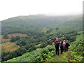
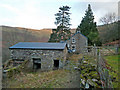
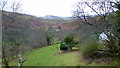
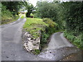
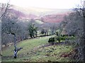
The above images may not be of the site on this page, they are loaded from Geograph.
Please Submit an Image of this site or go out and take one for us!
Click here to see more info for this site
Nearby sites
Key: Red: member's photo, Blue: 3rd party photo, Yellow: other image, Green: no photo - please go there and take one, Grey: site destroyed
Download sites to:
KML (Google Earth)
GPX (GPS waypoints)
CSV (Garmin/Navman)
CSV (Excel)
To unlock full downloads you need to sign up as a Contributory Member. Otherwise downloads are limited to 50 sites.
Turn off the page maps and other distractions
Nearby sites listing. In the following links * = Image available
1.6km NE 42° Pen Cerrig-calch* Cairn (SO21702236)
2.0km NNW 348° Pen Gloch Y Pibwr* Cairn (SO2020123205)
2.0km SSE 165° Gwernvale* Chambered Tomb (SO2111119217)
2.1km ESE 103° Crug Hywel* Hillfort (SO226207)
2.6km S 179° Llan-Wysg Well* Holy Well or Sacred Spring (SO2060318584)
2.7km WSW 239° Penmyarth* Standing Stone (Menhir) (SO18291986)
2.7km WNW 284° Tretower* Standing Stone (Menhir) (SO180219)
3.0km SSW 199° Ffawyddog Gaer Hillfort (SO196184)
3.1km N 1° Pen Alltmawr Cairns* Cairn (SO2069024330)
3.2km SSE 149° Great Oak Stone* Standing Stone (Menhir) (SO22181846)
3.2km W 260° Myarth Camp Hillfort (SO174207)
3.4km S 171° Llangattock Cross* Ancient Cross (SO2110017870)
3.4km SE 139° Llangenny Camp* Hillfort (SO228186)
3.5km S 169° Garn Coch (Powys)* Chambered Tomb (SO2123617708)
3.7km NW 315° Llanfihangel Cwmdu* Ancient Cross (SO18052384)
3.7km W 277° Celtic Head, Middle Gaer Carving (SO16962172)
3.9km SE 127° Coed Ynys Faen* Standing Stones (SO237188)
4.1km NW 312° Coed y Gaer Hillfort (SO176240)
4.3km NW 315° Coed y Gaer Cairn Cairn (SO1759324348)
4.8km SE 134° Golden Grove* Standing Stone (Menhir) (SO2396217829)
4.8km WNW 303° Cwmdu Stone Circle (SO166239)
5.0km W 260° Llwyn-Y-Fedwen* Standing Stone (Menhir) (SO15622039)
5.1km SSE 148° Cwrt-y-Gollen* Standing Stone (Menhir) (SO2324116860)
5.2km SSW 194° Coed Pentwyn* Hillfort (SO193162)
5.5km WNW 287° Bwlch Ring Cairn* Ring Cairn (SO154229)
View more nearby sites and additional images


 We would like to know more about this location. Please feel free to add a brief description and any relevant information in your own language.
 Wir möchten mehr über diese Stätte erfahren. Bitte zögern Sie nicht, eine kurze Beschreibung und relevante Informationen in Deutsch hinzuzufügen.
 Nous aimerions en savoir encore un peu sur les lieux. S'il vous plaît n'hesitez pas à ajouter une courte description et tous les renseignements pertinents dans votre propre langue.
 Quisieramos informarnos un poco más de las lugares. No dude en añadir una breve descripción y otros datos relevantes en su propio idioma.