


<< Our Photo Pages >> Braidwood Fort - Hillfort in Scotland in Midlothian
Submitted by SolarMegalith on Thursday, 18 August 2016 Page Views: 4539
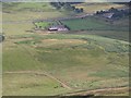
Iron Age and Later PrehistorySite Name: Braidwood Fort Alternative Name: Camp Hill fortCountry: Scotland County: Midlothian Type: Hillfort
Nearest Town: Penicuik
Map Ref: NT1928059630
Latitude: 55.823142N Longitude: 3.289952W
Condition:
| 5 | Perfect |
| 4 | Almost Perfect |
| 3 | Reasonable but with some damage |
| 2 | Ruined but still recognisable as an ancient site |
| 1 | Pretty much destroyed, possibly visible as crop marks |
| 0 | No data. |
| -1 | Completely destroyed |
| 5 | Superb |
| 4 | Good |
| 3 | Ordinary |
| 2 | Not Good |
| 1 | Awful |
| 0 | No data. |
| 5 | Can be driven to, probably with disabled access |
| 4 | Short walk on a footpath |
| 3 | Requiring a bit more of a walk |
| 2 | A long walk |
| 1 | In the middle of nowhere, a nightmare to find |
| 0 | No data. |
| 5 | co-ordinates taken by GPS or official recorded co-ordinates |
| 4 | co-ordinates scaled from a detailed map |
| 3 | co-ordinates scaled from a bad map |
| 2 | co-ordinates of the nearest village |
| 1 | co-ordinates of the nearest town |
| 0 | no data |
Internal Links:
External Links:
I have visited· I would like to visit
SolarMegalith visited on 10th Aug 2016 - their rating: Cond: 3 Amb: 4 Access: 4
")
The access to the fort is fairly easy, an unmade road goes just north of the earthworks.
Canmore entry.
You may be viewing yesterday's version of this page. To see the most up to date information please register for a free account.
")
")
")
")
Do not use the above information on other web sites or publications without permission of the contributor.
Nearby Images from Geograph Britain and Ireland:
©2009(licence)
©2009(licence)
©2018(licence)
©2018(licence)
©2005(licence)
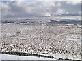
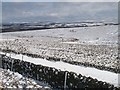
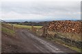
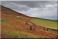
The above images may not be of the site on this page, they are loaded from Geograph.
Please Submit an Image of this site or go out and take one for us!
Click here to see more info for this site
Nearby sites
Key: Red: member's photo, Blue: 3rd party photo, Yellow: other image, Green: no photo - please go there and take one, Grey: site destroyed
Download sites to:
KML (Google Earth)
GPX (GPS waypoints)
CSV (Garmin/Navman)
CSV (Excel)
To unlock full downloads you need to sign up as a Contributory Member. Otherwise downloads are limited to 50 sites.
Turn off the page maps and other distractions
Nearby sites listing. In the following links * = Image available
141m NW 314° Camp Hill Burnt Mound North* Artificial Mound (NT19185973)
156m WNW 296° Camp Hill Burnt Mound South* Artificial Mound (NT19145970)
1.8km WSW 254° Monks Rig, Font Stone* Ancient Cross (NT17585919)
2.3km SSE 149° Gowk Stone Standing Stone (Menhir) (NT20425764)
2.5km NNE 25° Carnethy Hill cairn* Cairn (NT20386192)
4.2km NE 52° Marchwell (Glencourse) Stone Circle (NT22646211)
5.6km NE 39° Castle Law* Hillfort (NT2290063870)
5.8km NE 39° Castle Knowe (Glencorse)* Ancient Village or Settlement (NT22996404)
6.1km ENE 60° Glencorse Cup and Ring Marked Stone* Rock Art (NT24676261)
7.9km NNE 33° Caerketton Hill* Cairn (NT23706621)
8.1km N 352° St Mungo's Well (Edinburgh)* Holy Well or Sacred Spring (NT18346773)
8.4km NE 37° Hillend (Loanhead)* Hillfort (NT24526620)
8.7km ENE 66° St Matthew's Well (Roslin)* Holy Well or Sacred Spring (NT27326298)
9.3km NW 321° Dalmahoy Hill Hillfort (NT135669)
9.3km NW 317° Kaimes Standing Stones (NT130665)
9.6km NNW 334° Newhouse Standing Stone Standing Stone (Menhir) (NT15296838)
10.0km NNE 29° Caiy Stane* Standing Stone (Menhir) (NT2424368357)
10.1km NNE 30° Fairmiliehead (Edinburgh) Cairn (NT24466828)
10.5km NNE 28° 1, West Camus Road* Modern Stone Circle etc (NT2441068763)
10.6km NE 34° Galachlaw Cairn* Cairn (NT25366831)
10.7km NW 312° Kirknewton stone Sculptured Stone (NT11426693)
10.9km NNE 27° Buck Stane* Standing Stone (Menhir) (NT24506922)
11.0km NNE 18° Craiglockart Hill Vitrified Fort Hillfort (NT22827006)
11.8km NE 42° Balm Well* Holy Well or Sacred Spring (NT2732268363)
11.9km NNW 327° Tormain Hill* Rock Art (NT12906967)
View more nearby sites and additional images


 We would like to know more about this location. Please feel free to add a brief description and any relevant information in your own language.
 Wir möchten mehr über diese Stätte erfahren. Bitte zögern Sie nicht, eine kurze Beschreibung und relevante Informationen in Deutsch hinzuzufügen.
 Nous aimerions en savoir encore un peu sur les lieux. S'il vous plaît n'hesitez pas à ajouter une courte description et tous les renseignements pertinents dans votre propre langue.
 Quisieramos informarnos un poco más de las lugares. No dude en añadir una breve descripción y otros datos relevantes en su propio idioma.