


<< Our Photo Pages >> Ffynnon y Clawdd Llesg - Holy Well or Sacred Spring in Wales in Powys
Submitted by KiwiBetsy on Tuesday, 17 October 2006 Page Views: 8569
Springs and Holy WellsSite Name: Ffynnon y Clawdd Llesg Alternative Name: Well of the Old, Well of the Weak, Ffynnon Spout,Country: Wales
NOTE: This site is 3.1 km away from the location you searched for.
County: Powys Type: Holy Well or Sacred Spring
Nearest Town: Welshpool Nearest Village: Meifod
Map Ref: SJ153109
Latitude: 52.689139N Longitude: 3.254544W
Condition:
| 5 | Perfect |
| 4 | Almost Perfect |
| 3 | Reasonable but with some damage |
| 2 | Ruined but still recognisable as an ancient site |
| 1 | Pretty much destroyed, possibly visible as crop marks |
| 0 | No data. |
| -1 | Completely destroyed |
| 5 | Superb |
| 4 | Good |
| 3 | Ordinary |
| 2 | Not Good |
| 1 | Awful |
| 0 | No data. |
| 5 | Can be driven to, probably with disabled access |
| 4 | Short walk on a footpath |
| 3 | Requiring a bit more of a walk |
| 2 | A long walk |
| 1 | In the middle of nowhere, a nightmare to find |
| 0 | No data. |
| 5 | co-ordinates taken by GPS or official recorded co-ordinates |
| 4 | co-ordinates scaled from a detailed map |
| 3 | co-ordinates scaled from a bad map |
| 2 | co-ordinates of the nearest village |
| 1 | co-ordinates of the nearest town |
| 0 | no data |
Internal Links:
External Links:
")
From Meifod take the A495 to Newbridge and turn left just over the bridge. Follow the road past Lower Hall Farm and around a sharp bend to the right. With a house on your right and immediately before the drive into a house on the left, park near the gate on the left. On foot, follow the farm road uphill with Spout Wood on your right. When the road forks, go through the right hand gate into Spout Wood. Keep a close watch for a post on the right … this marks an indistinct path which leads uphill through gorse bushes for a short way before crossing a wooden footbridge to the well.
You may be viewing yesterday's version of this page. To see the most up to date information please register for a free account.
")
")
Do not use the above information on other web sites or publications without permission of the contributor.
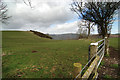
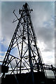
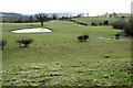
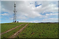
Nearby Images from Geograph Britain and Ireland:
©2009(licence)
©2009(licence)
©2009(licence)

©2009(licence)
©2009(licence)
The above images may not be of the site on this page, they are loaded from Geograph.
Please Submit an Image of this site or go out and take one for us!
Click here to see more info for this site
Nearby sites
Key: Red: member's photo, Blue: 3rd party photo, Yellow: other image, Green: no photo - please go there and take one, Grey: site destroyed
Download sites to:
KML (Google Earth)
GPX (GPS waypoints)
CSV (Garmin/Navman)
CSV (Excel)
To unlock full downloads you need to sign up as a Contributory Member. Otherwise downloads are limited to 50 sites.
Turn off the page maps and other distractions
Nearby sites listing. In the following links * = Image available
2.3km N 4° Meifod* Ancient Cross (SJ155132)
2.8km N 355° Meifod Cursus Cursus (SJ15121367)
2.9km N 358° Meifod Cursus Cursus (SJ15231380)
3.8km WSW 249° Pentre Camp Hillfort (SJ11730957)
6.0km SW 230° Tanllan Enclosure Ancient Village or Settlement (SJ10600715)
6.6km SW 227° Ffynnon Fair (Llanfair Caereinion)* Holy Well or Sacred Spring (SJ1036106480)
6.9km ENE 71° Trinity Well, Guilsfield Holy Well or Sacred Spring (SJ21881297)
7.3km ENE 72° Gaer Fawr (Guilsfield)* Hillfort (SJ223130)
7.9km ESE 114° Maen Llog* Standing Stone (Menhir) (SJ225076)
8.1km ESE 115° Powysland Museum* Museum (SJ226073)
8.4km ESE 115° Welshpool Eisteddfod Circle* Modern Stone Circle etc (SJ2286307263)
8.6km NE 48° Collfryn Ring Ditch Misc. Earthwork (SJ21861650)
8.7km N 350° St Myllin's Well* Holy Well or Sacred Spring (SJ1393819533)
8.7km SE 129° Sarn-y-bryn-caled II Cursus Cursus (SJ21970523)
8.8km SE 131° Sarn-y-bryn-caled II Cursus Cursus (SJ21830505)
8.8km SE 133° Welshpool A Cursus Cursus (SJ21640480)
8.8km SE 131° Welshpool A Cursus Cursus (SJ21820497)
8.9km SE 131° Sarn-y-Bryn-Caled* Timber Circle (SJ219049)
10.7km SSE 160° St Beuno (Berriew)* Natural Stone / Erratic / Other Natural Feature (SJ18780082)
10.8km SSE 151° Dyffryn Lane, Berriew* Henge (SJ2044101409)
10.8km SSE 152° Maen Beuno* Standing Stone (Menhir) (SJ2029201303)
11.7km ESE 104° Trinity Well, Cletterwood Holy Well or Sacred Spring (SJ26650780)
11.8km ENE 64° Trinity Well, Arddleen Holy Well or Sacred Spring (SJ25951594)
11.9km W 264° The Rustica Stone Early Christian Sculptured Stone (SJ0340809775)
12.3km ESE 114° Beacon Ring* Hillfort (SJ265058)
View more nearby sites and additional images


 We would like to know more about this location. Please feel free to add a brief description and any relevant information in your own language.
 Wir möchten mehr über diese Stätte erfahren. Bitte zögern Sie nicht, eine kurze Beschreibung und relevante Informationen in Deutsch hinzuzufügen.
 Nous aimerions en savoir encore un peu sur les lieux. S'il vous plaît n'hesitez pas à ajouter une courte description et tous les renseignements pertinents dans votre propre langue.
 Quisieramos informarnos un poco más de las lugares. No dude en añadir una breve descripción y otros datos relevantes en su propio idioma.