


<< Our Photo Pages >> Carnedd Rhys Goch - Cairn in Wales in Powys
Submitted by postman on Friday, 16 November 2012 Page Views: 3240
Neolithic and Bronze AgeSite Name: Carnedd Rhys GochCountry: Wales County: Powys Type: Cairn
Nearest Town: Llangollen Nearest Village: Glyn Ceiriog
Map Ref: SJ15763613
Latitude: 52.915961N Longitude: 3.25425W
Condition:
| 5 | Perfect |
| 4 | Almost Perfect |
| 3 | Reasonable but with some damage |
| 2 | Ruined but still recognisable as an ancient site |
| 1 | Pretty much destroyed, possibly visible as crop marks |
| 0 | No data. |
| -1 | Completely destroyed |
| 5 | Superb |
| 4 | Good |
| 3 | Ordinary |
| 2 | Not Good |
| 1 | Awful |
| 0 | No data. |
| 5 | Can be driven to, probably with disabled access |
| 4 | Short walk on a footpath |
| 3 | Requiring a bit more of a walk |
| 2 | A long walk |
| 1 | In the middle of nowhere, a nightmare to find |
| 0 | No data. |
| 5 | co-ordinates taken by GPS or official recorded co-ordinates |
| 4 | co-ordinates scaled from a detailed map |
| 3 | co-ordinates scaled from a bad map |
| 2 | co-ordinates of the nearest village |
| 1 | co-ordinates of the nearest town |
| 0 | no data |
Internal Links:
External Links:
")
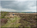
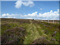
This cairn is in the middle of a little no where, There is only one way to get here as the road ends at the bottom of the valley. Through the small village of Pandy and look out for a car park on the right. Walk up the small lane that bends to the left and keep going till it turns into a footpath. the cairn can be seen from a distance due to the pillar of stones on it. There are at least four big stones on it's circumference . 75 yards to the N.W is a small standing stone, both stone and cairn are said to be associated with the poet Rhys Goch.
You may be viewing yesterday's version of this page. To see the most up to date information please register for a free account.
")
")
")
Do not use the above information on other web sites or publications without permission of the contributor.
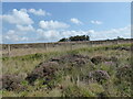
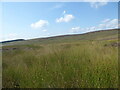
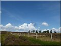
Nearby Images from Geograph Britain and Ireland:
©2021(licence)
©2012(licence)
©2021(licence)
©2021(licence)
©2021(licence)
The above images may not be of the site on this page, they are loaded from Geograph.
Please Submit an Image of this site or go out and take one for us!
Click here to see more info for this site
Nearby sites
Key: Red: member's photo, Blue: 3rd party photo, Yellow: other image, Green: no photo - please go there and take one, Grey: site destroyed
Download sites to:
KML (Google Earth)
GPX (GPS waypoints)
CSV (Garmin/Navman)
CSV (Excel)
To unlock full downloads you need to sign up as a Contributory Member. Otherwise downloads are limited to 50 sites.
Turn off the page maps and other distractions
Nearby sites listing. In the following links * = Image available
1.8km ESE 109° Tomen y Gwyddel* Round Cairn (SJ175355)
2.0km NNE 12° Tomen y Meirw* Round Barrow(s) (SJ162381)
2.1km SSW 194° Cerrig Gwynion (Wrexham)* Hillfort (SJ152341)
4.0km NNE 16° Vivod Mountain Cairn (SJ16964000)
4.5km NNE 21° Nant-Y-Bache Round Barrow(s) (SJ17474031)
5.0km NNE 27° Blaen Nant* Round Barrow(s) (SJ18144051)
6.2km NE 37° Ffynnon Las Round Barrow(s) (SJ19574099)
6.6km WNW 295° Nant Croes Y Wernen* Stone Circle (SJ09813906)
6.6km W 272° Careg-Y-Caws* Cairn (SJ09133650)
6.8km ENE 68° Llwynmawr* Standing Stone (Menhir) (SJ2211138530)
7.3km W 274° Pen Bwlch Llandrillo Cairn (SJ08513674)
7.6km ENE 60° Careg y Big (Llangollen)* Standing Stone (Menhir) (SJ224398)
7.6km NNW 336° Owain Glyndwr's House (Site of)* Rock Art (SJ12754309)
7.9km WSW 240° Cwm Maen Gwynedd Stone Row II Stone Row / Alignment (SJ0885332238)
8.0km WSW 239° Cwm Maen Gwynedd Stone Row I Stone Row / Alignment (SJ0881132142)
8.2km W 259° Bwrdd Arthur* Cairn (SJ077347)
8.2km WSW 251° Bwlch Maen Gwynedd* Cairn (SJ07953364)
8.2km NE 46° Plas Newydd Gorsedd Stone circle* Modern Stone Circle etc (SJ2181041661)
8.2km NE 43° Llangollen Museum Museum (SJ2145642103)
8.4km WSW 250° Berwyn mountains Marker stones* Marker Stone (SJ078334)
9.2km WSW 247° Cadair Berwyn* Cairn (SJ072327)
9.3km WSW 246° Cader Berwyn Cairn 2* Cairn (SJ07173245)
9.4km SE 146° St Silin's Well* Holy Well or Sacred Spring (SJ209282)
9.5km NE 42° Dinas Bran* Hillfort (SJ2224043060)
9.5km NNE 27° Pillar of Eliseg* Early Christian Sculptured Stone (SJ20264452)
View more nearby sites and additional images


 We would like to know more about this location. Please feel free to add a brief description and any relevant information in your own language.
 Wir möchten mehr über diese Stätte erfahren. Bitte zögern Sie nicht, eine kurze Beschreibung und relevante Informationen in Deutsch hinzuzufügen.
 Nous aimerions en savoir encore un peu sur les lieux. S'il vous plaît n'hesitez pas à ajouter une courte description et tous les renseignements pertinents dans votre propre langue.
 Quisieramos informarnos un poco más de las lugares. No dude en añadir una breve descripción y otros datos relevantes en su propio idioma.