


<< Our Photo Pages >> Bwrdd y Rhyfel 1 - Round Barrow(s) in Wales in Flintshire
Submitted by vicky on Thursday, 25 March 2004 Page Views: 5610
Neolithic and Bronze AgeSite Name: Bwrdd y Rhyfel 1 Alternative Name: Llyn DuCountry: Wales County: Flintshire Type: Round Barrow(s)
Nearest Town: Holywell Nearest Village: Babell
Map Ref: SJ1523075000 Landranger Map Number: 116
Latitude: 53.265196N Longitude: 3.272396W
Condition:
| 5 | Perfect |
| 4 | Almost Perfect |
| 3 | Reasonable but with some damage |
| 2 | Ruined but still recognisable as an ancient site |
| 1 | Pretty much destroyed, possibly visible as crop marks |
| 0 | No data. |
| -1 | Completely destroyed |
| 5 | Superb |
| 4 | Good |
| 3 | Ordinary |
| 2 | Not Good |
| 1 | Awful |
| 0 | No data. |
| 5 | Can be driven to, probably with disabled access |
| 4 | Short walk on a footpath |
| 3 | Requiring a bit more of a walk |
| 2 | A long walk |
| 1 | In the middle of nowhere, a nightmare to find |
| 0 | No data. |
| 5 | co-ordinates taken by GPS or official recorded co-ordinates |
| 4 | co-ordinates scaled from a detailed map |
| 3 | co-ordinates scaled from a bad map |
| 2 | co-ordinates of the nearest village |
| 1 | co-ordinates of the nearest town |
| 0 | no data |
Internal Links:
External Links:
")
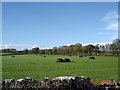
"A ploughed-down round barrow, c.27m in diameter and 0.4m high, which, when opened before 1819, produced skeletal material and a possible bronze spear-head." - Coflein site no. 306901.
You may be viewing yesterday's version of this page. To see the most up to date information please register for a free account.
Do not use the above information on other web sites or publications without permission of the contributor.
coldrum has found this location on Google Street View:
Nearby Images from Geograph Britain and Ireland:
©2019(licence)
©2019(licence)
©2010(licence)
©2015(licence)
©2005(licence)
The above images may not be of the site on this page, they are loaded from Geograph.
Please Submit an Image of this site or go out and take one for us!
Click here to see more info for this site
Nearby sites
Key: Red: member's photo, Blue: 3rd party photo, Yellow: other image, Green: no photo - please go there and take one, Grey: site destroyed
Download sites to:
KML (Google Earth)
GPX (GPS waypoints)
CSV (Garmin/Navman)
CSV (Excel)
To unlock full downloads you need to sign up as a Contributory Member. Otherwise downloads are limited to 50 sites.
Turn off the page maps and other distractions
Nearby sites listing. In the following links * = Image available
267m NNW 346° Holywell Racecourse* Round Barrow(s) (SJ15177526)
803m S 174° Babell Round Barrow(s) (SJ153742)
1.6km ENE 79° Naid-y-March* Standing Stones (SJ16767528)
1.6km ENE 78° Naid-Y-March* Standing Stones (SJ1676775288)
1.6km N 358° Gorsedd Church* Standing Stones (SJ152766)
1.6km SE 142° Gatehouse Farm Round Barrow(s) (SJ162737)
1.6km NNW 347° Y Gorseddau* Round Barrow(s) (SJ149766)
1.7km S 177° Waen Isaf Round Barrow(s) (SJ153733)
1.9km WNW 297° Ffrith-Y-Garreg-Wen* Round Barrow(s) (SJ13587589)
2.2km E 99° Brynford* Barrow Cemetery (SJ174746)
3.1km NNE 31° Ffynnon Oswald Holy Well or Sacred Spring (SJ1688577622)
3.2km NNW 348° Whitford Inscribed Stone* Early Christian Sculptured Stone (SJ146781)
3.3km SE 138° Plas Captain* Cairn (SJ17367253)
3.3km NNW 348° Whitford Church Inscribed Stone Early Christian Sculptured Stone (SJ146782)
3.4km SE 136° Llwyn Erddyn* Ring Cairn (SJ17567249)
3.5km ENE 68° St Winefrides Well* Holy Well or Sacred Spring (SJ18517627)
4.0km SE 128° Parc y Prysau 1* Round Barrow(s) (SJ183725)
4.2km WNW 281° Traveller's Inn* Round Barrow(s) (SJ111759)
4.2km SE 129° Parc y Prysau 2 Round Barrow(s) (SJ185723)
4.5km NNW 328° Maen Achwyfan* Ancient Cross (SJ129788)
5.2km WSW 255° Coed Bron Fawr* Barrow Cemetery (SJ10167372)
5.4km WNW 288° Hendre Bach Round Barrow(s) (SJ10137671)
5.7km WNW 282° Pany Y Dulath Round Barrow(s) (SJ09677624)
6.0km W 280° Criafol* Round Barrow(s) (SJ09317611)
6.2km WSW 245° Cefn Du Ancient Village or Settlement (SJ0956272450)
View more nearby sites and additional images


 We would like to know more about this location. Please feel free to add a brief description and any relevant information in your own language.
 Wir möchten mehr über diese Stätte erfahren. Bitte zögern Sie nicht, eine kurze Beschreibung und relevante Informationen in Deutsch hinzuzufügen.
 Nous aimerions en savoir encore un peu sur les lieux. S'il vous plaît n'hesitez pas à ajouter une courte description et tous les renseignements pertinents dans votre propre langue.
 Quisieramos informarnos un poco más de las lugares. No dude en añadir una breve descripción y otros datos relevantes en su propio idioma.