


<< Text Pages >> Kaimes - Standing Stones in Scotland in Midlothian
Submitted by vicky on Saturday, 25 September 2004 Page Views: 8943
Neolithic and Bronze AgeSite Name: KaimesCountry: Scotland County: Midlothian Type: Standing Stones
Map Ref: NT130665 Landranger Map Number: 65
Latitude: 55.883759N Longitude: 3.392362W
Condition:
| 5 | Perfect |
| 4 | Almost Perfect |
| 3 | Reasonable but with some damage |
| 2 | Ruined but still recognisable as an ancient site |
| 1 | Pretty much destroyed, possibly visible as crop marks |
| 0 | No data. |
| -1 | Completely destroyed |
| 5 | Superb |
| 4 | Good |
| 3 | Ordinary |
| 2 | Not Good |
| 1 | Awful |
| 0 | No data. |
| 5 | Can be driven to, probably with disabled access |
| 4 | Short walk on a footpath |
| 3 | Requiring a bit more of a walk |
| 2 | A long walk |
| 1 | In the middle of nowhere, a nightmare to find |
| 0 | No data. |
| 5 | co-ordinates taken by GPS or official recorded co-ordinates |
| 4 | co-ordinates scaled from a detailed map |
| 3 | co-ordinates scaled from a bad map |
| 2 | co-ordinates of the nearest village |
| 1 | co-ordinates of the nearest town |
| 0 | no data |
Internal Links:
External Links:
Pair of Standing Stones in Midlothian
Have you visited this site? Please add a comment below.
You may be viewing yesterday's version of this page. To see the most up to date information please register for a free account.
Do not use the above information on other web sites or publications without permission of the contributor.
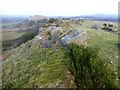
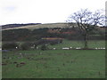
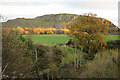
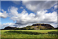
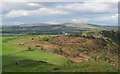
Nearby Images from Geograph Britain and Ireland:
©2015(licence)
©2008(licence)
©2017(licence)
©2011(licence)
©2008(licence)
The above images may not be of the site on this page, they are loaded from Geograph.
Please Submit an Image of this site or go out and take one for us!
Click here to see more info for this site
Nearby sites
Key: Red: member's photo, Blue: 3rd party photo, Yellow: other image, Green: no photo - please go there and take one, Grey: site destroyed
Download sites to:
KML (Google Earth)
GPX (GPS waypoints)
CSV (Garmin/Navman)
CSV (Excel)
To unlock full downloads you need to sign up as a Contributory Member. Otherwise downloads are limited to 50 sites.
Turn off the page maps and other distractions
Nearby sites listing. In the following links * = Image available
639m NE 50° Dalmahoy Hill Hillfort (NT135669)
1.6km WNW 284° Kirknewton stone Sculptured Stone (NT11426693)
3.0km NE 49° Newhouse Standing Stone Standing Stone (Menhir) (NT15296838)
3.2km N 357° Tormain Hill* Rock Art (NT12906967)
3.2km N 354° Witches' Stone (Ratho)* Rock Art (NT12736973)
4.5km N 1° Witchis Stane* Standing Stone (Menhir) (NT13177104)
5.5km ENE 76° St Mungo's Well (Edinburgh)* Holy Well or Sacred Spring (NT18346773)
6.0km NNE 23° Gogar Stone* Standing Stone (Menhir) (NT15487199)
6.1km N 356° Lochend menhir* Standing Stone (Menhir) (NT12667263)
6.1km N 353° Huly Hill Cairn* Round Cairn (NT1234272610)
6.1km N 353° Huly Hill Standing Stones* Standing Stones (NT1234272610)
8.1km NNE 12° Cat Stane (Kirkliston)* Standing Stone (Menhir) (NT1489374373)
8.1km N 4° Carlowrie (Kirkliston) Rock Art (NT138746)
8.6km SSE 147° Monks Rig, Font Stone* Ancient Cross (NT17585919)
8.7km ESE 121° Carnethy Hill cairn* Cairn (NT20386192)
8.9km NE 46° Physic Well (Corstorphine)* Holy Well or Sacred Spring (NT19597252)
9.0km NE 46° Lady Well* Holy Well or Sacred Spring (NT196726)
9.1km SE 137° Camp Hill Burnt Mound South* Artificial Mound (NT19145970)
9.1km SE 137° Camp Hill Burnt Mound North* Artificial Mound (NT19185973)
9.3km SE 136° Braidwood Fort* Hillfort (NT1928059630)
9.3km NNE 27° Cammo Stone* Standing Stone (Menhir) (NT1747774681)
10.2km ESE 104° Castle Law* Hillfort (NT2290063870)
10.3km ESE 103° Castle Knowe (Glencorse)* Ancient Village or Settlement (NT22996404)
10.4km ENE 69° Craiglockart Hill Vitrified Fort Hillfort (NT22827006)
10.6km ESE 113° Marchwell (Glencourse) Stone Circle (NT22646211)
View more nearby sites and additional images


 We would like to know more about this location. Please feel free to add a brief description and any relevant information in your own language.
 Wir möchten mehr über diese Stätte erfahren. Bitte zögern Sie nicht, eine kurze Beschreibung und relevante Informationen in Deutsch hinzuzufügen.
 Nous aimerions en savoir encore un peu sur les lieux. S'il vous plaît n'hesitez pas à ajouter une courte description et tous les renseignements pertinents dans votre propre langue.
 Quisieramos informarnos un poco más de las lugares. No dude en añadir una breve descripción y otros datos relevantes en su propio idioma.