 with our Megalithic Portal iPhone app")


<< Text Pages >> Abbots Deuglie - Stone Circle in Scotland in Perth and Kinross
Submitted by BigSweetie on Friday, 26 March 2004 Page Views: 7239
Neolithic and Bronze AgeSite Name: Abbots Deuglie Alternative Name: Abbot's DeuglieCountry: Scotland
NOTE: This site is 4.2 km away from the location you searched for.
County: Perth and Kinross Type: Stone Circle
Nearest Town: Kinross Nearest Village: Glenfarg
Map Ref: NO109110 Landranger Map Number: 58
Latitude: 56.283062N Longitude: 3.440766W
Condition:
| 5 | Perfect |
| 4 | Almost Perfect |
| 3 | Reasonable but with some damage |
| 2 | Ruined but still recognisable as an ancient site |
| 1 | Pretty much destroyed, possibly visible as crop marks |
| 0 | No data. |
| -1 | Completely destroyed |
| 5 | Superb |
| 4 | Good |
| 3 | Ordinary |
| 2 | Not Good |
| 1 | Awful |
| 0 | No data. |
| 5 | Can be driven to, probably with disabled access |
| 4 | Short walk on a footpath |
| 3 | Requiring a bit more of a walk |
| 2 | A long walk |
| 1 | In the middle of nowhere, a nightmare to find |
| 0 | No data. |
| 5 | co-ordinates taken by GPS or official recorded co-ordinates |
| 4 | co-ordinates scaled from a detailed map |
| 3 | co-ordinates scaled from a bad map |
| 2 | co-ordinates of the nearest village |
| 1 | co-ordinates of the nearest town |
| 0 | no data |
Internal Links:
External Links:
Stone Circle in Perthshire
Have you visited this site? Please add a comment below.
You may be viewing yesterday's version of this page. To see the most up to date information please register for a free account.
Do not use the above information on other web sites or publications without permission of the contributor.
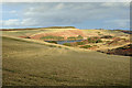
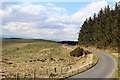
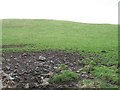
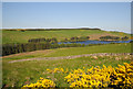
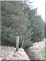
Nearby Images from Geograph Britain and Ireland:
©2008(licence)
©2015(licence)
©2008(licence)
©2008(licence)
©2008(licence)
The above images may not be of the site on this page, they are loaded from Geograph.
Please Submit an Image of this site or go out and take one for us!
Click here to see more info for this site
Nearby sites
Key: Red: member's photo, Blue: 3rd party photo, Yellow: other image, Green: no photo - please go there and take one, Grey: site destroyed
Download sites to:
KML (Google Earth)
GPX (GPS waypoints)
CSV (Garmin/Navman)
CSV (Excel)
To unlock full downloads you need to sign up as a Contributory Member. Otherwise downloads are limited to 50 sites.
Turn off the page maps and other distractions
Nearby sites listing. In the following links * = Image available
706m S 187° West Blair Standing Stone (Menhir) (NO108103)
7.1km SSE 162° Orwell Cursus Cursus (NO13010423)
7.8km SSE 148° Orwell Standing Stones* Standing Stones (NO14940432)
8.1km NW 315° Forteviot Timber Circle (NO053169)
8.4km NW 319° Forteviot Dagger Burial* Cist (NO055175)
8.6km NNE 14° Moncrieffe Timber Circle (NO132193)
8.6km NW 318° St Andrew's Church (Forteviot) Class III Pictish Cross Slab (NO052175)
8.7km NW 318° Forteviot Cross* Sculptured Stone (NO0518017527)
8.7km W 274° Gray Stone (Dunning)* Standing Stone (Menhir) (NO02191180)
8.7km NNE 17° Moncrieffe* Stone Circle (NO13601933)
8.8km NNE 17° Gask House Class II Pictish Symbol Stone (NO13661933)
8.8km NNE 17° Boar Stone* Class III Pictish Cross Slab (NO13661933)
9.1km NNE 13° Moncreiffe Hill* Hillfort (NO13131988)
9.2km WNW 290° Dun Knock (Dunning)* Hillfort (NO0230914317)
9.4km NE 56° Abernethy Den* Stone Circle (NO188161)
9.4km NNE 16° Moredun Top Hillfort (NO13621999)
9.5km N 359° Kirkton Hill Stone Circle (NO109205)
9.6km WNW 290° Dupplin Cross* Ancient Cross (NO01901448)
9.6km N 352° Callarfountain* Standing Stone (Menhir) (NO09752058)
9.7km N 360° Hilton Of Moncrieffe* Standing Stone (Menhir) (NO11062067)
9.7km NE 55° Abernethy Symbol Stone* Class I Pictish Symbol Stone (NO18991638)
9.7km WNW 291° Dunning* Standing Stone (Menhir) (NO01851469)
9.9km NE 53° Abernethy Circle Stone Circle (NO189168)
9.9km N 5° Craigclowan Standing Stone (Menhir) (NO12022083)
10.2km WNW 297° Leadketty Stone Circle (NO01921581)
View more nearby sites and additional images


 We would like to know more about this location. Please feel free to add a brief description and any relevant information in your own language.
 Wir möchten mehr über diese Stätte erfahren. Bitte zögern Sie nicht, eine kurze Beschreibung und relevante Informationen in Deutsch hinzuzufügen.
 Nous aimerions en savoir encore un peu sur les lieux. S'il vous plaît n'hesitez pas à ajouter une courte description et tous les renseignements pertinents dans votre propre langue.
 Quisieramos informarnos un poco más de las lugares. No dude en añadir una breve descripción y otros datos relevantes en su propio idioma.