 with our Megalithic Portal iPhone app")


<< Text Pages >> Llwynda-ddu - Hillfort in Wales in South Glamorgan
Submitted by coldrum on Monday, 25 June 2007 Page Views: 5188
Iron Age and Later PrehistorySite Name: Llwynda-dduCountry: Wales County: South Glamorgan Type: Hillfort
Nearest Town: Pentyrch
Map Ref: ST10878100
Latitude: 51.520859N Longitude: 3.286024W
Condition:
| 5 | Perfect |
| 4 | Almost Perfect |
| 3 | Reasonable but with some damage |
| 2 | Ruined but still recognisable as an ancient site |
| 1 | Pretty much destroyed, possibly visible as crop marks |
| 0 | No data. |
| -1 | Completely destroyed |
| 5 | Superb |
| 4 | Good |
| 3 | Ordinary |
| 2 | Not Good |
| 1 | Awful |
| 0 | No data. |
| 5 | Can be driven to, probably with disabled access |
| 4 | Short walk on a footpath |
| 3 | Requiring a bit more of a walk |
| 2 | A long walk |
| 1 | In the middle of nowhere, a nightmare to find |
| 0 | No data. |
| 5 | co-ordinates taken by GPS or official recorded co-ordinates |
| 4 | co-ordinates scaled from a detailed map |
| 3 | co-ordinates scaled from a bad map |
| 2 | co-ordinates of the nearest village |
| 1 | co-ordinates of the nearest town |
| 0 | no data |
Internal Links:
External Links:
Iron Age fort whose defenses have been damaged and partially destroyed.
Originally this fort had two ramparts and ditches enclosing an egg shaped area of 0.4 ha.
Bank height is about 2.5m above the ditch bottom.
Coflein record: LLWYNDA-DDU.
Ariel photo: photo.
You may be viewing yesterday's version of this page. To see the most up to date information please register for a free account.
Do not use the above information on other web sites or publications without permission of the contributor.
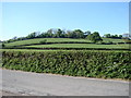
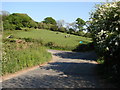
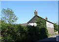
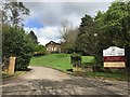
Nearby Images from Geograph Britain and Ireland:
©2007(licence)
©2007(licence)
©2007(licence)
©2018(licence)

©2023(licence)
The above images may not be of the site on this page, they are loaded from Geograph.
Please Submit an Image of this site or go out and take one for us!
Click here to see more info for this site
Nearby sites
Key: Red: member's photo, Blue: 3rd party photo, Yellow: other image, Green: no photo - please go there and take one, Grey: site destroyed
Download sites to:
KML (Google Earth)
GPX (GPS waypoints)
CSV (Garmin/Navman)
CSV (Excel)
To unlock full downloads you need to sign up as a Contributory Member. Otherwise downloads are limited to 50 sites.
Turn off the page maps and other distractions
Nearby sites listing. In the following links * = Image available
838m NW 320° Ffynnoncattwg* Holy Well or Sacred Spring (ST10348165)
1.6km W 263° Craig-y-Parc Ancient Village or Settlement (ST09298084)
1.9km ENE 57° Lesser Garth Cave* Cave or Rock Shelter (ST125820)
2.6km NNW 346° Garth Hill* Round Barrow(s) (ST103835)
2.7km ESE 110° Radyr Woods Burnt Mound* Artificial Mound (ST13438003)
2.8km SSW 195° Sant-Y-Nyll Round Barrow(s) (ST10077829)
2.8km NNE 21° Taffs Well* Holy Well or Sacred Spring (ST1192683638)
3.2km ESE 114° Pistyll Golau Holy Well or Sacred Spring (ST13787962)
3.3km WNW 289° Cae'rarfau* Chambered Tomb (ST0772582144)
3.9km SSE 167° Museum of Welsh Life, St Fagans* Museum (ST117772)
4.0km SSE 164° St Fagan's Well Holy Well or Sacred Spring (ST11917712)
4.7km ENE 67° Wennalt Camp Ancient Village or Settlement (ST15208275)
5.5km ESE 121° St Teilo's Well, Llandaff* Holy Well or Sacred Spring (ST15567805)
6.5km SSW 196° St Nicholas' Well (Glamorgan)* Holy Well or Sacred Spring (ST08937484)
6.5km SSE 156° Caerau (Cardiff)* Hillfort (ST13377498)
6.8km SW 221° Ffynnon Deilo* Holy Well or Sacred Spring (ST0633975904)
7.0km S 180° Vianshill Round Barrow(s) (ST10717401)
7.3km NE 36° Gorsedd Stones (Caerphilly)* Modern Stone Circle etc (ST153868)
7.3km S 180° St Lythans Down Round Barrow* Round Barrow(s) (ST10717367)
7.4km SSE 160° Coed-y Cymdda Hillfort (ST13297398)
7.4km S 174° Quarrymen Stone* Modern Stone Circle etc (ST115736)
7.4km SSW 201° Cottrell Park Standing Stone* Standing Stone (Menhir) (ST0804574124)
7.5km S 176° Marsyd Round Barrow(s) (ST11217352)
7.7km SSW 200° Coed-Y-Cwm* Chambered Cairn (ST08117378)
7.8km SSW 202° Redland Farm Standing Stone (Menhir) (ST07817382)
View more nearby sites and additional images


 We would like to know more about this location. Please feel free to add a brief description and any relevant information in your own language.
 Wir möchten mehr über diese Stätte erfahren. Bitte zögern Sie nicht, eine kurze Beschreibung und relevante Informationen in Deutsch hinzuzufügen.
 Nous aimerions en savoir encore un peu sur les lieux. S'il vous plaît n'hesitez pas à ajouter une courte description et tous les renseignements pertinents dans votre propre langue.
 Quisieramos informarnos un poco más de las lugares. No dude en añadir una breve descripción y otros datos relevantes en su propio idioma.