<< Our Photo Pages >> Poldean menhir - Standing Stone (Menhir) in Scotland in Dumfries and Galloway
Submitted by Apocryphus on Monday, 21 January 2019 Page Views: 1283
Neolithic and Bronze AgeSite Name: Poldean menhirCountry: Scotland County: Dumfries and Galloway Type: Standing Stone (Menhir)
Nearest Town: Moffat Nearest Village: Poldean
Map Ref: NT1037900011
Latitude: 55.286039N Longitude: 3.412627W
Condition:
| 5 | Perfect |
| 4 | Almost Perfect |
| 3 | Reasonable but with some damage |
| 2 | Ruined but still recognisable as an ancient site |
| 1 | Pretty much destroyed, possibly visible as crop marks |
| 0 | No data. |
| -1 | Completely destroyed |
| 5 | Superb |
| 4 | Good |
| 3 | Ordinary |
| 2 | Not Good |
| 1 | Awful |
| 0 | No data. |
| 5 | Can be driven to, probably with disabled access |
| 4 | Short walk on a footpath |
| 3 | Requiring a bit more of a walk |
| 2 | A long walk |
| 1 | In the middle of nowhere, a nightmare to find |
| 0 | No data. |
| 5 | co-ordinates taken by GPS or official recorded co-ordinates |
| 4 | co-ordinates scaled from a detailed map |
| 3 | co-ordinates scaled from a bad map |
| 2 | co-ordinates of the nearest village |
| 1 | co-ordinates of the nearest town |
| 0 | no data |
Internal Links:
External Links:
I have visited· I would like to visit
Anne T visited on 25th Jun 2021 - their rating: Cond: 3 Amb: 4 Access: 4 Poldean menhir: Re-visited this stone whilst in the Moffat area. Not much has changed, except the weeds have been allowed to grow high around the stone. The area around its base has been heavily trampled, and was difficult to walk across. Two VERY large, very handsome bulls in the field of pasture, but thankfully an electric fence between us and them.
markj99 visited on 7th Jul 2019 - their rating: Cond: 3 Amb: 3 Access: 4 Poldean menhir is not the most spectacular standing stone, however it is adjacent to a road so why not stop when passing by.
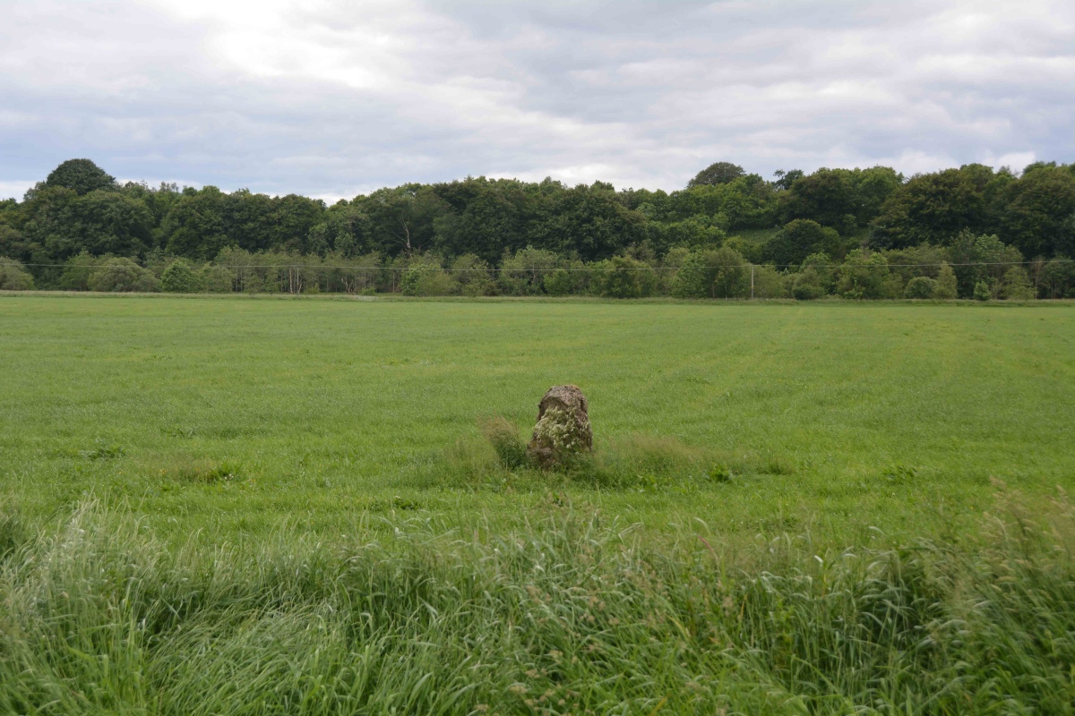
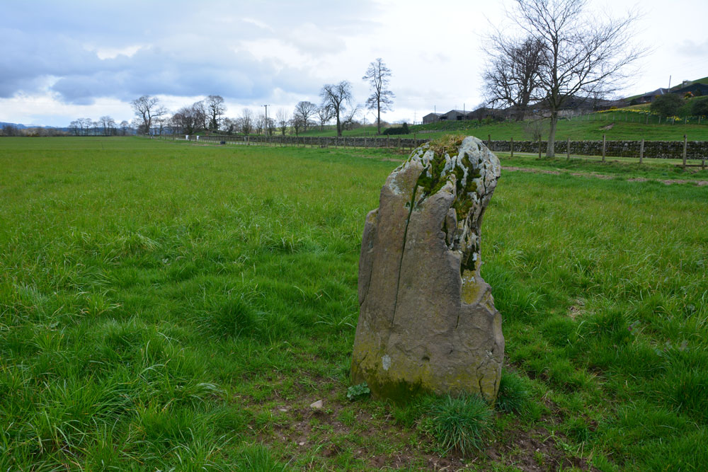
Anne T visited on 4th Apr 2019 - their rating: Cond: 3 Amb: 3 Access: 4 Poldean Standing Stone: The third stop of the day with this stone easily visible just to the west of the road, towards the eastern edge of a large field of pasture.
We let ourselves in through the gate NY 10424 99981, walking over a small stream, again with the River Annan to its west and the busy A754(M) in the distance.
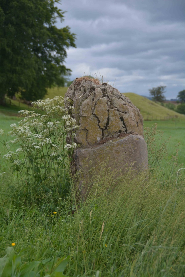
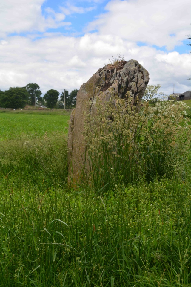
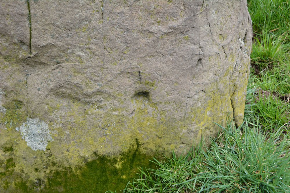
The eastern side of the stone is very craggy, as if bedding planes have been worn/broken away. There appears to have been a cup low down on its western side, but this could be a solution hole, if the stone had been lying flat for some considerable time in the past.
markj99 visited on 19th May 2012 - their rating: Cond: 3 Amb: 3 Access: 4 Poldean menhir is not the most spectacular standing stone, however it is adjacent to a road so why not stop when passing by.
Average ratings for this site from all visit loggers: Condition: 3 Ambience: 3.25 Access: 4
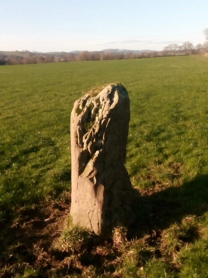
Travelling south from Moffat on the "Old Carlisle Road" the stone sits in an open field on the right. It is opposite Poldean Farm.
The field was in pasture (January) and the gate was open.
This stone is recorded as Canmore ID 49734, Prehistoric Standing Stone, the 1920 entry of which reads: "A standing stone of whin, 4 feet 7 inches in height above ground, and triangular in section. This stone is said to have been erected to mark the spot where Prince Charles' troops bivouacked on their march into England in the '45". A more recent entry from 1990 adds: "The ground around the base of the stone has been eroded as a result of animals using the stone as a rubbing post".
You may be viewing yesterday's version of this page. To see the most up to date information please register for a free account.




Do not use the above information on other web sites or publications without permission of the contributor.
Click here to see more info for this site
Nearby sites
Key: Red: member's photo, Blue: 3rd party photo, Yellow: other image, Green: no photo - please go there and take one, Grey: site destroyed
Download sites to:
KML (Google Earth)
GPX (GPS waypoints)
CSV (Garmin/Navman)
CSV (Excel)
To unlock full downloads you need to sign up as a Contributory Member. Otherwise downloads are limited to 50 sites.
Turn off the page maps and other distractions
Nearby sites listing. In the following links * = Image available
1.1km SSE 157° Chapman's Stone* Standing Stone (Menhir) (NY1078398986)
3.9km SSE 156° Pumplaburn* Cairn (NY11869644)
4.3km SE 144° Wamphray Place* Misc. Earthwork (NY12829648)
4.3km NNW 331° Dyke Row* Stone Row / Alignment (NT0837503820)
4.4km SE 142° St Cuthbert's Church (Wamphray)* Ancient Cross (NY1307096462)
5.4km SE 137° Kirkhill* Stone Circle (NY1397895929)
5.6km S 171° Skip Knowe* Standing Stone (Menhir) (NY1118094430)
6.4km WSW 258° Stiddrig* Cairn (NY04139877)
7.3km N 350° Moffat Well* Holy Well or Sacred Spring (NT0924007200)
7.5km SSW 212° Crunzierton Wood Scooped Settlement* Ancient Village or Settlement (NY0625093750)
8.0km W 265° Lonnachie Rig Cairn (NY024995)
10.7km S 183° Lochbrow Cursus* Cursus (NY0951489350)
10.9km S 184° Lochbrow Prehistoric Landscape* Ancient Village or Settlement (NY0942389153)
11.3km NNE 30° Peatshiel Sike* Standing Stone (Menhir) (NT16190972)
11.7km S 185° Archwood Hill* Hillfort (NY0911488380)
14.2km E 88° Naga Stupa(cairn)* Modern Stone Circle etc (NT246001)
15.1km ESE 106° Bessie's Hill Fort* Hillfort (NY2490095540)
15.2km ESE 106° Bessie's Hill Settlement Ancient Village or Settlement (NY249955)
15.4km ESE 103° Girdle Stanes* Stone Circle (NY2535196153)
15.5km ESE 116° Castle O'er Fort* Hillfort (NY2419092850)
15.6km WSW 243° Gulfhill Rig Cairn (NX963933)
15.6km ESE 114° Over Rig* Misc. Earthwork (NY2455693475)
15.6km ESE 101° Loupin' Stanes NW* Stone Circle (NY25709663)
15.7km ESE 101° Loupin' Stanes SE* Stone Row / Alignment (NY25729660)
16.3km ESE 117° The Knowe* Ancient Village or Settlement (NY24799226)
View more nearby sites and additional images


 We would like to know more about this location. Please feel free to add a brief description and any relevant information in your own language.
 Wir möchten mehr über diese Stätte erfahren. Bitte zögern Sie nicht, eine kurze Beschreibung und relevante Informationen in Deutsch hinzuzufügen.
 Nous aimerions en savoir encore un peu sur les lieux. S'il vous plaît n'hesitez pas à ajouter une courte description et tous les renseignements pertinents dans votre propre langue.
 Quisieramos informarnos un poco más de las lugares. No dude en añadir una breve descripción y otros datos relevantes en su propio idioma.