


<< Text Pages >> Coed Yr Hendre House Platform - Ancient Village or Settlement in Wales in Mid Glamorgan
Submitted by coldrum on Thursday, 12 July 2007 Page Views: 4507
Multi-periodSite Name: Coed Yr Hendre House PlatformCountry: Wales
NOTE: This site is 0.4 km away from the location you searched for.
County: Mid Glamorgan Type: Ancient Village or Settlement
Nearest Town: Bedlinog
Map Ref: SO104018
Latitude: 51.707756N Longitude: 3.298121W
Condition:
| 5 | Perfect |
| 4 | Almost Perfect |
| 3 | Reasonable but with some damage |
| 2 | Ruined but still recognisable as an ancient site |
| 1 | Pretty much destroyed, possibly visible as crop marks |
| 0 | No data. |
| -1 | Completely destroyed |
| 5 | Superb |
| 4 | Good |
| 3 | Ordinary |
| 2 | Not Good |
| 1 | Awful |
| 0 | No data. |
| 5 | Can be driven to, probably with disabled access |
| 4 | Short walk on a footpath |
| 3 | Requiring a bit more of a walk |
| 2 | A long walk |
| 1 | In the middle of nowhere, a nightmare to find |
| 0 | No data. |
| 5 | co-ordinates taken by GPS or official recorded co-ordinates |
| 4 | co-ordinates scaled from a detailed map |
| 3 | co-ordinates scaled from a bad map |
| 2 | co-ordinates of the nearest village |
| 1 | co-ordinates of the nearest town |
| 0 | no data |
Be the first person to rate this site - see the 'Contribute!' box in the right hand menu.
Internal Links:
External Links:
Ancient Village or Settlement in Mid Glamorgan
House Platform.
You may be viewing yesterday's version of this page. To see the most up to date information please register for a free account.
Do not use the above information on other web sites or publications without permission of the contributor.
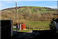
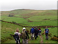
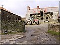
Nearby Images from Geograph Britain and Ireland:
©2019(licence)
©2021(licence)
©2016(licence)
©2008(licence)
©2023(licence)
The above images may not be of the site on this page, they are loaded from Geograph.
Please Submit an Image of this site or go out and take one for us!
Click here to see more info for this site
Nearby sites
Key: Red: member's photo, Blue: 3rd party photo, Yellow: other image, Green: no photo - please go there and take one, Grey: site destroyed
Download sites to:
KML (Google Earth)
GPX (GPS waypoints)
CSV (Garmin/Navman)
CSV (Excel)
To unlock full downloads you need to sign up as a Contributory Member. Otherwise downloads are limited to 50 sites.
Turn off the page maps and other distractions
Nearby sites listing. In the following links * = Image available
1.1km SE 138° Cefn Gelligaer Cairn Cairn (SO111010)
1.1km SE 138° Cefn Gelligaer Cross Dyke Misc. Earthwork (SO111010)
1.4km N 357° Blaenllwynau, Cairn I Cairn (SO10350316)
1.4km N 357° Blaenllwynau, Cairn II Cairn (SO10340318)
1.4km NNW 334° Gelligaer Common Round Barrow(s) (SO09810305)
1.5km N 353° Pen Garnbugail Cairn (SO10250328)
1.5km NNW 339° Pen Garnbugail Ring Cairn (SO09870324)
1.6km NW 323° Coly Uchaf Cairnfield Cairn (SO09460307)
1.6km NNW 329° Cefn Gelli-Gaer Round Barrow(s) (SO09610318)
1.6km N 357° Gelligaer Common Standing Stone* Standing Stone (Menhir) (SO10340340)
1.6km NNW 337° Pen Garnbugail Round Barrow Cairn (SO09810329)
1.7km NNW 341° Pen Garnbugail Ring Cairn Ring Cairn (SO09870341)
1.7km NNW 327° Coly Uchaf Cairn (SO09470326)
1.8km NNW 347° Cairn North of Cairn Bugail Cairn (SO10010359)
1.8km NNW 346° Carn Y Bugail* Round Cairn (SO100036)
2.6km N 352° Pentwyn Cairns Cairn (SO101044)
2.7km SW 233° Mynydd Y Capel Cairn Cemetry Cairn (SO0822200245)
2.7km SW 228° Mynydd Y Capel Cairnfield* Cairn (SO0835100032)
2.8km SW 225° Mynydd Y Capel Cairns Cairn (ST084999)
2.8km SW 225° Mynydd Y Capel Standing Stone* Standing Stone (Menhir) (ST084999)
2.8km SSW 200° Coed Cae Cairns and field system Cairn (ST094992)
2.8km ENE 61° New Tredegar Cairn Cairn (SO129031)
3.1km ENE 60° New Tredeger Cairns Cairn (SO131033)
3.1km N 350° Mynydd Fochriw Cairn Cairn (SO099049)
3.3km ENE 68° New Tredegar House Platforms Ancient Village or Settlement (SO135030)
View more nearby sites and additional images


 We would like to know more about this location. Please feel free to add a brief description and any relevant information in your own language.
 Wir möchten mehr über diese Stätte erfahren. Bitte zögern Sie nicht, eine kurze Beschreibung und relevante Informationen in Deutsch hinzuzufügen.
 Nous aimerions en savoir encore un peu sur les lieux. S'il vous plaît n'hesitez pas à ajouter une courte description et tous les renseignements pertinents dans votre propre langue.
 Quisieramos informarnos un poco más de las lugares. No dude en añadir una breve descripción y otros datos relevantes en su propio idioma.