 with our Megalithic Portal iPhone app")


<< Our Photo Pages >> Kerry Ridgeway - Ancient Trackway in Wales in Powys
Submitted by Andy B on Tuesday, 05 September 2006 Page Views: 16112
Multi-periodSite Name: Kerry RidgewayCountry: Wales County: Powys Type: Ancient Trackway
Nearest Town: Kerry, Bishops Castl
Map Ref: SO108846
Latitude: 52.452046N Longitude: 3.314015W
Condition:
| 5 | Perfect |
| 4 | Almost Perfect |
| 3 | Reasonable but with some damage |
| 2 | Ruined but still recognisable as an ancient site |
| 1 | Pretty much destroyed, possibly visible as crop marks |
| 0 | No data. |
| -1 | Completely destroyed |
| 5 | Superb |
| 4 | Good |
| 3 | Ordinary |
| 2 | Not Good |
| 1 | Awful |
| 0 | No data. |
| 5 | Can be driven to, probably with disabled access |
| 4 | Short walk on a footpath |
| 3 | Requiring a bit more of a walk |
| 2 | A long walk |
| 1 | In the middle of nowhere, a nightmare to find |
| 0 | No data. |
| 5 | co-ordinates taken by GPS or official recorded co-ordinates |
| 4 | co-ordinates scaled from a detailed map |
| 3 | co-ordinates scaled from a bad map |
| 2 | co-ordinates of the nearest village |
| 1 | co-ordinates of the nearest town |
| 0 | no data |
Internal Links:
External Links:
I have visited· I would like to visit
TimPrevett has visited here
")
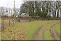
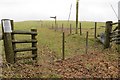
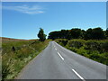
Linking footpaths and bridleways have been improved, while two car parks have been built, signs erected and a new guidebook published.
Drovers used it to shepherd sheep, cattle and geese to markets in England.
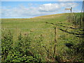
Linking the Powys village of Kerry, near Newtown, and the Shropshire town of Bishops Castle, the ridgeway is a regional trail and open to walkers, horse riders and cyclists.
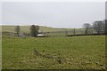
Last used regularly by drovers some 150 years ago, the ancient highway forges a track through airy heather moors, cool woodlands and breezy bilberry-rich heaths.
Source: BBC News
You may be viewing yesterday's version of this page. To see the most up to date information please register for a free account.
Do not use the above information on other web sites or publications without permission of the contributor.
Nearby Images from Geograph Britain and Ireland:
©2015(licence)
©2015(licence)
©2015(licence)
©2010(licence)
©2022(licence)
The above images may not be of the site on this page, they are loaded from Geograph.
Please Submit an Image of this site or go out and take one for us!
Click here to see more info for this site
Nearby sites
Key: Red: member's photo, Blue: 3rd party photo, Yellow: other image, Green: no photo - please go there and take one, Grey: site destroyed
Download sites to:
KML (Google Earth)
GPX (GPS waypoints)
CSV (Garmin/Navman)
CSV (Excel)
To unlock full downloads you need to sign up as a Contributory Member. Otherwise downloads are limited to 50 sites.
Turn off the page maps and other distractions
Nearby sites listing. In the following links * = Image available
986m ENE 62° Two Tumps* Round Barrow(s) (SO11688505)
2.5km S 172° Rhiw Porthnant* Barrow Cemetery (SO111821)
2.6km NE 42° Gwernescob Round Barrow(s) (SO12578647)
2.6km NE 42° Caebetin Hill Timber Circle (SO126865)
4.0km NE 41° Hubert's Folly Ancient Village or Settlement (SO13458754)
5.2km ENE 72° Kerry Hill* Stone Circle (SO15768607)
5.3km ENE 71° Shenton's Tump Barrow* Round Barrow(s) (SO15848622)
5.3km NNW 344° Castell-Y-Dail* Ancient Village or Settlement (SO09448972)
7.1km NE 36° Kerry barrows* Round Barrow(s) (SO151903)
7.2km N 357° Newtown Gorsedd Circle* Modern Stone Circle etc (SO1057591808)
7.8km E 98° Grey Stones* Stone Circle (SO185834)
8.5km SW 230° Banc Du (Powys)* Stone Circle (SO042792)
8.9km ENE 69° Upper Short Ditch* Misc. Earthwork (SO192876)
9.9km WNW 297° Nant-Yr-Hebog* Ancient Village or Settlement (SO02058932)
10.3km S 186° St Anno's Church (Llannano)* Misc. Earthwork (SO0956874345)
10.6km WNW 299° Cefn Carnedd Hillfort (SO016900)
11.9km SSE 149° Rhos-Crug Barrows I and II* Round Barrow(s) (SO167743)
11.9km ENE 72° Lower Short Ditch* Misc. Earthwork (SO222880)
12.6km WNW 295° Pont Ar Daf Cairn Cairn (SN995902)
13.3km WNW 291° Gaer Bella Hillfort (SN98508969)
14.3km E 97° Fron Camp* Hillfort (SO250826)
15.1km NW 326° Llyn-y-Tarw* Stone Circle (SO02579726)
15.2km E 86° St Chad's Well (nr Clun)* Holy Well or Sacred Spring (SO26068529)
15.3km ESE 106° Llanfair Hill North Standing Stone (Menhir) (SO25428006)
15.4km NW 325° Llyn-y-Tarw Hut Circle* Ancient Village or Settlement (SO0227597395)
View more nearby sites and additional images


 We would like to know more about this location. Please feel free to add a brief description and any relevant information in your own language.
 Wir möchten mehr über diese Stätte erfahren. Bitte zögern Sie nicht, eine kurze Beschreibung und relevante Informationen in Deutsch hinzuzufügen.
 Nous aimerions en savoir encore un peu sur les lieux. S'il vous plaît n'hesitez pas à ajouter une courte description et tous les renseignements pertinents dans votre propre langue.
 Quisieramos informarnos un poco más de las lugares. No dude en añadir una breve descripción y otros datos relevantes en su propio idioma.